River Swift facts for kids
Quick facts for kids River Swift |
|
|---|---|

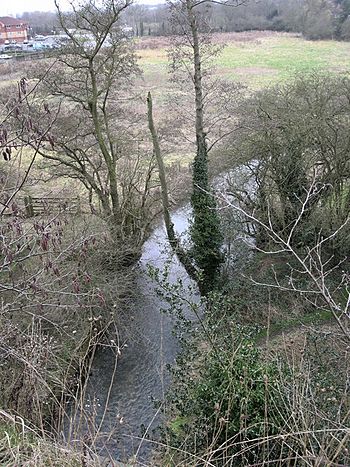
River Swift near Lutterworth
|
|
|
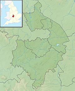
Location of the mouth within Warwickshire
|
|
| Country | England |
| Counties | Leicestershire, Warwickshire |
| Towns | Lutterworth, Rugby |
| Physical characteristics | |
| Main source | Upper Bruntingthorpe, Leicestershire |
| River mouth | Confluence with River Avon Rugby, Warwickshire 52°23′13″N 1°15′32″W / 52.3869°N 1.2588°W |
| Length | 23 km (14 mi) |
| Basin features | |
| Basin size | 80 km2 (31 sq mi) |
The River Swift is a river in England that is about 14 miles (23 km) long. It's a smaller river that flows into the River Avon. The Swift starts in south Leicestershire and travels through the town of Lutterworth. It then joins the River Avon near Rugby in Warwickshire.
River Swift's Journey
The River Swift begins as a small stream in Leicestershire, near a place called Bruntingthorpe Aerodrome. It starts high up, about 142 meters (466 feet) above sea level. This area is a watershed, meaning it's where water divides to flow into different river systems, like the Avon and the Soar.
As the Swift flows, it passes by the villages of Walton and Kimcote. Here, other small streams join it, adding more water. The river then moves southwest, going north of Walcote. It flows through the Misterton Marshes, which is a special area for nature.
After the marshes, the Swift goes under the M1 motorway bridge and reaches the town of Lutterworth. It flows along the south side of the town. Further along its path, it crosses under the Lutterworth bypass. The river continues southwest until it goes under the A5 road at Bransford Bridge. This A5 road is actually an old Roman road that connected London to Wroxeter long ago!
Downstream from the bridge, the river passes the site of an old medieval village called Cestersover. It then flows by the modern village of Churchover. At this point, some water is taken from the river to supply a nearby canal. The Swift then goes under the M6 motorway.
The river then flows south through the Swift Valley Nature Reserve, which is a protected area for wildlife. It passes Brownsover Hall and then goes through an industrial area. The Oxford Canal crosses over the Swift using an aqueduct, which is like a bridge for boats! Finally, the River Swift joins the River Avon between Brownsover and Rugby.
River Swift's Area
The area where the River Swift collects its water is called its catchment. This area covers about 80 square kilometers (31 square miles). The Swift's catchment is located between the Avon and Welland rivers to the east, the River Sowe to the west, and the River Soar to the north.
The ground in this area is mostly made of a type of clay called Lias Clay and mudstones. On top of this, there are layers of sand, gravel, and till left behind by glaciers. Because the clay doesn't let water soak in easily, the River Swift can rise quickly when there's a lot of rain.
Flooding and Safety
The River Swift has had some minor flooding events along its course, especially in Lutterworth. Floods were recorded in 1875, 1931, and more recently in 2008. To help keep people safe, there is a special flood warning service for the river's area. This service works with warnings for the Upper Avon and the Clay Coton brook.
In February 2012, a family needed help when their car got stuck in floodwaters while trying to cross the river between Churchover and Harborough Magna. This shows why it's so important to pay attention to flood warnings and never drive through flooded roads.
 | Aurelia Browder |
 | Nannie Helen Burroughs |
 | Michelle Alexander |


