San Miguel County, Colorado facts for kids
Quick facts for kids
San Miguel County
|
|
|---|---|

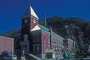
The San Miguel County Courthouse
|
|

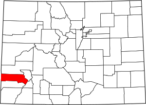
Location within the U.S. state of Colorado
|
|
 Colorado's location within the U.S. |
|
| Country | |
| State | |
| Founded | March 2, 1883 |
| Named for | San Miguel River |
| Seat | Telluride |
| Largest town | Telluride |
| Area | |
| • Total | 1,289 sq mi (3,340 km2) |
| • Land | 1,287 sq mi (3,330 km2) |
| • Water | 2.0 sq mi (5 km2) 0.2%% |
| Population
(2020)
|
|
| • Total | 8,072 |
| • Density | 6.2622/sq mi (2.4179/km2) |
| Time zone | UTC−7 (Mountain) |
| • Summer (DST) | UTC−6 (MDT) |
| Congressional district | 3rd |
San Miguel County is a place in Colorado, a state in the United States. In 2020, about 8,072 people lived here. The main town, or county seat, is Telluride. The county gets its name from the San Miguel River.
Contents
History
San Miguel County got its name from the Spanish language words for "Saint Michael". This name comes from the nearby San Miguel River. On February 27, 1883, San Miguel County was created. It was formed by splitting off a part of Ouray County.
In 1875, a rich gold area called the Smuggler vein was found near Telluride. By 1920, the Smuggler-Union, Tomboy, and Liberty Bell mines had produced over one hundred tons of gold. This made them the third-highest gold producers in Colorado.
In 1903, mining companies in the San Juan mountain area formed a group. It was called the San Juan District Mining Association (SJDMA). This happened because miners wanted an eight-hour workday. Most Colorado voters had already agreed to this idea. But the SJDMA did not want to shorten work hours or raise wages. This led to a difficult strike in the area.
Geography
San Miguel County covers about 1,289 square miles. Most of this area, 1,287 square miles, is land. Only a small part, about 2.0 square miles (0.2%), is water.
Neighboring Counties
- Montrose County - to the north
- Ouray County - to the east
- San Juan County - to the southeast
- Dolores County - to the south
- San Juan County, Utah - to the west
Main Roads
Protected Natural Areas
- Lizard Head Wilderness
- Mount Sneffels Wilderness
- Old Spanish National Historic Trail
- Telluride National Historic District
- Uncompahgre National Forest
Trails and Scenic Drives
- Great Parks Bicycle Route
- San Juan Skyway National Scenic Byway
- Unaweep/Tabeguache Scenic and Historic Byway
- Western Express Bicycle Route
Population Numbers
| Historical population | |||
|---|---|---|---|
| Census | Pop. | %± | |
| 1890 | 2,909 | — | |
| 1900 | 5,379 | 84.9% | |
| 1910 | 4,700 | −12.6% | |
| 1920 | 5,281 | 12.4% | |
| 1930 | 2,184 | −58.6% | |
| 1940 | 3,664 | 67.8% | |
| 1950 | 2,693 | −26.5% | |
| 1960 | 2,944 | 9.3% | |
| 1970 | 1,949 | −33.8% | |
| 1980 | 3,192 | 63.8% | |
| 1990 | 3,653 | 14.4% | |
| 2000 | 6,594 | 80.5% | |
| 2010 | 7,359 | 11.6% | |
| 2020 | 8,072 | 9.7% | |
| 2023 (est.) | 7,868 | 6.9% | |
| U.S. Decennial Census 1790-1960 1900-1990 1990-2000 2010-2020 |
|||
Communities
Towns
Census-designated place
Unincorporated Communities
See also
 In Spanish: Condado de San Miguel (Colorado) para niños
 | William L. Dawson |
 | W. E. B. Du Bois |
 | Harry Belafonte |

