Scott County, Minnesota facts for kids
Quick facts for kids
Scott County
|
||
|---|---|---|

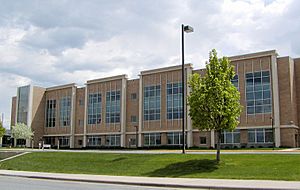
Scott County Government Center
|
||
|
||

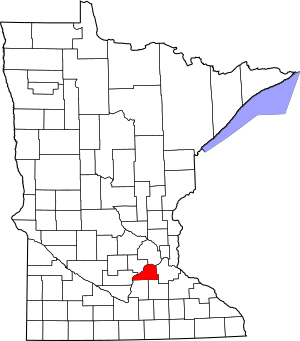
Location within the U.S. state of Minnesota
|
||
 Minnesota's location within the U.S. |
||
| Country | ||
| State | ||
| Founded | March 5, 1853 | |
| Named for | Winfield Scott | |
| Seat | Shakopee | |
| Largest city | Shakopee | |
| Area | ||
| • Total | 368 sq mi (950 km2) | |
| • Land | 356 sq mi (920 km2) | |
| • Water | 12 sq mi (30 km2) 3.2%% | |
| Population
(2020)
|
||
| • Total | 150,928 | |
| • Estimate
(2023)
|
155,814 |
|
| • Density | 424.0/sq mi (163.7/km2) | |
| Time zone | UTC−6 (Central) | |
| • Summer (DST) | UTC−5 (CDT) | |
| Congressional district | 2nd | |
Scott County is a county in the state of Minnesota, USA. In 2020, about 150,928 people lived here. The main city and county seat is Shakopee. Shakopee is also the biggest city in Scott County.
The county was created in 1853. It was named after General Winfield Scott. Scott County is part of the larger Minneapolis-St. Paul area. This area is a big group of cities and towns.
The Shakopee-Mdewakanton Indian Reservation is completely inside Scott County. It is near the cities of Prior Lake and Shakopee. The tribe runs popular casinos and a hotel. They use the money to help their community grow. They also give a lot of money to charities across the country.
In the past, the Minnesota River helped with fur trading and farming. Today, Scott County has more businesses and homes. But it is still mostly a rural area with lots of open space. The county has fun places to visit. These include Canterbury Park, Minnesota's Largest Candy Store, Elko Speedway, Mystic Lake Casino, the Renaissance Festival, and Valleyfair Amusement Park.
Contents
History of Scott County
Scott County was first home to two groups of Santee Sioux (Dakota) Indians. These were the Mdewakanton and Wahpeton people. They moved around with the seasons to find food. They hunted, fished, and grew corn. In summer, they lived in villages. In winter, they split into smaller groups for hunting.
They had many villages along the Minnesota River. Trails connected these villages to other areas. Later, fur traders and settlers used these trails. They were called "ox cart trails."
Early Settlement and Treaties
The land in Scott County was opened for new settlers in 1851 and 1853. This happened because of two important agreements called treaties. These treaties moved the Dakota Indians to special areas called reservations in northern Minnesota.
Scott County was officially created on March 5, 1853. It covers about 369 square miles (956 square kilometers). It was named after General Winfield Scott. Settlers began moving into the area in the mid-1850s. The Minnesota River and the ox cart trails were the main ways to travel.
The first settlers were from the eastern United States. Then, groups from Germany, Ireland, Czech Republic, and Scandinavia arrived. They brought their own traditions and religions. Most of these new settlers became farmers.
Growth and Development
In the 1800s, fur trading, logging, and farming were the main jobs in Minnesota. As farms grew, new towns appeared. Shakopee, the county seat, started in 1851. It was a trading post near the village of Chief Shakopee. Other towns grew along the transportation routes.
Later, railroads became the main way to travel. Then, highways were built along the old ox cart trails. These connected the communities.
Today, Scott County is changing a lot. More people are moving from cities to live in the county. This is called urban sprawl or suburbanization. The population grew from about 90,000 in 2000 to over 150,000 today. This makes Scott County one of Minnesota's fastest-growing counties.
Geography of Scott County
Scott County covers about 368 square miles (953 square kilometers). About 356 square miles (922 square kilometers) is land. The other 12 square miles (31 square kilometers) is water. This means about 3.2% of the county is water. It is one of the smallest counties in Minnesota.
The Minnesota River forms the county's northern and western borders. The river valley cuts through old rock and soil left by glaciers. This area was once an "oak savanna." This means it had a mix of grasses and groups of trees. This savanna was next to the "Big Woods," a thick forest that covered much of Minnesota. Scott County has more savanna soils than forest or prairie soils.
Lakes in Scott County
Scott County has many lakes. Here are some of them:
- Ahlswede Lake
- Blue Lake
- Browns Lake
- Campbell Lake
- Cedar Lake (two lakes with this name)
- Clark Lake
- Cleary Lake
- Crystal Lake
- Cynthia Lake
- Deans Lake
- Fish Lake
- Fisher Lake
- Gifford Lake
- Hanrahan Lake
- Hickey Lake
- Horseshoe Lake
- Howard Lake
- Kane Lake
- Lennon Lake
- Lower Prior Lake
- Markley Lake
- McMahon Lake
- Mud Lake
- Murphy Lake
- O'Dowd Lake
- Pike Lake
- Pleasant Lake
- Rice Lake (three lakes with this name)
- Schneider Lake
- Spring Lake
- St. Catherine Lake
- Thole Lake
- Upper Prior Lake
Major Roads in Scott County
Neighboring Counties
Scott County shares borders with these other counties:
- Hennepin County (north)
- Dakota County (east)
- Rice County (southeast)
- Le Sueur County (southwest)
- Sibley County (west)
- Carver County (northwest)
Protected Natural Areas
Part of the Minnesota Valley National Wildlife Refuge is in Scott County. This area helps protect wildlife and nature.
Population and People
| Historical population | |||
|---|---|---|---|
| Census | Pop. | %± | |
| 1860 | 4,595 | — | |
| 1870 | 11,042 | 140.3% | |
| 1880 | 13,516 | 22.4% | |
| 1890 | 13,831 | 2.3% | |
| 1900 | 15,147 | 9.5% | |
| 1910 | 14,888 | −1.7% | |
| 1920 | 14,245 | −4.3% | |
| 1930 | 14,116 | −0.9% | |
| 1940 | 15,585 | 10.4% | |
| 1950 | 16,486 | 5.8% | |
| 1960 | 21,909 | 32.9% | |
| 1970 | 32,423 | 48.0% | |
| 1980 | 43,784 | 35.0% | |
| 1990 | 57,846 | 32.1% | |
| 2000 | 89,498 | 54.7% | |
| 2010 | 129,928 | 45.2% | |
| 2020 | 150,928 | 16.2% | |
| 2023 (est.) | 155,814 | 19.9% | |
| U.S. Decennial Census 1790-1960 1900-1990 1990-2000 2010-2020 |
|||
Scott County has grown a lot over the years. In 2010, there were almost 130,000 people. By 2020, the population was over 150,000. Most people in Scott County are White. However, the number of people from other backgrounds is growing. This includes Black or African American, Asian, Native American, and Hispanic or Latino people.
Cities and Towns
Cities in Scott County
- Belle Plaine
- Credit River
- Elko New Market
- Jordan
- New Prague (partly in Le Sueur County)
- Prior Lake
- Savage
- Shakopee (county seat)
Townships in Scott County
- Belle Plaine Township
- Blakeley Township
- Cedar Lake Township
- Helena Township
- Jackson Township
- Louisville Township
- New Market Township
- Sand Creek Township
- Spring Lake Township
- St. Lawrence Township
Unincorporated Communities
These are smaller communities that are not officially cities or townships.
- Blakeley
- Cedar Lake
- Helena
- Lydia
- Marystown
- Mudbaden
- Spring Lake
- St. Benedict
- St. Patrick
- Union Hill
See also
 In Spanish: Condado de Scott (Minnesota) para niños


