
Silver Beach (Kurnell) facts for kids
Quick facts for kids Silver Beach |
|
|---|---|
| Kurnell Beach | |
.jpg)
Heritage-listed James Cook landing site with obelisk in background.
|
|
| Location | Kurnell, New South Wales, Australia |
| Coordinates | 34°00′30″S 151°12′28″E / 34.008222°S 151.207748°E |
| Offshore water bodies | Botany Bay |
| Length | 2.8 kilometres (1.7 mi) |
| Geology | Beach |
| Hazard rating | 1/10 (least hazardous) |
| Access | Prince Charles Parade |
|
|
|
Silver Beach is a beautiful sandy beach in Kurnell, New South Wales, Australia. It stretches for about 2.8 kilometers (1.7 miles) and is located about 18 kilometers (11 miles) south of Sydney's city center. The beach is known for its sparkling, silver-colored sand, which is how it got its name. It also has 14 rock walls, called groynes, that reach out into Botany Bay.
This beach is very important in Australian history. It's the place where Captain James Cook first landed in Australia in 1770. This event marked the beginning of Britain's interest in Australia.
Contents
Discovering Silver Beach
First Nations People
Before Europeans arrived, the land around Botany Bay was home to Indigenous Australians for thousands of years. The people living south of Botany Bay were part of the Dharawal language group. Specifically, the Gweagal clan lived in the Kurnell area where Silver Beach is. On the northern side of the bay, the Cadigal people, who spoke the Dharug language, lived.
These groups lived well because the area had lots of food and a mild climate. They ate many kinds of seafood, as shown by the ancient shell piles called middens found along the shores. They also ate local plants like fern roots and a spinach-like plant called warrigal. Both sides of Botany Bay were important gathering places for the Dharawal and Darug people.
Captain Cook's Arrival

On April 29, 1770, Captain James Cook, sailing on his ship Endeavour, landed on Silver Beach. This was the first time Europeans set foot on the eastern coast of Australia. A Royal Navy officer named Isaac Smith was the first European to step onto the land.
When Cook and his men landed, they met the local Gweagal people. In Aboriginal culture, visitors usually wait to be invited onto someone's land. The Gweagal warriors tried to tell the strangers not to come ashore. They even threw a spear, but it was likely a warning, not an attack. Cook's arrival without an invitation was a big cultural misunderstanding.
Cook first called the area "Sting-Ray Harbour" because he saw many stingrays. Later, it was renamed "Botanist Bay" and then "Botany Bay". This was because the ship's botanists, Joseph Banks, Daniel Solander, and Herman Spöring, found so many new and amazing plants and animals there.
Early European Settlement
After Cook's trip, Joseph Banks suggested Botany Bay would be a good place for a British settlement. Cook had reported that the land seemed good for farming. However, when Captain Arthur Phillip and the First Fleet arrived in 1788 to start a new colony, they found it wasn't as good as described. The soil was poor, there was no safe place to anchor ships, and not enough fresh water. So, they moved to Sydney Cove instead.
Over time, Cook's Landing Place became a popular spot for people interested in Australian history. In 1870, a man named Thomas Holt built Cook's Obelisk to mark the European landing. To help visitors, he also built the first wharf (dock) at Kurnell. Today, Cook's Obelisk is a very important heritage site.
Exploring Silver Beach

Silver Beach is backed by houses along 2 kilometers (1.2 miles) of its length. A 1-kilometer (0.6 miles) jetty for the Kurnell Refinery also crosses the beach. The rock walls (groynes) were built in 1969–70 to help stop the beach from washing away. The western end of the beach has a 1-kilometer (0.6 miles) long reserve with a boat ramp.
Near where Cook landed, there's a 530-meter (1,740 feet) strip of sand that is visible at high tide. This area includes the Captain Cook Obelisk and memorials to Cook's sailor, Sutherland, and botanist Solander. The rocks at the eastern end of Silver Beach show the start of the large sandstone Kurnell Peninsula. This area is part of Botany Bay National Park.
Fun Activities at Silver Beach
Silver Beach is a great place for swimming in Sydney. There's a netted swimming area in the middle of the beach, but you can swim outside it too. You can also go fishing here, and you might catch bream, trevally, or flathead.
There's a walking path called the Burrawang Walk, which starts at the east end of the beach. Along this walk, you can see modern and historic monuments. The park also has bushland trails, picnic areas, and spots for whale watching. The Cape Solander Trail goes all the way to Greenhills Beach. At the western end of Silver Beach, there's a special beach area for dogs where they can play.
How to Get There
Silver Beach is located at the corner of Dampier Street and Prince Charles Parade. You can reach it from Captain Cook Drive, which connects to Princes Highway from the west. There's a big parking lot at Bonna Point Reserve near the boat ramp. You can also find parking along Prince Charles Parade. There are bus stops on the Parade too.
Gallery
-
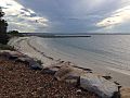
The beach on a cloudy day
-
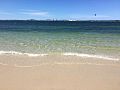
Beach waves
-
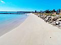
Beach's east side
-
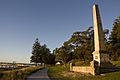
Captain Cooks Landing Place Reserve, which is a New South Wales State Heritage Register
-
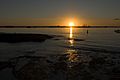
Sunset at the beach
-
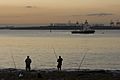
Fishing on the beach
-
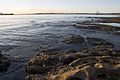
Rocky shores
-
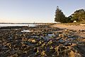
Sydney sandstone formation
-
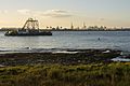
With Sydney skyline in distance


.jpg)
.jpg)
.jpg)
.jpg)
.jpg)
.jpg)
