Skokie River facts for kids
Quick facts for kids Skokie River |
|
|---|---|

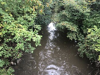
Skokie River in the spring, taken from the bridge on Old Elm road in Lake Forest
|
|
| Physical characteristics | |
| Main source | North Chicago, Illinois 686 ft (209 m) 42°18′42″N 87°52′22″W / 42.3116667°N 87.8727778°W |
| River mouth | Confluence with the North Branch Chicago River, Northfield, Illinois 614 ft (187 m) 42°05′15″N 87°46′20″W / 42.0875°N 87.7722222°W |
| Basin features | |
| Progression | Skokie River → North Branch Chicago River → Chicago River → Chicago Sanitary and Ship Canal → Des Plaines River → Illinois River → Mississippi → Gulf of Mexico |
| GNIS ID | 418584 |
The Skokie River is a small river in Illinois. It is about 20-mile-long (32 km). The river flows through the northern suburbs of Chicago. It runs close to the shore of Lake Michigan.
Long ago, the Skokie River flowed into Lake Michigan. It joined the Chicago River first. But in 1900, people built the Chicago Sanitary and Ship Canal. This canal changed how the rivers flowed. Now, the Skokie River and Chicago River flow southwest. Their water eventually reaches the Mississippi River.
The Skokie River starts in a flat, wet area. This is near the city of Waukegan. It flows south through Lake County. Then it enters Cook County. Finally, it joins the North Branch of the Chicago River. This meeting point is near Morton Grove and Wilmette.
Skokie River: A Look Back in Time
The Skokie River used to be a very slow-moving river. It flowed through a valley. This valley was formed by two sand dunes near Lake Michigan. In the past, the river did not have clear banks. It was more like a wide, wet area.
This area was full of wet prairie grasses and other plants. The river's size changed with the seasons. It would grow bigger after rain. It would shrink during dry times.
The river was home to many fish and waterbirds. Native American people lived near the river's mouth. They had a seasonal village there. The Potawatomi people called this wet area Chewab Skokie. This means "big wet prairie." They saw it as a long, wet ribbon of land, not just a river.
The Skokie River Today
Over time, the land around the Skokie River became very valuable. It was close to train lines that went to Chicago. This made it a good place for building homes. But the river area often flooded, which caused problems.
The Skokie River has changed a lot. It is one of the most altered rivers in the Chicago area. People have dug ditches and built up its banks. They have also changed the land around it.
In Lake County, the river valley became home to many golf courses. The river was reshaped to fit these courses. It now looks like a gentle staircase of water hazards.
Further south in Cook County, much of the river area was bought by the Forest Preserve District of Cook County. In the 1930s, the Civilian Conservation Corps (CCC) worked there. They created the Skokie Lagoons Forest Preserve. This was a huge project for the CCC.
The old wetlands were dug out. They were replaced with seven man-made lagoons. Some of these lagoons are 16 ft (4.9 m) deep. The lagoons cover 190 acres (77 ha) of land. In the 1990s, some efforts were made to restore parts of the lagoons. The goal was to bring back some of the original wetland feel.
The Skokie River area continues to be changed for different uses. The Wilmette Golf Club, located near the river's mouth, rebuilt its grounds in 2013. This was done to help reduce flooding on the course.
The Forest Preserve District regularly adds fish to the Skokie River. They try to bring back fish species that were there long ago. These include bass, walleye, northern pike, channel catfish, bluegill, crappie, and bullheads. They also try to control carp, which are not native to the area.
 | Isaac Myers |
 | D. Hamilton Jackson |
 | A. Philip Randolph |

