Sour Howes facts for kids
Quick facts for kids Sour Howes |
|
|---|---|

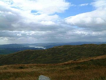
Sour Howes with Windermere beyond from Sallows.
|
|
| Highest point | |
| Elevation | 483 m (1,585 ft) |
| Prominence | c. 34 m |
| Parent peak | Sallows |
| Listing | Wainwright |
| Geography | |
| Location | Cumbria, England |
| Parent range | Lake District, Far Eastern Fells |
| OS grid | NY427032 |
| Topo map | OS Landranger 90, OS Explorer 7 |

Sour Howes is a small hill, also called a fell, located in the beautiful Lake District in England. It sits about 5 kilometers (3 miles) east of Ambleside. This fell is found between the Troutbeck and Kentmere valleys. Sour Howes is one of two separate hills on a place called Applethwaite Common. The other hill is named Sallows.
Contents
What is Sour Howes Like?
Sour Howes reaches a height of 483 meters (1,585 feet). It is mostly covered in grass. However, you can find heather plants growing on its eastern side. A tall dry stone wall crosses the top of the hill. This wall connects Sour Howes to its neighbor, Sallows, which is about one kilometer to the northeast. The wall also links to a smaller part of Sour Howes called Capple Howe. Capple Howe is 445 meters (1,460 feet) high and lies 600 meters to the southeast.
The Sides of Sour Howes
The western side of Sour Howes drops steeply down to the Troutbeck valley. A path called the Dubbs Road bridleway runs along the lower part of this slope. This path goes north and joins another track. This track crosses the Garburn Pass on its way to Kentmere.
On these western slopes, near the Garburn track, you can find an old, unused quarry. It's now covered in trees and is a large and interesting place to explore. The eastern side of Sour Howes slopes more gently towards the Kentmere valley. A stream called Park Beck flows down from the fell on this side. Park Beck is a small river that flows into the River Kent. You can also see some well-built grouse butts among the heather on these eastern slopes.
How Can You Climb Sour Howes?
You can climb Sour Howes from either the Troutbeck or Kentmere valleys. Many people like to combine their climb of Sour Howes with a visit to the nearby fell of Sallows. You could also visit the more exciting ridge to the north, which includes Yoke and Thornthwaite Crag.
To climb Sour Howes from either valley, you would use the Garburn Pass track. You follow this track to its highest point. From there, you head south towards the summit, following the dry stone wall.
What is the Top of Sour Howes Like?
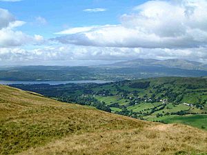
The very top of Sour Howes has several grassy bumps, or knolls. The highest point is marked by a small pile of stones. Even though Sour Howes is a small fell, the view from the top is truly amazing! You can see the tall mountains to the west very clearly. To the south, Windermere lake looks beautiful. Beyond the lake, you can even see Morecambe Bay.
 | Kyle Baker |
 | Joseph Yoakum |
 | Laura Wheeler Waring |
 | Henry Ossawa Tanner |


