Springfield metropolitan area, Illinois facts for kids
Quick facts for kids
Springfield Metropolitan Area
Springfield, IL Metropolitan Statistical Area
|
|
|---|---|

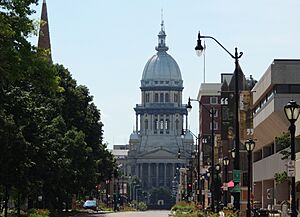
Downtown Springfield and the Illinois State Capitol
|
|
| Country | |
| State | |
| Time zone | UTC−6 (CST) |
| • Summer (DST) | UTC−5 (CDT) |
The Springfield Metropolitan Statistical Area is a special area in Central Illinois, defined by the United States Census Bureau. It includes two counties and has the city of Springfield as its main center. In 2000, about 201,437 people lived here. By 2009, this number grew to an estimated 208,182 people.
This area is located southwest of Chicago. It's also south of Peoria and southwest of Bloomington and Champaign. To the west, you'll find Decatur.
Contents
Counties in the Springfield Area
The Springfield Metropolitan Area is made up of two main counties. These counties are important parts of the region.
Communities and Towns
This metropolitan area is home to many different communities. They range from a large city to smaller towns and villages.
Major City: Springfield
- Springfield is the largest city in the area. It is the main city that anchors the entire metropolitan region.
Towns with 10,000 to 20,000 People
Towns with 1,000 to 10,000 People
|
Towns with 500 to 1,000 People
Smaller Places with Fewer than 500 People
Unincorporated Communities
These are places that are not officially part of a city or town.
|
Population and People
In 2000, the Springfield Metropolitan Area had a population of 201,437 people. There were 83,595 households, which are groups of people living together.
Most of the people living in the area (88.11%) were White. About 9.08% were African American. Other groups included 1.04% Asian, 0.21% Native American, and 0.03% Pacific Islander. About 1.04% of the population identified as Hispanic or Latino.
See also
 In Spanish: Área metropolitana de Springfield (Illinois) para niños

