
Suárez River facts for kids
Quick facts for kids Suárez River |
|
|---|---|

Suárez River close to Barbosa
|
|

Location of the Suárez River in Colombia
|
|
| Other name(s) | Guane: Saravita |
| Country | Colombia |
| Department | Cundinamarca, Boyacá, Santander |
| Provinces | Ubaté, Western Boyacá, Ricaurte, Vélez, Comunera, Guanentá |
| Municipalities | Fúquene, San Miguel de Sema, Chiquinquirá, Saboyá, Puente Nacional, Barbosa, Moniquirá, Güepsa, San José de Pare, Santana, San Benito, Suaita, El Guacamayo, Guadalupe, Contratación, Chima, Guapotá, Palmas del Socorro, Socorro, Simacota, San Gil, Palmar, Cabrera, Barichara, Galán, Zapatoca, Villanueva |
| Physical characteristics | |
| Main source | Lake Fúquene Fúquene 2,537.72 m (8,325.9 ft) 5°29′11.9″N 73°46′07.8″W / 5.486639°N 73.768833°W |
| River mouth | Sogamoso River Villanueva 700 m (2,300 ft) 6°46′06.7″N 73°11′54.9″W / 6.768528°N 73.198583°W |
| Length | 172 km (107 mi) |
| Basin features | |
| River system | Sogamoso River Magdalena Basin Caribbean Sea |
| Basin size | 98,230 km2 (37,930 sq mi) |
| Tributaries |
|
| Waterbodies | Lake Fúquene |
The Suárez River is an important river in the Colombian Andes mountains. It starts in Lake Fúquene, which is on the border of the Cundinamarca and Boyacá regions. The river then flows until it joins with the Chicamocha River. When these two rivers meet, they form the Sogamoso River in the Santander region. The Suárez River is part of a larger river system that eventually flows into the Caribbean Sea.
This river is about 172 kilometres (107 mi) long. It's one of the longest rivers in the Altiplano Cundiboyacense, which is a high plateau area. The Suárez River acts as a natural border between Cundinamarca and Boyacá, and later between Boyacá and Santander. The river's path goes from a high elevation of about 2,538 metres (8,327 ft) at its start to 700 metres (2,300 ft) where it ends. This big change in height causes different weather conditions along the river. The river is named after Gonzalo Suárez Rendón, a Spanish explorer. His horse drowned in the river during a sudden flood.
Contents
What's in a Name?
The Suárez River got its name from a Spanish explorer named Gonzalo Suárez Rendón. His horse sadly drowned in the river because of a sudden flood. Before the Spanish arrived, the Guane (an indigenous group) called the river Saravita. This name meant "departs from here."
River's Journey
The Suárez River is 172 kilometres (107 mi) long. Its drainage basin, which is the area of land where all the water flows into the river, covers about 98,230 square kilometres (37,930 sq mi). A big part of this basin, about 34,825.6 square kilometres (13,446.2 sq mi), is in the Santander region.
The river begins at Lake Fúquene in the Boyacá region. This is at a high point of about 2,540 metres (8,330 ft). As it flows, it eventually joins the Chicamocha River in the Santander region, forming the Sogamoso River. This meeting point is at an elevation of about 700 metres (2,300 ft). The Suárez River is the only river that flows out of Lake Fúquene.
The river starts on the Altiplano Cundiboyacense. Here, it forms the border between the Cundinamarca and Boyacá regions. For much of its journey downstream, it also forms the natural border between Boyacá and Santander.
As the Suárez River flows, other smaller rivers join it:
- Near Chiquinquirá, it meets the Chiquinquirá River.
- In Puente Nacional, a stream called Quebrada Aguaclara joins it.
- In Barbosa, the Moniquirá River flows into the Suárez River.
- Near Moniquirá, the Ubasa River joins in.
- West of San Gil, the Fonce River adds its waters to the Suárez River.
- Finally, in Villanueva, the Chicamocha River and the Suárez River come together to create the Sogamoso River.
River Climate
Other smaller rivers and lakes also feed into the Suárez River. These include the Lenguazaque River, Ráquira River, Ubaté River, Susa River, Simijaca River, and Cucunubá. Interestingly, nearby Lake Suesca does not flow into the Suárez River.
The weather around Saboyá is very wet, with over 2,400 millimetres (94 in) of rain each year. However, Lake Fúquene, where the river starts, gets less rain, only about 1,000 millimetres (39 in) per year. The amount of water flowing in the river near Saboyá changes throughout the year. It can be as low as 1 cubic metre per second (35 cu ft/s) and as high as 12 cubic metres per second (420 cu ft/s). The most water flows in May, and the least in January.
River Plants
Many types of plants grow around the Suárez River, especially near Saboyá. Some of these include:
- Inga sp. (a type of tree)
- Croton funckianus
- Mircyanthes sp.
- Gynerium saggitattum (a type of grass)
- Tropical smoke bush (Euphorbia cotinifolia)
- Castorbean plants (Ricinus communis)
- Alchornea sp.
- Colombian oaks (Quercus humboldtii)
- Eucalyptus globulus
- Cupressus sp. (cypress trees)
- Pinus sp. (pine trees)
- Acacia sp. (acacia trees)
River History
The Suárez River played an important role in the history of Colombia. Spanish explorers, known as conquistadors, used the river as a path. They traveled uphill from the hot lowlands of La Tora (now Barrancabermeja) towards the Muisca Confederation, a group of indigenous people living in the high Andes.
The Spanish explorers, including Gonzalo Jiménez de Quesada, followed the left bank of the Suárez River until they reached Lake Fúquene. At that time, the lake's water level was much higher than it is today, possibly 10 to 15 metres (33 to 49 ft) higher than in the 1950s.
Fun Things to Do
The Suárez River area offers some cool activities for visitors!
- Every year in early January, the town of Barbosa hosts a festival on one of the river's many beaches.
- San Gil is a very popular place for tourists, especially for water sports. While many activities happen on the Fonce River, you can also enjoy water sports on the Suárez River!
Images for kids
-
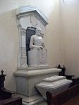
Tomb of Gonzalo Suárez Rendón in Tunja, the person the river is named after
-
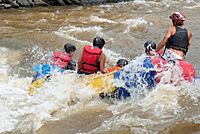
Rafting in San Gil
-
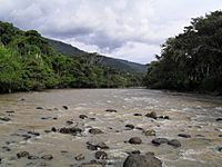
Río Fonce near San Gil


See also
 In Spanish: Río Suárez para niños
