Tampa, Kansas facts for kids
Quick facts for kids
Tampa, Kansas
|
|
|---|---|

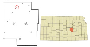
Location within Marion County and Kansas
|
|

|
|
| Country | United States |
| State | Kansas |
| County | Marion |
| Township | Blaine |
| Platted | 1887 |
| Incorporated | 1908 |
| Government | |
| • Type | Mayor–Council |
| Area | |
| • Total | 0.18 sq mi (0.46 km2) |
| • Land | 0.18 sq mi (0.46 km2) |
| • Water | 0.00 sq mi (0.00 km2) |
| Elevation | 1,427 ft (435 m) |
| Population
(2020)
|
|
| • Total | 105 |
| • Density | 583/sq mi (228/km2) |
| Time zone | UTC-6 (CST) |
| • Summer (DST) | UTC-5 (CDT) |
| ZIP code |
67483
|
| Area code | 785 |
| FIPS code | 20-70000 |
| GNIS ID | 2396029 |
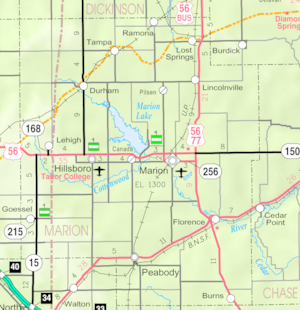
Tampa is a small city in Marion County, Kansas, United States. In 2020, about 105 people lived there. It is located between the towns of Durham and Ramona. A railroad runs right next to the city.
History of Tampa

Early Days
For thousands of years, the Great Plains of North America were home to nomadic Native American tribes.
From the 1500s to the 1700s, France claimed a large part of North America. In 1762, after a war, France secretly gave this land to Spain.
Becoming Part of the U.S.
In 1802, Spain gave most of the land back to France. Then, in 1803, the United States bought a huge area, including most of what is now Kansas. This was part of the Louisiana Purchase. The U.S. paid about 2.83 cents per acre for this land.
From the 1820s to the 1870s, an important travel route called the Santa Fe Trail passed near where Tampa is today. Two markers for the Santa Fe Trail are located close to Tampa. This trail was used across Marion County from 1821 to 1866.
In 1854, the Kansas Territory was created. Then, in 1861, Kansas officially became the 34th U.S. state. Marion County, where Tampa is, was formed in 1855.
The Railroad Arrives
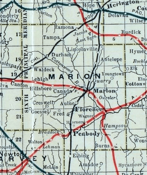
In 1887, the Chicago, Kansas and Nebraska Railway built a main railroad line. It ran through Tampa, connecting Herington to Pratt. This line was later extended further south.
This railroad company changed names several times over the years. Today, it is part of the Union Pacific Railroad. However, many local people still call it the "Rock Island" railroad.
The Golden Belt Town Company officially planned out the city of Tampa in 1887. People say that a railroad engineer suggested the name "Tampa." The city was officially made a city in 1908. A post office opened in Tampa on April 17, 1888.
Geography
Tampa is located in the beautiful Flint Hills and Great Plains regions of Kansas. The city covers about 0.18 square miles (0.46 square kilometers) of land. There is no water area within the city limits.
Population Information
| Historical population | |||
|---|---|---|---|
| Census | Pop. | %± | |
| 1910 | 256 | — | |
| 1920 | 262 | 2.3% | |
| 1930 | 275 | 5.0% | |
| 1940 | 222 | −19.3% | |
| 1950 | 216 | −2.7% | |
| 1960 | 145 | −32.9% | |
| 1970 | 154 | 6.2% | |
| 1980 | 113 | −26.6% | |
| 1990 | 113 | 0.0% | |
| 2000 | 144 | 27.4% | |
| 2010 | 112 | −22.2% | |
| 2020 | 105 | −6.2% | |
| U.S. Decennial Census | |||
2010 Census Details
In 2010, there were 112 people living in Tampa. These people lived in 48 homes, and 27 of these were families. The city had about 622 people per square mile.
Most of the people living in Tampa (98.2%) were White. About 1.8% were Native American. A small number (0.9%) were Hispanic or Latino.
In Tampa, 22.9% of homes had children under 18. Half of the homes (50%) were married couples. About 43.8% of homes were single people living alone. The average age of people in Tampa was 45 years old.
Places to Visit
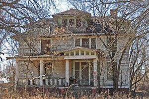
Tampa has one building listed on the National Register of Historic Places. This means it is an important historic site. It is the P. H. Meehan House, built in 1910. You can find it at 401 North Columbus Street. This house is not open to the public. Patrick Henry Meehan, who lived from 1868 to 1944, was the president of Tampa State Bank.
Other historic places nearby include:
- The Santa Fe Trail
- There are many Santa Fe Trail Markers in the area.
- You can also take a Santa Fe Trail Self-Guided Auto Tour.
Local Businesses
Tampa is home to the Tampa State Bank and the Tampa Cafe.
Education
Students in Tampa attend schools in the Centre USD 397 public school district. The high school is part of a special network called T.E.E.N. This network uses video to connect five area high schools for shared classes.
- Centre School is located at 2374 310th St, Lost Springs, KS. It is between Lost Springs and Lincolnville, east of the U.S. 77 highway.
Tampa used to have its own high school, called Tampa High School. Its mascot was the Tampa Tigers. This school is now closed.
Local News
To find out what's happening in Tampa, you can read these newspapers:
- The Herington Times, from Herington.
- Marion County Record, from Marion.
- Hillsboro Free Press, a free newspaper for the wider Marion County area.
Transportation and Services
Transportation
The K-15 highway is about 3.75 miles west of Tampa. The city is served by the Union Pacific Railroad. This railroad line, once called the "Rock Island," still helps move goods for the Tampa Elevator during summer harvests.
Utilities and Services
- Internet: You can get fiber optics internet from TCT. Satellite internet is also available from companies like HughesNet and WildBlue.
- TV: Fiber optics TV is provided by TCT. Satellite TV is available from DirecTV and Dish Network. You can also get local digital TV channels.
- Telephone: Fiber optics phone service is offered by TCT.
- Electricity: Electricity for rural areas is provided by Flint Hills RECA.
- Water: Water for rural areas comes from Marion County RWD #1.
See also
 In Spanish: Tampa (Kansas) para niños
 | Valerie Thomas |
 | Frederick McKinley Jones |
 | George Edward Alcorn Jr. |
 | Thomas Mensah |


