Tennant Creek facts for kids
Quick facts for kids Tennant CreekNorthern Territory |
|||||||||
|---|---|---|---|---|---|---|---|---|---|
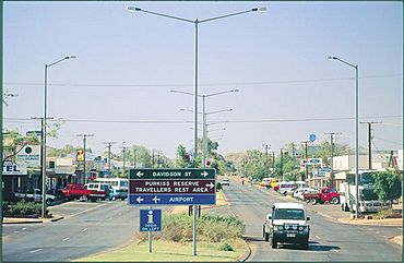
Main Street, Tennant Creek
|
|||||||||
| Population | 3,080 (2021 census) | ||||||||
| Established | 3 June 1954 (town) | ||||||||
| Postcode(s) | 0860 | ||||||||
| Time zone | ACST (UTC+9:30) | ||||||||
| Location |
|
||||||||
| LGA(s) | Barkly Region | ||||||||
| Territory electorate(s) | Barkly | ||||||||
| Federal Division(s) | Lingiari | ||||||||
|
|||||||||
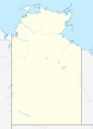
Tennant Creek (Warumungu: Jurnkkurakurr) is a town in the Northern Territory of Australia. It is the seventh largest town in the Northern Territory. You can find it on the Stuart Highway, just south of where it meets the Barkly Highway. In 2021, Tennant Creek had 3,080 people living there. More than half of them (55%) were Indigenous.
The town is about 1,000 kilometres south of Darwin, the capital of the Northern Territory. It is also 500 kilometres north of Alice Springs. Tennant Creek gets its name from a nearby stream. It is the main town for the huge Barkly Tableland. This area has vast, flat plains with golden Mitchell grass. It covers more than 240,000 square kilometres.
Tennant Creek is close to cool places like the Devils Marbles. Other spots include Mary Ann Dam, Battery Hill Mining Centre, and the Nyinkka Nyunyu Culture Centre. The Barkly Tableland stretches east from Tennant Creek towards Queensland. It is one of the most important cattle grazing areas in the Northern Territory. This region is about the same size as the United Kingdom. It has open grass plains and some of the world's biggest cattle farms.
Two major highways meet near Tennant Creek: the Barkly Highway and the Stuart Highway. The Barkly Highway is also called the Overlander's Way. It follows the path that early stockmen used to move their cattle from Queensland.
Contents
Exploring Tennant Creek's Location
Tennant Creek is right in the middle of the Northern Territory. It sits 376.5 metres above sea level. The average highest temperatures range from 24 to 38 degrees Celsius. About 22 days a year, the temperature goes above 40 degrees Celsius. The lowest temperatures range from 12 degrees in winter to 25 degrees in hotter months.
Weather and Seasons
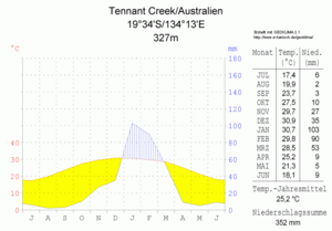
Tennant Creek has a tropical semi-arid climate. This means it has a short, very hot wet season from December to February. It also has a long, hot dry season from March to November. Because the dry season is so long, the plants here are like those found in a warm desert climate. Tennant Creek gets about 181 clear days each year.
The short wet season is very hot and has some rain. It also has higher humidity. Winds come from the Arafura Sea. However, the large size of the Northern Territory's Top End means less rain reaches inland places like Tennant Creek. This also helps keep the season sunny. Temperatures do not change as much during this season. The lowest temperature recorded was 15.7 °C, and the highest was 45.6 °C. Over 70% of Tennant Creek's yearly rain falls during this time. Sometimes, heavy rain can cause flooding.
The long dry season is warm to hot with little or no rain. The air is very dry, and there is lots of sunshine. Winds usually come from the east to south-east. This means Tennant Creek is in a rain shadow from the Great Dividing Range. Most rain from the Coral and Tasman Seas falls closer to the Pacific Ocean. In winter, nights are usually cool, averaging 12.7 °C in July. However, Tennant Creek has never had frost. The coldest it has ever been is 5.6 °C in June. Because it's warm and dry, droughts and bushfires can happen.
| Climate data for Tennant Creek Airport (1991–2020 normals and extremes); 376 m AMSL; 19° 38′ 32.28″ S | |||||||||||||
|---|---|---|---|---|---|---|---|---|---|---|---|---|---|
| Month | Jan | Feb | Mar | Apr | May | Jun | Jul | Aug | Sep | Oct | Nov | Dec | Year |
| Record high °C (°F) | 45.6 (114.1) |
43.2 (109.8) |
42.5 (108.5) |
38.4 (101.1) |
36.8 (98.2) |
34.0 (93.2) |
34.7 (94.5) |
36.0 (96.8) |
39.4 (102.9) |
41.9 (107.4) |
43.4 (110.1) |
45.4 (113.7) |
45.6 (114.1) |
| Mean daily maximum °C (°F) | 36.7 (98.1) |
35.8 (96.4) |
34.8 (94.6) |
32.4 (90.3) |
27.7 (81.9) |
24.8 (76.6) |
25.1 (77.2) |
27.6 (81.7) |
32.5 (90.5) |
35.2 (95.4) |
36.9 (98.4) |
37.0 (98.6) |
32.2 (90.0) |
| Daily mean °C (°F) | 30.9 (87.6) |
30.2 (86.4) |
29.2 (84.6) |
26.7 (80.1) |
22.1 (71.8) |
19.0 (66.2) |
18.9 (66.0) |
21.0 (69.8) |
25.8 (78.4) |
28.6 (83.5) |
30.6 (87.1) |
31.0 (87.8) |
26.2 (79.1) |
| Mean daily minimum °C (°F) | 25.0 (77.0) |
24.5 (76.1) |
23.5 (74.3) |
20.9 (69.6) |
16.4 (61.5) |
13.2 (55.8) |
12.7 (54.9) |
14.4 (57.9) |
19.1 (66.4) |
22.0 (71.6) |
24.2 (75.6) |
25.0 (77.0) |
20.1 (68.1) |
| Record low °C (°F) | 17.2 (63.0) |
17.2 (63.0) |
14.7 (58.5) |
12.0 (53.6) |
6.7 (44.1) |
5.6 (42.1) |
6.0 (42.8) |
6.6 (43.9) |
8.3 (46.9) |
11.6 (52.9) |
15.9 (60.6) |
15.7 (60.3) |
5.6 (42.1) |
| Average precipitation mm (inches) | 128.2 (5.05) |
132.9 (5.23) |
45.7 (1.80) |
15.0 (0.59) |
8.1 (0.32) |
4.1 (0.16) |
3.9 (0.15) |
2.4 (0.09) |
5.0 (0.20) |
16.9 (0.67) |
45.7 (1.80) |
86.8 (3.42) |
494.7 (19.48) |
| Average precipitation days (≥ 1.0 mm) | 8.2 | 8.0 | 3.3 | 1.1 | 1.0 | 0.7 | 0.5 | 0.2 | 1.1 | 2.5 | 3.9 | 6.7 | 37.2 |
| Average afternoon relative humidity (%) | 33 | 37 | 28 | 24 | 26 | 26 | 22 | 17 | 17 | 19 | 22 | 29 | 25 |
| Average dew point °C (°F) | 13.4 (56.1) |
14.9 (58.8) |
10.4 (50.7) |
6.5 (43.7) |
3.9 (39.0) |
2.1 (35.8) |
−0.2 (31.6) |
−1.3 (29.7) |
1.5 (34.7) |
3.0 (37.4) |
7.5 (45.5) |
11.5 (52.7) |
6.1 (43.0) |
| Mean monthly sunshine hours | 285.2 | 257.1 | 291.4 | 297.0 | 303.8 | 294.0 | 313.1 | 331.7 | 309.0 | 313.1 | 294.0 | 275.9 | 3,565.3 |
| Mean daily sunshine hours | 9.2 | 9.1 | 9.4 | 9.9 | 9.8 | 9.8 | 10.1 | 10.7 | 10.3 | 10.1 | 9.8 | 8.9 | 9.8 |
| Source: Australian Bureau of Meteorology | |||||||||||||
Town Buildings and Facilities
Tennant Creek has grown from its early days of droving and gold mining. It is now a modern town with shops, a supermarket, places to stay, bars, clubs, and restaurants. It also has a regional hospital, schools, and banks.
Fun Parks and Gardens
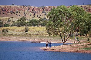
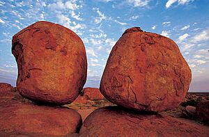
Mary Ann Dam is a great place to relax. You can easily get there from town by road or bike path. It's popular for swimming, barbecues, picnics, or bush walks. The most famous attraction nearby is Karlu Karlu / Devils Marbles Conservation Reserve. It's about 100 kilometres south of Tennant Creek. These huge granite boulders are scattered across a wide, shallow valley. They look amazing, especially when they glow red in the evening light. Local Aboriginal stories say the boulders are the eggs of the Rainbow Serpent. You can walk around the area yourself from the car park. There are also places to camp.
Another popular spot near Tennant Creek is the Iytwelepenty / Davenport Ranges National Park. It's best to explore this park with a four-wheel-drive vehicle.
A Look Back at Tennant Creek's Past
The Warumungu people have lived around Tennant Creek for thousands of years. The traditional name for the creek north of the town is Jurnkkurakurr. This name is now also used for the town area. The first European explorer to visit was John McDouall Stuart in 1860. He named a creek after John Tennant, who helped pay for his trips across Australia.
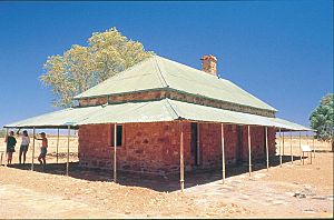
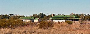
The Australian Overland Telegraph Line was built in the 1870s. This line allowed people in southern Australia to talk to London. A temporary building for a telegraph station was put up near Tennant Creek in 1872. Two years later, the strong stone buildings of the Tennant Creek Telegraph Station were finished. This is one of only four original telegraph stations left in Australia.
The Gold Rush Era
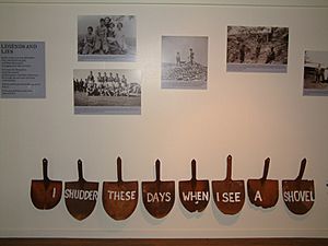
Tennant Creek was the site of Australia's last big gold rush in the 1930s. At that time, it was the third-largest gold producer in Australia. The Tennant Creek Telegraph Station was a very lonely place until then.
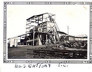
Gold was first found in 1926 by J Smith Roberts. In 1927, Charles Windley, a telegraph operator, found gold at what became the first mine, The Great Northern. But the big gold rush really started in December 1932. This was after Frank Juppurla, a local Indigenous man, showed gold to telegraph operator Woody Woodruffe. The town quickly grew to about 600 people. "Battery Hill" is a place overlooking Tennant Creek. It has one of the last working ten-head stamp batteries. This is a government-owned machine that crushes ore.
The town of Tennant Creek was built 12 km south of the creek. This was because the Overland Telegraph Station had an 11 km protected area. A local story says the town was built there for a different reason. In 1934, Joe Kilgarriff built the Tennant Creek hotel. The building materials came on the first commercial trip of the AEC Roadtrain from Alice Springs. The pub is still there today and is an important part of history.
Cecil Armstrong helped build up Tennant Creek early on. He arrived in 1935 and started baking bread the next day. In 1937, he built Armstrong's bakery and cafe. He worked there for over twenty years. The building is still standing today.
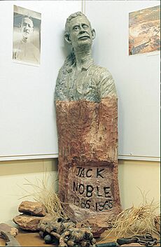
Mrs. Weaber was another important person in Tennant Creek. She was the wife of the blind owner of the Rising Sun Mine. This was one of the richest gold mines before World War II. Mrs. Weaber was very religious. She paid to have an old church from Pine Creek moved to Tennant Creek, piece by piece. This is how the Tennant Creek Catholic Church was started. Mrs. Weaber also started the Tennant Creek Christmas tree event. In the early 1930s, she held a party at her husband's mine. She gave every child a present. This kind act continues today. Every year, the town puts up a public Christmas tree. Every child, local or visitor, gets a present. The Weaber family left Tennant Creek in 1940. They sold the lease to what became the richest post-war mine, Nobles Nob. They did not know how valuable it would become. Nobles Nob was named after Jack Noble, a friend of the Weaber family.
Gold mining in Tennant Creek mostly stopped in 1942. Only one large mine with its own crushing plant kept working. During World War II, the Australian Army set up a hospital near Tennant Creek. The Royal Australian Air Force used Tennant Creek Airfield for emergency landings.
Today, the town is on a part of the Stuart Highway called Paterson Street. As a regional centre, it has government services and local businesses. It also has a growing tourist centre with restaurants and activities. People in Tennant Creek enjoy modern facilities like parks, sports venues, galleries, and a civic hall. It also hosts Australia's top go-karting event on a street circuit.
People of Tennant Creek
In 2021, the population of Tennant Creek was 3,080 people. Of these, 1,707 (55.4%) were Aboriginal.
How Tennant Creek Makes Money
Mining for Resources
Tennant Creek was once the third largest gold producer in Australia. It is still very productive today. Over 210 tonnes of gold have been mined here. Famous old mines include the Nobles Nob and the Peko mines. These started in 1933 and 1934.
The Bootu Mine, north of town, sends manganese to China. Large mining companies are still looking for other minerals. These include bauxite, lead, zinc, silver, and copper around the area. They have also started exploring for minerals southeast of the town.
Powering the Future
The nearby town of Elliot is planned to be the site of a very large solar panel farm. This is part of the Sun Cable project.
Tourism and Visitors
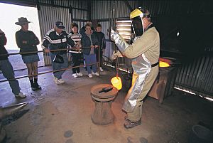
Tourism is a growing industry here. It highlights the town's location, history, beautiful scenery, and culture. It gives visitors a chance to experience the outback. The mineral collection at Battery Hill is a must-see. The stamp battery stopped working in 2005 but has been fixed. It now runs daily for tours. The exhibition Freedom, Fortitude and Flies at the social history museum tells the story of mining through the eyes of women and children.
The Nyinkka Nyunyu Arts and Culture Centre opened in July 2003. It lets visitors and the community learn about Aboriginal life, history, and culture.
Getting Around Tennant Creek
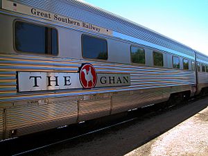
Tennant Creek has had train access since 2004. This was when the Adelaide-Darwin railway was finished. The Ghan train, run by Great Southern Rail, passes through twice a week. It travels between Adelaide and Darwin.
Tennant Creek is served by Tennant Creek Airport. There are regular flights to Alice Springs and Darwin. Outback Airlines flies mining charters between Alice Springs and Tennant Creek. Anyone can buy a seat on these flights.
Tennant Creek has daily bus services from Darwin and Alice Springs. The Barkly Tablelands are best explored from Tennant Creek. You can get there on the fully paved Explorer's Way. This road is 1,000 kilometres south of Darwin and 510 kilometres north of Alice Springs. The Overlander's Way (Barkly Highway) is another tourist drive from Queensland. It meets the Explorer's Way at Threeways, 25 kilometres north of Tennant Creek.
In 2005, two companies agreed to study building a 250 km railway. This railway would go from Tennant Creek to Wonarah. There have also been talks about a rail link between Tennant Creek and Mount Isa. This link would help resource companies use both the Adelaide-Darwin and Townsville-Mount Isa train lines. It would also give train passengers direct access to Darwin from Australia's East Coast. The Australian Defence Force might also use this link.
Learning in Tennant Creek
Tennant Creek has both a primary school and a high school. In the past, high school students often left Tennant Creek. They would live and study at schools in Darwin and Alice Springs. But today, young people prefer to stay and study at schools in Tennant Creek.
Life and Culture in Tennant Creek
Aboriginal people have lived in the Barkly region for over 40,000 years. The Barkly region is rich in the old traditions and beliefs of its traditional owners. About nine Aboriginal groups call this area home. These include the Warumungu, Warlpiri, Kaytetye, and Alyawarre people. Tennant Creek is an important place for many Aboriginal people from different language groups.
Fun and Entertainment
The Northern Territory has several regional events each year. These can affect how many visitors come to the area. Events in the Barkly Area include the Desert Harmony Festival, the Barkly Campdraft and Rodeo, Saint Patrick's Day Races, Barkly May Day Muster, and the Brunette Downs Races. The World Solar Challenge happens every two years.
The Tennant Creek Public Library serves the people of the town and nearby areas.
Arts and Creativity
Tennant Creek has a lively music community. The Winanjjikari Music Centre is home to many new singers, songwriters, and musicians.
The Artists of the Barkly group is supported by Barkly Regional Arts. It represents over 50 Aboriginal artists. These artists live in five remote communities across the region. These are Tennant Creek, Wutunugurra (Epenarra), Owairtilla (Canteen Creek), Kulumindini (Elliott), and Mungkarta (McLaren Creek).
The Nyinkka Nyunyu Art and Culture Centre opened in 2003. The Warumungu community of Tennant Creek started it in 1995. It is a special centre with displays about five topics: bush tucker (food) and resources, Country, Language, History, and Punttu (family). The Julalikari Council Aboriginal Corporation runs it.
Sports and Activities
Tennant Creek has many sports and recreation clubs for locals. Some of these are the Tennant Creek Bowling Club, Golf Club, Gun Club, Soccer Club, and Swimming Pool.
Tennant Creek Speedway (19°37′28″S 134°11′56″E / 19.62444°S 134.19889°E) is just north of town. It has hosted important motorcycle speedway events. This includes qualifying rounds for the Speedway World Championship since 1985.
Four clubs from Tennant Creek play in the regional Barkly Australian Football League Australian rules football competition.
The Tennant Creek Cricket Association has started again after 20 years without a competition.
The Tennant Creek Youth Centre will host basketball.
NRL Northern Territory runs the Central Australian Rugby Football League. Teams from Alice Springs and wider communities, including Tennant Creek and Yuendumu, play in this league.
Sister Cities
 Ballard, Utah, United States
See also
 In Spanish: Tennant Creek para niños
 | Precious Adams |
 | Lauren Anderson |
 | Janet Collins |


