
Thayer County, Nebraska facts for kids
Quick facts for kids
Thayer County
|
|
|---|---|

Thayer County Courthouse in Hebron
|
|

Location within the U.S. state of Nebraska
|
|
| Country | |
| State | |
| Established | May 9, 1871 |
| Named for | John Milton Thayer |
| County seat | Hebron |
| Largest city | Hebron |
| Area | |
| • Total | 575 sq mi (1,490 km2) |
| • Land | 574 sq mi (1,490 km2) |
| • Water | 1.2 sq mi (3 km2) 0.2% |
| Highest elevation | 1,545 ft (471 m) |
| Lowest elevation | 1,142 ft (348 m) |
| Population | |
| • Estimate
(2021)
|
4,913 |
| • Density | 8.8/sq mi (3.4/km2) |
| Time zone | UTC−6 (Central) |
| • Summer (DST) | UTC−5 (CDT) |
| Area code | 402/531 |
| FIPS code | 31169 |
| GNIS feature ID | 835906 |
| Website | thayercountyne.gov |
Thayer County is a special area in the state of Nebraska, USA. It is like a local government division. As of 2020, about 5,034 people live there. The main town, or county seat, where the county government is located, is Hebron.
Thayer County was first created in 1856. It was originally called Jefferson County. Later, in 1870-1871, it was officially organized and renamed. It got its new name from General and Governor John Milton Thayer.
If you see a Nebraska license plate with the number 32, it means the vehicle is from Thayer County. This number was given because Thayer County had the 32nd largest number of vehicles registered in the state back in 1922.
Contents
Geography of Thayer County
Thayer County is located in the southern part of Nebraska. Its southern border touches the northern border of Kansas. The land here has gentle, rolling hills that slope towards the east.
Waterways and Land Use
Two important streams flow through the county. Big Sandy Creek flows southeast and then east through the northern part. Rose Creek flows northeast through the southeastern part. These two creeks meet east of Thayer County. Many flat areas of the county are used for farming.
Thayer County covers about 575 square miles. Most of this area, about 574 square miles, is land. Only a small part, about 1.2 square miles, is water.
Main Roads in Thayer County
 U.S. Highway 81
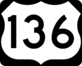
 U.S. Highway 136
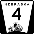
 Nebraska Highway 4
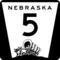
 Nebraska Highway 5
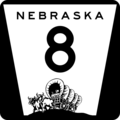
 Nebraska Highway 8
 Nebraska Highway 53
Neighboring Counties
- Saline County – to the northeast
- Jefferson County – to the east
- Washington County, Kansas – to the southeast
- Republic County, Kansas – to the south
- Nuckolls County – to the west
- Fillmore County – to the north
Protected Natural Areas
Thayer County is home to some special natural places:
- Prairie Marsh State Wildlife Management Area
- Prairie Marsh West State Wildlife Management Area
These areas help protect local wildlife and their habitats.
Population of Thayer County
| Historical population | |||
|---|---|---|---|
| Census | Pop. | %± | |
| 1880 | 6,113 | — | |
| 1890 | 12,738 | 108.4% | |
| 1900 | 14,325 | 12.5% | |
| 1910 | 14,775 | 3.1% | |
| 1920 | 13,976 | −5.4% | |
| 1930 | 13,684 | −2.1% | |
| 1940 | 12,262 | −10.4% | |
| 1950 | 10,563 | −13.9% | |
| 1960 | 9,118 | −13.7% | |
| 1970 | 7,779 | −14.7% | |
| 1980 | 7,582 | −2.5% | |
| 1990 | 6,635 | −12.5% | |
| 2000 | 6,055 | −8.7% | |
| 2010 | 5,228 | −13.7% | |
| 2020 | 5,034 | −3.7% | |
| 2021 (est.) | 4,913 | −6.0% | |
| US Decennial Census 1790-1960 1900-1990 1990-2000 2010-2013 Its county seat is Hebron. |
|||
In 2000, there were 6,055 people living in Thayer County. The population density was about 10 people per square mile. Most of the people living there were White (98.70%).
About 27.70% of the households had children under 18 living with them. The average household had about 2.31 people. The average family had about 2.90 people.
The median age of people in the county was 44 years old. About 24.10% of the population was under 18 years old.
Towns and Villages
Thayer County has several communities, including cities and smaller villages.
Cities
Villages
Images for kids
-

U.S. Highway 81 sign
-
U.S. Highway 136 sign
-
Nebraska Highway 4 sign
-
Nebraska Highway 5 sign
-
Nebraska Highway 8 sign
-
Nebraska Highway 53 sign


See also
 In Spanish: Condado de Thayer para niños
