The Ridgeway facts for kids
Quick facts for kids The Ridgeway |
|
|---|---|
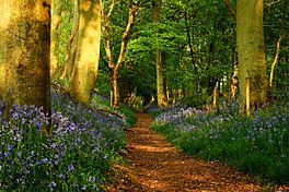
The Ridgeway in Grim's Ditch near Mongewell
|
|
| Length | 87 miles (139km) |
| Location | southern England, United Kingdom |
| Designation | UK National Trail |
| Trailheads | Overton Hill, near Avebury, Wiltshire and Ivinghoe Beacon, Buckinghamshire |
| Use | Hiking |
| Elevation change | 3,881 feet (1,183 m) |
| Season | All year |
| Trail map | |
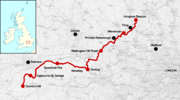
Map of the Ridgeway National Trail in the south of England
|
|
The Ridgeway is a very old path in England. Some people call it Britain's oldest road! It follows a high, dry path across chalk hills. This path stretches from Wiltshire to the River Thames at a place called the Goring Gap.
This ancient path is now part of a longer walking route called the Ridgeway National Trail. This trail starts at Overton Hill near Avebury and goes all the way to Ivinghoe Beacon in Buckinghamshire. The whole National Trail is about 87 miles (139 km) long. It's a great place for hiking and exploring history!
Contents
A Journey Through Time: The Ridgeway's History
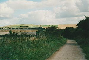
People have used the Ridgeway for at least 5,000 years. Imagine that! It was a super important route for trading goods. It connected the Dorset coast to the Wash in Norfolk.
Why was it so popular? The path is on high, dry ground. This made travel easier and safer. Travelers could see far away, helping them spot any danger.
- Bronze Age: Around 4,000 years ago, people created amazing things along the Ridgeway. This includes the famous Uffington White Horse and the huge stone circle at Avebury.
- Iron Age: Later, people built hillforts on the high ground. These forts helped protect the trading route from attacks.
- Later Years: Even after the Roman Empire ended, armies like the Saxons and Vikings used this path. In the Middle Ages, farmers used it to move their animals (called "droving") to markets.
Before the 1700s, the Ridgeway was just a bunch of informal tracks. Travelers picked the best path depending on the weather. But after 1750, hedges and earth banks were built. This helped create the clear path we see today.
The Ridgeway National Trail: Your Adventure Awaits
The idea for a long walking path here started way back in 1947. The Ridgeway became an official National Trail in 1973. It's one of fifteen long-distance trails in England and Wales.
The trail stretches 87 miles (139 km) from Overton Hill (part of the Avebury World Heritage Site) to Ivinghoe Beacon.
- Connecting Trails:
* Near Marlborough, it meets the Wessex Ridgeway. This path goes southwest towards Lyme Regis. * At Ivinghoe Beacon, it connects with the Icknield Way Path, which continues northeast. * At the Goring Gap, the Ridgeway crosses paths with the Thames Path National Trail.
The Ridgeway climbs a total of 3,881 feet (1,183 meters) along its route. The official guide divides the trail into six sections. You can join or leave the trail at many places. Some towns with public transport links include Avebury, Swindon, Wantage, Wallingford, Princes Risborough, and Tring.
| Section | Start point | Finish point | Distance | Ascent | Descent |
|---|---|---|---|---|---|
| 1 | Overton Hill | Ogbourne St George | 14.5 km (9.0 mi) | 191 m (627 ft) | 264 m (866 ft) |
| 2 | Ogbourne St George | Sparsholt Firs | 25 km (16 mi) | 421 m (1,381 ft) | 352 m (1,155 ft) |
| 3 | Sparsholt Firs | Streatley | 28 km (17 mi) | 242 m (794 ft) | 415 m (1,362 ft) |
| 4 | Streatley | Watlington | 24 km (15 mi) | 400 m (1,300 ft) | 328 m (1,076 ft) |
| 5 | Watlington | Wendover | 27 km (17 mi) | 550 m (1,800 ft) | 555 m (1,821 ft) |
| 6 | Wendover | Ivinghoe Beacon | 18.6 km (11.6 mi) | 408 m (1,339 ft) | 315 m (1,033 ft) |
The Ridgeway is part of a bigger network of paths. These paths together are sometimes called the Greater Ridgeway.
Amazing Sights Along the Ridgeway
The Ridgeway passes by many cool ancient sites. These include places from the Neolithic, Iron Age, and Bronze Age periods:
- Avebury Stone Circle: A huge and mysterious circle of standing stones.
- Hill Forts: You'll see several ancient hill forts like Barbury Castle, Liddington Castle, Uffington Castle, and Segsbury Camp. These were strongholds built on high ground.
- Wayland's Smithy: An ancient burial tomb from the Neolithic period.
- Uffington White Horse: A giant, 400-foot-long horse carved into the chalk hillside. It's thousands of years old!
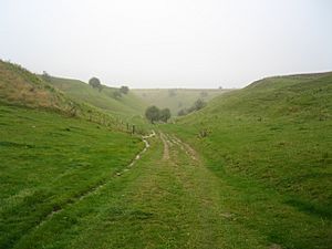
- Grim's Ditch: A 5-mile-long earthwork. Iron Age people built it, possibly as a border.
Other interesting spots include the Blowing Stone and Victory Drive, which leads to Chequers (the British Prime Minister's country home).
How to Travel the Ridgeway
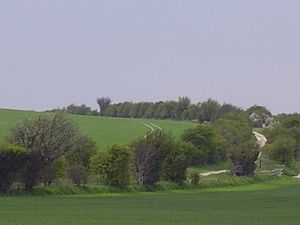
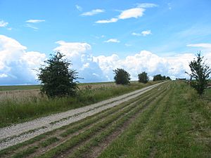
The path itself changes a lot. Some parts are chalky farm paths or green lanes. These can get very muddy after rain! Other parts are small paved roads.
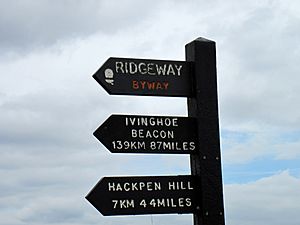
Most of the Ridgeway is a bridleway. This means you can walk, ride a horse, or cycle on it. Some parts are called "byways," which means motorized vehicles can use them. However, many of these byway sections only allow vehicles during the summer. Also, many parts of the Ridgeway are now closed to regular cars all year round. This helps keep the path safe and peaceful for walkers, cyclists, and horse riders.
Even though the Ridgeway was planned out by people, it's so old and special that a TV show called Seven Natural Wonders featured it in 2005. They called it one of the wonders of the South of England!
Places Along The Ridgeway Trail
Here are some of the towns and places you'll find near (or on) The Ridgeway National Trail, going from west to east:
- Avebury
- Overton Hill
- Swindon
- Marlborough
- Liddington Castle
- Wanborough
- Wayland's Smithy
- Uffington Castle
- Lambourn
- Segsbury Camp
- Wantage
- West Lockinge
- East Lockinge
- West Ginge
- West Hendred
- East Hendred
- Harwell
- Chilton
- Compton
- Didcot
- Blewbury
- Streatley
- Goring-on-Thames
- Wallingford
- Thame
- Chinnor
- Reading
- Henley-on-Thames
- Princes Risborough
- Cadsden
- Aylesbury
- Wendover
- High Wycombe
- Tring
- Ivinghoe Beacon
See also
 In Spanish: The Ridgeway para niños
 | Claudette Colvin |
 | Myrlie Evers-Williams |
 | Alberta Odell Jones |


