The Rock of Gibraltar facts for kids
Quick facts for kids Rock of Gibraltar |
|
|---|---|

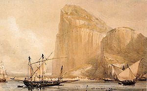
Western face of the Rock of Gibraltar, in April 2006
|
|
| Highest point | |
| Elevation | 426 m (1,398 ft) |
| Prominence | 423 m (1,388 ft) |
| Geography | |
| Location | Gibraltar |
| Parent range | Betic Cordillera |
| Geology | |
| Age of rock | Jurassic |
| Climbing | |
| Easiest route | Gibraltar Cable Car, Road, Hike |
The Rock of Gibraltar is a huge, single piece of limestone rock. It stands tall in the British territory of Gibraltar, at the very tip of southwestern Europe. This famous rock is about 426 meters (1,398 feet) high.
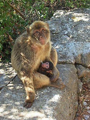
Most of the upper part of the Rock is a nature reserve. It is home to about 300 Barbary macaques, which are a type of monkey. Many tourists visit the Rock each year to see these monkeys and explore the amazing tunnels inside.
Long ago, the Romans called the Rock of Gibraltar Mons Calpe. It was one of the two Pillars of Hercules. The other pillar was Jebel Musa in Africa. In ancient times, people believed these two points marked the end of the known world.
Gibraltar is surrounded by the Mediterranean Sea. It does not touch the Atlantic Ocean.
Contents
What is the Rock of Gibraltar Made Of?
The Rock of Gibraltar is a giant monolith, meaning it's one huge stone. It is mostly made of limestone and other rocks formed during the Jurassic period. This was about 175 to 200 million years ago.
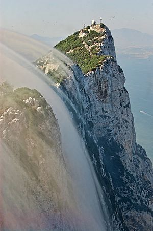
The Rock has a sharp top, with parts over 400 meters (1,300 feet) high. Over time, the Earth's movements have folded and broken these rock layers. The oldest layers of rock are actually on top of the younger ones!
The Rock has different types of rock layers. These include the Catalan Bay Shale, Gibraltar Limestone, Little Bay Shale, and Dockyard Shale. The Gibraltar Limestone makes up about three-quarters of the Rock.
Geologists have found old fossils in the Gibraltar Limestone. These include corals and shells. These fossils show that the limestone formed in the early Jurassic period.
About 5 million years ago, the African tectonic plate crashed into the Eurasian plate. This caused the Mediterranean Sea to dry up for a while. Later, the Atlantic Ocean broke through the Strait of Gibraltar. This refilled the Mediterranean Sea. The Rock of Gibraltar is part of the Betic Cordillera, a mountain range in southern Spain.
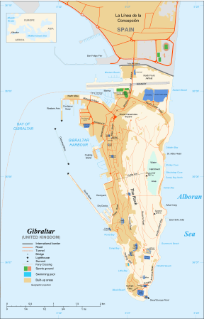
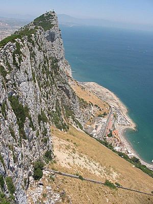
Today, the Rock of Gibraltar sticks out into the Strait of Gibraltar. It is connected to Spain by a sandy strip of land. The northern side of the Rock rises straight up from the sea. Its highest point is 426 meters (1,398 feet) high.
The western side of the Rock is less steep. This is where the City of Gibraltar is located.
Caves of the Rock
Calcite, a mineral in limestone, slowly dissolves in rainwater. This process creates caves over many years. Because of this, the Rock of Gibraltar has over 100 caves!
St. Michael's Cave is the most famous. It is located halfway up the western side of the Rock. It is a very popular place for tourists to visit.
Ancient Human Discoveries
Fossils of Neanderthals have been found in several places on the Rock. In 1848, a Neanderthal woman's skull was found at Forbes' Quarry.
Later, in Gorham's Cave, scientists found proof that Neanderthals lived there. They also found plant and animal remains. This showed that Neanderthals had a very varied diet.
How the Rock of Gibraltar Was Fortified
The Rock of Gibraltar has been a fortress for centuries.
The Moorish Castle
The Moorish Castle is a very old building. It reminds us of the time when the Moors ruled Gibraltar for 710 years. It was built in A.D. 711. This was when the leader Tariq ibn-Ziyad first landed on the Rock. The Rock is named after him.
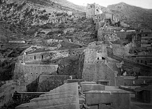
The main part of the castle still standing is the Tower of Homage. It is a huge building made of brick and strong concrete. The upper part of the tower had living areas and a Moorish bath.
The Great Siege Tunnels
A special feature of the Rock is its system of underground tunnels. These are known as the Galleries or the Great Siege Tunnels.
The first tunnels were dug during the Great Siege of Gibraltar (1779-1783). General Elliot wanted to fire cannons at the Spanish from the side of the Rock. A soldier named Henry Ince suggested digging a tunnel.
At first, they just wanted a tunnel for air. But once they made an opening, they put a cannon in it! By the end of the siege, the British had six openings and four cannons.
The Galleries that tourists can visit were built later, finished in 1797. They are a system of halls and passages, almost 304 meters (1,000 feet) long. From these tunnels, you can see amazing views of the Bay of Gibraltar and Spain.
The Rock During World War II
When World War II started in 1939, the people living in Gibraltar were moved away. This was so the military could make the Rock stronger against a possible German attack.
By 1942, over 30,000 British soldiers, sailors, and airmen were on the Rock. They made the tunnel system even bigger. The Rock became very important for protecting shipping routes to the Mediterranean.
In 1997, a secret plan called Operation Tracer was revealed. The British planned to hide servicemen in tunnels under the Rock. If the Germans captured Gibraltar, this team would use radios to report enemy movements. A six-man team waited for two and a half years. But the Germans never got close to capturing the Rock, so the men were never sealed inside.
Famous Sayings About the Rock
The saying "solid as the Rock of Gibraltar" means something is very safe or strong.
The motto of the Royal Gibraltar Regiment is Nulli Expugnabilis Hosti. This is Latin for "No Enemy Shall Expel Us."
Nature and Wildlife on the Rock
About 40% of Gibraltar's land is a protected nature reserve. This was made official in 1993.
Plants and Animals of the Rock
The plants and animals in the Gibraltar Nature Reserve are very important. They are protected by law. The most famous animals are the Barbary macaques, also known as the Rock apes. There are also Barbary partridges.
Some special flowers grow here, like the Gibraltar Candytuft. The macaques might have come from North Africa. Or, they could be a very old group of monkeys that lived across Southern Europe millions of years ago.
Birds and Migration
The Rock of Gibraltar is at the top of the Strait. This makes it a key stopping point for migrating birds. Many birds stop here to rest and eat before flying across the sea and desert. In spring, they stop again on their way to places like Western Europe, Greenland, or Russia.
BirdLife International has named the Rock an Important Bird Area. This is because about 250,000 raptors (birds of prey) fly across the Strait each year. The Rock also has breeding groups of Barbary partridges and lesser kestrels.
Images for kids
See also
 In Spanish: Peñón de Gibraltar para niños
 | William L. Dawson |
 | W. E. B. Du Bois |
 | Harry Belafonte |


