Thomas Jefferys facts for kids

Thomas Jefferys (born around 1719 – died 1771) was a very important mapmaker from England. He was even called the "Geographer to King George III", which meant he was the official mapmaker for the king! He was the best map supplier of his time. Thomas Jefferys made and printed maps for the government and other important groups. He also created many maps and atlases (books of maps) for people to buy, especially maps of North America.
Early Mapmaking Work
Before working for the King, Thomas Jefferys was the "Geographer to the Prince of Wales". This was another important job! During this time, he created a map called A Plan of all the Houses, destroyed & damaged by the Great Fire, which began in Exchange Alley Cornhill, on Friday March 25, 1748. This map showed all the buildings that were ruined or hurt by a big fire in London in 1748.
He also worked with another mapmaker, Thomas Kitchin, to create The Small English Atlas. An atlas is a collection of maps in a book. Jefferys also drew detailed maps of towns in the middle of England, known as the English Midlands.
Mapping North America
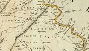
Thomas Jefferys was well-known for his maps of North America. In 1754, he published a map called Map of the Most Inhabited Part of Virginia. This map was based on surveys (measurements of the land) done by Joshua Fry and Peter Jefferson in 1751. The next year, he released a map of New England.
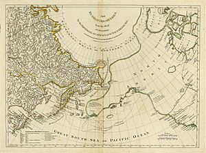
Later, in 1768, he worked with Robert Sayer to publish A General Topography of North America and the West Indies. This was a huge collection of maps of these areas.
Even after he passed away, his maps were still very popular. In 1775, Robert Sayer published collections of Jefferys' maps, including The American Atlas and The West-India Atlas. The American Atlas was re-released in 1776 and made even bigger because of the growing problems between the British and the Americans. It included maps by other famous surveyors like Joshua Fry, Peter Jefferson, and Lewis Evans.
In 1754, Thomas Jefferys was also involved in important discussions about the border between Nova Scotia and Acadia. This was a big topic at the time, especially during a conflict known as Father Le Loutre's War.
Maps of English Counties
Thomas Jefferys also paid people to survey (measure) and create maps of several counties in England. These were very detailed maps, often needing several large sheets for each county. For example, his maps of Bedfordshire and Huntingdonshire were drawn at a scale of two inches for every mile, which is very precise!
Here are some of the English counties he mapped:
- Bedfordshire: Surveyed in 1765 by John Ainslie, published in 1765.
- Huntingdonshire: Surveyed in 1766, published in 1768.
- Oxfordshire: Surveyed in 1766-67, published in 1767.
- County Durham: Published in 1768.
- Buckinghamshire: Surveyed in 1766-68 by John Ainslie, published in 1770.
- Westmoreland: Surveyed in 1768, published in 1770.
- Yorkshire: Surveyed in 1767-70 by John Ainslie, published in 1771-72.
- Cumberland: Surveyed in 1770-71, published in 1774.
- Northamptonshire: An older survey was updated in 1771 and published in 1779.
After Thomas Jefferys died, other map publishers like William Faden continued to print and sell his maps.
See also
 | Shirley Ann Jackson |
 | Garett Morgan |
 | J. Ernest Wilkins Jr. |
 | Elijah McCoy |


