Thoreau, New Mexico facts for kids
Quick facts for kids
Thoreau, New Mexico
|
|
|---|---|

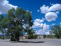
Thoreau school and water tower
|
|

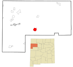
Location in McKinley County and the state of New Mexico
|
|
| Country | United States |
| State | New Mexico |
| County | McKinley |
| Area | |
| • Total | 39.49 sq mi (102.3 km2) |
| • Land | 39.49 sq mi (102.3 km2) |
| • Water | 0.00 sq mi (0 km2) |
| Elevation | 7,225 ft (2,202 m) |
| Population
(2020)
|
|
| • Total | 2,367 |
| • Density | 59.94/sq mi (23.14/km2) |
| Time zone | UTC-7 (MST) |
| • Summer (DST) | UTC-6 (MDT) |
| ZIP code |
87323
|
| Area code(s) | 505 |
| FIPS code | 35-77530 |
| GNIS feature ID | 2410078 |
Thoreau (Navajo: Dlǫ́ʼí Yázhí) is a small community in McKinley County, New Mexico, United States. It's a place where the government collects information about the population, called a census-designated place (CDP). In 2020, about 2,367 people lived there. This was more than the 1,865 people counted in 2010.
Most people in Thoreau are Native American, mainly from the Navajo Nation. This is because Thoreau is located within the Navajo Nation's lands.
If you visit Thoreau, you'll hear its name pronounced "thuh-ROO." It sounds like the word "through" or "threw." The ZIP code for Thoreau is 87323.
Contents
Exploring Thoreau's Location and Landscape
Thoreau is in the middle of McKinley County. It sits high up, about 7,140 feet (2,176 meters) above sea level. The town is about 5 miles (8 km) east of the Continental Divide. This is a line where rivers on one side flow to the Pacific Ocean and rivers on the other side flow to the Atlantic Ocean.
Mountains and Rivers Near Thoreau
Thoreau is in a wide valley. This valley is below a large cliff made of Entrada sandstone. This cliff marks the southern edge of the Colorado Plateau. You can see Mount Powell and Castle Rock along this cliff. To the south of Thoreau are the Zuñi Mountains.
The community is in a valley where a stream called Mitchell Draw flows. This stream goes southeast into the Rio San Jose. The Rio San Jose is part of the Rio Puerco watershed, which eventually leads to the Rio Grande.
Highways and Transportation
Important roads pass through or near Thoreau. Interstate 40 and the historic U.S. Route 66 are two of them. These highways connect Thoreau to other towns. Going west for about 30 miles (48 km) leads to Gallup. Gallup is the main town in McKinley County. Going southeast the same distance leads to Grants.
Other New Mexico State highways also go through Thoreau. These include 122, 371, and 612. Besides roads, two natural gas pipelines and a major railway also cross through the community.
Climate and Nature in Thoreau
Thoreau has a dry climate. The plants here are typical for a dry region. You'll see pinyon pine and juniper trees, sagebrush, and some short grasses. The area has four clear seasons.
- Summer: Summers are mild because Thoreau is high up and the air is not humid. Temperatures usually don't go above 91°F (33°C). In July and August, thunderstorms with lots of lightning happen due to the southwest monsoon.
- Autumn: Fall is pleasant with warm days and cool nights.
- Winter: Winters have frequent snowstorms. Temperatures can drop to about 5°F (-15°C) or even colder.
- Spring: Cold, strong, and windy conditions are common in spring, especially in March.
Who Lives in Thoreau?
| Historical population | |||
|---|---|---|---|
| Census | Pop. | %± | |
| 2000 | 1,863 | — | |
| 2010 | 1,865 | 0.1% | |
| 2020 | 2,367 | 26.9% | |
| U.S. Decennial Census | |||
In 2000, there were 1,863 people living in Thoreau. The population density was about 117 people per square mile (45 people per square kilometer). Most people living in Thoreau are Native American, making up about 71% of the population. About 23% are White. People of Hispanic or Latino background made up about 9% of the population.
Many households in Thoreau have children under 18. The average household had about 3.5 people. The average family had about 4.16 people. In 2000, the median age in Thoreau was 24 years old. This means half the people were younger than 24 and half were older.
Thoreau is located within the Navajo Nation. The Navajo are the largest Native American tribe in the United States. Their culture and history are very important in Thoreau. The Navajo Nation has a local office here called a Chapter House. Many Navajo residents, also known as Diné, speak their native language.
Thoreau is a place where local artists trade their handmade goods. These artists create beautiful items like woven rugs, sandpaintings, silver jewelry, pottery, and turquoise jewelry. You can also find ancient Anasazi archaeological sites around Thoreau. These sites are connected to the famous Chaco Canyon.
Learning and Schools in Thoreau
The Gallup-McKinley County Public Schools district serves Thoreau.
There are three public schools in Thoreau:
- Thoreau Elementary School: For students from Kindergarten to 5th grade.
- Thoreau Middle School: For students in 6th through 8th grades.
- Thoreau High School: For students in 9th through 12th grades.
These schools serve students from Thoreau and the nearby rural areas. The school mascot is the Hawks, and the school colors are green and gold.
There is also a private school called the St. Bonaventure Indian School. It started as a preschool in 1980. Later, it added an elementary school. It also had a high school from 1986 to 2001. This school is also known as the Blessed Kateri Tekakwitha Academy. It is named after the first Native American Catholic saint in North America.
Faith and Beliefs in Thoreau
Most of the people in Thoreau are Navajo. Many practice traditional Navajo beliefs, often with the help of medicine men and through the Native American Church. Some residents are also part of different Christian churches. These include the Saint Bonaventure Catholic mission, The Church of Jesus Christ of Latter-day Saints, and various Protestant groups like Baptists, Church of Christ, Church of God, and other evangelical churches.
See also
 In Spanish: Thoreau (Nuevo México) para niños
 | Roy Wilkins |
 | John Lewis |
 | Linda Carol Brown |


