
Thunstetten facts for kids
Quick facts for kids
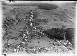
Thunstetten
|
||
|---|---|---|
_266.JPG) |
||
|
||

Thunstetten
Location in Switzerland

Thunstetten
Location in Canton of Bern
|
||
| Country | Switzerland | |
| Canton | Bern | |
| District | Oberaargau | |
| Area | ||
| • Total | 9.66 km2 (3.73 sq mi) | |
| Elevation | 541.1 m (1,775.3 ft) | |
| Population
(Dec 2020 )
|
||
| • Total | 3,458 | |
| • Density | 357.97/km2 (927.1/sq mi) | |
| Postal code |
4922
|
|
| Surrounded by | Aarwangen, Bleienbach, Graben, Herzogenbuchsee, Langenthal, Thörigen | |

Thunstetten is a town, also called a municipality, located in the Oberaargau administrative district. This area is part of the canton of Bern in Switzerland.
Contents
History of Thunstetten
_258.JPG)

Thunstetten was first mentioned in official records in the year 1220. It was called Tunchsteten back then.
Even before that, people lived here! Some tools and items from the neolithic era (New Stone Age) have been found in the Thunstetterwald forest. Also, Hallstatt era (an early Iron Age culture) grave mounds are located in Tannwäldli and Bützberg. These mounds are like ancient burial hills.
A group called the Knights Hospitaller built a special place called the Thunstetten Commandery before 1210. This was like a religious and military base. Over the next two centuries, the Commandery grew a lot. They received land from donations and bought more from local nobles. At their strongest, they owned land in many areas, including Oberaargau and around Solothurn. They even bought vineyards and rights over village churches.
As the Commandery grew, so did Thunstetten. It got its own seal (a special stamp) in 1274. It also made agreements with other towns like Wangen and Bern. These agreements were called Burgrecht. In 1528, after the Protestant Reformation (a big change in religion), the Commandery's lands became property of Bern. A Bernese bailiff (a local official) then managed these lands.
Between 1711 and 1713, a man named Hieronymus von Erlach built Thunstetten Castle. He then combined the castle's lands with the local court system of Thunstetten. The castle stayed with the Erlach family until 1746. After that, it had many different owners. In 1971, a special foundation was created to take care of the castle. It is now considered a very important heritage site for Switzerland.
In the 13th century, the area of Thunstetten had several small groups of people living in different spots. These spots grew into villages by the 14th century. Farmers grew crops and sometimes grapes for wine. The villages stayed quite small. In 1780, Bützberg was the biggest with 31 houses.
During the 18th and 19th centuries, many large farms were divided into smaller ones. Shared lands, called commons, became private property. This meant small farmers, who needed the commons to survive, had to find other ways to earn money. They started cottage industries like weaving and knitting from their homes. By 1855, farmers in the area focused more on dairy and cattle farming. Dairy cooperatives (groups of farmers working together) opened in each village.
Today, farming is still important in Thunstetten. However, Bützberg has good transport links, which helped industries and businesses grow there. Bützberg is now home to almost two-thirds of the population and the main office for the whole municipality.
Geography of Thunstetten
_295.JPG)
Thunstetten covers an area of about 9.7 square kilometers (3.7 square miles). More than half of this land, about 53.9%, is used for farming. Forests cover about 26.2% of the area.
The remaining land is mostly built up with buildings and roads (19.8%). A very small part (0.3%) is rivers or lakes. The rest (0.1%) is land that cannot be used for anything.
Most of the built-up area is for houses and other buildings (9.3%) or transportation (7.4%). Industrial buildings make up 2.0% of the area. All the forested land is covered with thick forests. For farming, 38.4% is used for growing crops, and 9.9% is pastures for animals. About 5.5% is used for orchards or vineyards.
Thunstetten is located in the Oberaargau region. It includes the main villages of Thunstetten and Bützberg, plus many smaller scattered settlements.
In 2010, Thunstetten joined a new administrative area called Verwaltungskreis Oberaargau.
Coat of Arms
The blazon (description) of Thunstetten's municipal coat of arms is simple. It shows a red shield with a silver Latin Cross that goes all the way to the edges.
People of Thunstetten (Demographics)
_272.JPG)
_289.JPG)
Thunstetten has a population of about 3,500 people (as of 2023). About 15.9% of the people living here are foreign nationals, meaning they are not Swiss citizens. Over the last ten years, the population has changed only a little. More people moved in than moved out, and there were slightly more births than deaths.
Most people in Thunstetten (about 90.3%) speak German as their first language. Albanian is the second most common language (2.7%), followed by Italian (1.3%).
In 2008, about 51.3% of the population was male and 48.7% was female. Most people living in Thunstetten were born either in the town itself (26.5%) or in the same canton (42.0%). About 18.7% were born elsewhere in Switzerland, and 12.3% were born outside of Switzerland.
Children and teenagers (up to 19 years old) make up about 21.9% of the population. Adults (20-64 years old) are the largest group at 60.6%, and seniors (over 64 years old) make up 17.5%.
In 2000, about 1,177 people were single and had never been married. There were 1,487 married people, 148 widows or widowers, and 145 divorced individuals.
Most apartments in Thunstetten are lived in all the time. In 2010, new homes were being built at a rate of 6.2 new units for every 1000 residents.
The population of Thunstetten has grown over time. For example, in 1764, there were 904 people. By 2000, the population had increased to 2,957.
Important Heritage Sites
_259.JPG)
Thunstetten Castle is a very important building. It is listed as a Swiss heritage site of national significance. This means it's a special place that needs to be protected.
The castle was built between 1711 and 1715 as a country house for a local governor, the Landvogt Hieronymus von Erlach. It was designed by an architect named Joseph Abeille. The Erlach family owned the castle until 1746. After that, it had many different owners. In 1971, the Stiftung Schloss Thunstetten (Thunstetten Castle Foundation) took over its care. Today, you can even rent rooms or the whole castle for events or meetings!
Economy and Jobs
_287.JPG)
In 2011, Thunstetten had a low unemployment rate of 2.6%. This means most people who wanted to work had jobs. In 2008, about 1,669 people worked in the municipality.
Jobs are divided into three main types:
- Primary sector: This includes jobs related to getting raw materials, like farming or forestry. About 136 people worked in this sector, mostly in agriculture.
- Secondary sector: This involves making things, like in factories or construction. About 897 people worked here, with most in manufacturing.
- Tertiary sector: This covers service jobs, like retail, transportation, or healthcare. About 636 people worked in this sector. Many worked in sales, transport, or as technical professionals.
Thunstetten is a place where more people come to work than leave for work. This means it has more jobs than local workers. About 12.2% of working people used public transport to get to work, while 55.2% used a private car.
Religion in Thunstetten
_265.JPG)
Based on a 2000 survey, most people in Thunstetten belong to Christian churches. About 68.5% were part of the Swiss Reformed Church, and 13.6% were Roman Catholic.
Other Christian groups, like Orthodox churches, also have members here. A smaller number of people belonged to other religions, such as Islam (5.38%), Hindu (47 people), or Buddhist (3 people). About 6.46% of the population did not belong to any church or religion.
Education in Thunstetten
In Thunstetten, many adults have completed higher education. About 41.2% of the population has finished non-mandatory upper secondary education (like high school). About 10.2% have gone on to even higher education, such as a university or a Fachhochschule (a type of professional university).
The school system in the Canton of Bern works like this:
- One year of non-mandatory Kindergarten.
- Six years of Primary school.
- Three years of obligatory lower Secondary school. In this stage, students are grouped based on their abilities.
After lower Secondary, students can continue their studies or start an apprenticeship (on-the-job training).
During the 2009-2010 school year, 335 students attended schools in Thunstetten. There were 60 kindergarten students, 215 primary students, and 60 lower secondary students. Some of these students were not Swiss citizens, and many spoke a different language at home than the one used in the classroom.
In 2000, 36 students came to Thunstetten from other towns to go to school. At the same time, 149 students from Thunstetten went to schools outside the municipality.
See also
 In Spanish: Thunstetten para niños
