Transportation in Louisville, Kentucky facts for kids
Louisville, Kentucky, like many cities in America, mostly uses cars for getting around. But this city actually started because of the river, which was the main way to travel long ago. Trains have also been a big part of Louisville's businesses for over 100 years. More recently, Louisville has become a major center for air cargo, which means lots of goods are flown in and out. This has created more than 20,000 jobs! The city is also working to make biking easier and more fun for everyone. In 2016, Louisville was ranked 43rd for being "walkable" among 141 big U.S. cities. In 2016, about 10.9% of homes in Louisville didn't have a car, which is less than the national average of 8.7%. On average, Louisville homes had 1.61 cars in 2016, while the national average was 1.8 cars per home.
Contents
Getting Around Louisville by Road
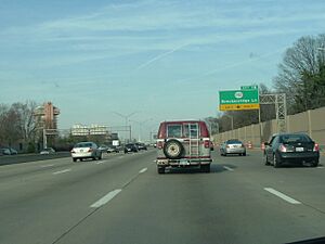
Louisville's road system is pretty typical for a U.S. city. Streets in the downtown area are set up in a grid, with some streets going only one way. Many main roads start downtown and spread out from the city like spokes on a wheel. Some roads, like Bardstown Road and Shelbyville Road, even lead out of Louisville to smaller towns nearby.
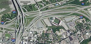
Major highways called Interstates pass through or start in Louisville. These include I-64, I-65, and I-71. All three of these highways meet in almost the same spot just east of downtown. This busy area is known as "Spaghetti Junction" because all the highways and exits look like a big bowl of spaghetti from above! Louisville Waterfront Park is built right under and near this interchange.
Two other Interstates, I-264 (also called the Henry Watterson Expressway or Shawnee Expressway) and I-265 (the Gene Snyder Freeway), form loops around the city on the Kentucky side. Louisville is the only city in the country to have two Interstate highways with numbers right next to each other like this.
For many years, there was a plan called the Ohio River Bridges Project to build two new bridges over the Ohio River. These bridges would connect Louisville to Indiana and also fix up Spaghetti Junction. Construction started in 2012. The first bridge, called the Abraham Lincoln Bridge, opened next to the existing Kennedy Bridge to help with I-65 traffic. The second bridge, called the Lewis and Clark Bridge, connects I-265 between Indiana and Kentucky.
Louisville's Airports: Planes, Cargo, and History
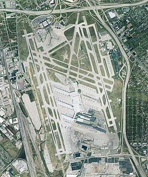
Louisville's main airport is the Louisville Muhammad Ali International Airport. Its airport code, SDF, comes from its old name, Standiford Field, which many locals still use. This airport is also home to the UPS Worldport, which is a huge package sorting center. The first runway was built in 1941 for World War II planes, and the airport officially opened on November 15, 1947.
In 2019, SDF had its busiest year ever, with over 4.2 million passengers. As of 2021, it's the 71st busiest airport in the U.S. for passengers. However, it's the third busiest airport in the U.S. for cargo traffic, and the sixth busiest in the world! In 2021, over 17.5 billion pounds of cargo passed through the airport.
The airport recently finished big updates to its main building. It has three runways. Two main runways run north-south, allowing planes to take off and land at the same time. The third runway runs east-west and is shorter, usually used only when the weather is bad.
A much smaller airport, Bowman Field, is mainly used for smaller, private planes. Bowman Field opened in 1921 and was Louisville's first airport. Today, it's used for business flights, flight lessons, and other private flying.
Boats and Rivers: Louisville's Waterways
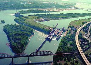
The McAlpine Locks and Dam is located on the Kentucky side of the Ohio River, close to downtown Louisville. These locks were built to help ships get past the Falls of the Ohio, which are rocky areas in the river. In 2001, over 55 million tons of goods passed through these locks. A new lock was finished in early 2009 to replace older ones.
For many decades, ferry boats connected Louisville to Southern Indiana. But these ferries became unnecessary when the Clark Memorial Bridge opened, allowing cars to cross the river.
Buses and Trolleys: Public Transit in Louisville
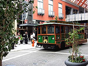
Public transportation in Louisville includes buses and vans run by the Transit Authority of River City (TARC). TARC has a large network that serves downtown Louisville and Jefferson County, as well as nearby Indiana towns like Jeffersonville, Clarksville, and New Albany. Besides regular city buses, there are also special motorized trolleys called the Toonerville II Trolley that help people get around the downtown hotel and shopping areas.
Louisville also has bus services for traveling between cities, provided by Megabus and Greyhound. These buses leave from the Louisville Civic Center.
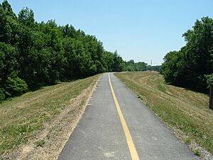
The city has several trails that can be used by both bikes and people walking. However, many of these trails are not connected to each other, so you can't use them to get across the whole city. In the central part of Louisville, there are some bike paths on the roads that help cyclists move around.
Like most cities, Louisville used to have electric streetcars in the 1900s. The last streetcars ran on May 1, 1948, taking people to and from the Kentucky Derby. A light rail system, which is like a modern streetcar, has been looked into for the city, but there were no plans to build one as of 2007.
Trains: Louisville's Railway History
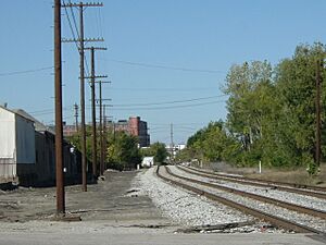
Louisville has always been a big center for train traffic. The Louisville and Nashville Railroad used to have its main office here before it was bought by CSX Transportation. Old train stations like Central Station, Southern Station, and Union Station once had many train companies with passenger services passing through the city.
Today, two major freight railroads, CSX and Norfolk Southern, serve Louisville. CSX has a large sorting yard in the southern part of the city. Five main train lines connect Louisville to other parts of the region. Two smaller, regional railroads, the Paducah & Louisville Railway and the Louisville and Indiana Railroad, also serve the city. Since the Kentucky Cardinal passenger train stopped running in 2003, Amtrak passenger trains no longer come to Louisville. This makes Louisville one of the largest cities in the country without Amtrak service.
Biking Around Louisville: Trails and Lanes
In March 2007, Mayor Jerry Abramson gave a speech at a national biking summit where he talked about the past and future of biking in Louisville.
The city is creating bike lanes on streets and shared lanes, as well as a 100-mile "Metro Loop" trail that will go all the way around the county. By the end of 2007, almost a third of this loop was planned to be finished. Another third to half was expected to be completed in the next three to five years as part of the Floyd's Fork corridor project. This project was managed by the City of Parks group. They got $38 million from the U.S. government and another $20 million from private groups just for the Floyd's Fork part of the project.
In 2006, the League of American Bicyclists called Louisville a "Bronze-Level Bicycle Friendly Community." This was because the city was building more bike paths and teaching people about bike safety.
However, a $65 million project to redesign Westport Road only added bike lanes for a third of the way. These lanes didn't connect neighborhoods like St. Matthews to shopping areas. Mayor Abramson said that the city's bike path plans were an "urban planning mistake" because they didn't connect well.
 | Janet Taylor Pickett |
 | Synthia Saint James |
 | Howardena Pindell |
 | Faith Ringgold |


