
Clarksville, Indiana facts for kids
Quick facts for kids
Clarksville, Indiana
|
||
|---|---|---|

Clarksville Town Hall
|
||
|
||

Location of Clarksville in Clark County, Indiana.
|
||
| Country | United States | |
| State | Indiana | |
| County | Clark | |
| Townships | Silver Creek, Jeffersonville | |
| Government | ||
| • Type | Town Council | |
| Area | ||
| • Total | 10.23 sq mi (26.51 km2) | |
| • Land | 10.04 sq mi (26.00 km2) | |
| • Water | 0.20 sq mi (0.51 km2) | |
| Elevation | 469 ft (143 m) | |
| Population
(2020)
|
||
| • Total | 22,333 | |
| • Density | 2,224.62/sq mi (858.90/km2) | |
| Time zone | UTC−5 (EST) | |
| • Summer (DST) | UTC−4 (EDT) | |
| ZIP codes |
47129
|
|
| Area code(s) | 812 & 930 | |
| FIPS code | 18-12934 | |
| GNIS feature ID | 2396649 | |

Clarksville is a town in Clark County, Indiana, United States. It is located along the Ohio River and is part of the Louisville area. In 2020, about 22,333 people lived there.
Clarksville was founded in 1783 by George Rogers Clark. It is the oldest American town in the area once known as the Northwest Territory. This area is special because it has the only seasonal rapids on the entire Ohio River. The town is also home to the Colgate clock, one of the biggest clocks in the world. You can also visit the Falls of the Ohio State Park, which has the world's largest exposed Devonian period fossil bed.
Contents
History of Clarksville
How Clarksville Began

The land where Clarksville now stands was first used by George Rogers Clark. He set up a base here during the American Revolutionary War. In 1778, he trained his soldiers on an island at the top of the Falls of the Ohio.
After the war, Clark was given a large piece of land, about 150,000 acres (607 km2), for his service. In 1783, 1,000 acres (4 km2) of this land were set aside to build a town called Clarksville. That same year, a fort was built, and people started to settle there.
Lewis and Clark Expedition Connection
William Clark was the younger brother of George Rogers Clark. He was a famous explorer. Historian Stephen Ambrose wrote that the famous Lewis and Clark Expedition began when William Clark and Meriwether Lewis met and shook hands in Clarksville. There is a statue near the falls that remembers this important expedition.
Challenges and Growth
Clarksville faced many challenges, like floods in the 1800s. There were also failed attempts to build a canal around the Ohio Falls. A canal would have made river travel easier. However, the race to build a canal was lost in 1826 to the Louisville and Portland Canal. Not having a canal made it hard for Clarksville to grow.
Clarksville also became a popular place for duels. People from Kentucky would come here to duel because dueling was against the law in their home state.

The town was first managed by a group of ten trustees. These trustees could sell land to help the town. Over time, the way the town was governed changed. By 1937, a five-member board elected by the residents was in charge.
The Great Flood and Rebuilding
In 1937, a huge flood, known as the Great Flood of 1937, hit Clarksville. The entire town was under as much as 12 feet (3.7 m) of water for over three weeks. Most of the old town was destroyed. After the flood, Clarksville was rebuilt with a new, modern plan.
After World War II, Clarksville grew a lot. More people moved in, and new jobs became available. The population jumped from 2,400 in 1940 to 22,000 by 2000. The town also expanded by adding nearby areas. Today, Clarksville is a major shopping area in Southern Indiana.
Geography of Clarksville
Clarksville covers an area of about 10.17 square miles (26.34 km2). Most of this area, about 9.97 square miles (25.82 km2), is land. The rest, about 0.2 square miles (0.52 km2), is water.
Population Information
Clarksville has grown quite a bit over the years.
| Historical population | |||
|---|---|---|---|
| Census | Pop. | %± | |
| 1880 | 1,037 | — | |
| 1890 | 1,692 | 63.2% | |
| 1900 | 2,370 | 40.1% | |
| 1910 | 2,743 | 15.7% | |
| 1920 | 2,322 | −15.3% | |
| 1930 | 2,243 | −3.4% | |
| 1940 | 2,386 | 6.4% | |
| 1950 | 5,905 | 147.5% | |
| 1960 | 8,088 | 37.0% | |
| 1970 | 13,298 | 64.4% | |
| 1980 | 15,164 | 14.0% | |
| 1990 | 19,833 | 30.8% | |
| 2000 | 21,400 | 7.9% | |
| 2010 | 21,724 | 1.5% | |
| 2020 | 22,333 | 2.8% | |
| Source: US Census Bureau | |||
In 2010, there were 21,724 people living in Clarksville. The average age of residents was about 37 years old. About 23% of the people were under 18.
Fun Places to Visit

Clarksville is famous for having the largest exposed fossil beds from the Devonian period. These fossils are from a prehistoric coral reef and are 386 million years old! This area is now part of the Falls of the Ohio State Park. The park has an education center where you can learn all about these ancient fossils.
The town also has several parks with sports fields. One example is Lapping Park, which is 332 acres (1.3 km2). It has a golf course, a Disc Golf course, a softball field, and hiking trails.
You can see the "7th largest clock in the world" in Clarksville. It's at the old Colgate-Palmolive Plant near the Ohio River. This huge clock can be seen from across the river in downtown Louisville, Kentucky.
Clarksville is also home to the Clarksville Little Theater. It is one of the oldest community theaters that has been running continuously in the United States. Another fun place is Derby Dinner Playhouse, which is a dinner theater.

The restaurant chain Texas Roadhouse first started in Clarksville. Its original location is still open at the Green Tree Mall. Clarksville also has the second-largest Bass Pro Shops in the United States, located at the River Falls Mall.
Education in Clarksville
Several school districts serve the students in Clarksville. These include Clarksville Community School Corporation, Greater Clark County Schools, and West Clark Community Schools.
Famous People from Clarksville
- John James Audubon: A famous bird artist who drew many of his bird sketches at the Falls of the Ohio.
- Tony Bennett: Former Indiana Director of Education.
- Frank Kimmel: A NASCAR driver who was born and lives in Clarksville.
- Rose Will Monroe: Also known as Rosie the Riveter, a symbol of women working in factories during World War II.
Sister Cities
Clarksville has a "sister city" program that started in 1998. This program helps build friendships with cities in other countries.
 Bewdley, Worcestershire, United Kingdom
- Melton Mowbray, Leicestershire, United Kingdom
 La Garenne-Colombes, Île-de-France, France
Images for kids
-
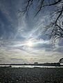
Ohio River Greenway, Clarksville, IN. Overlooking Fourteenth Street Bridge and Ohio River.
-
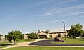
Clarksville High School
-
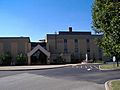
Providence High School
-
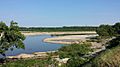
World's largest exposed Devonian fossil bed is at Clarksville's Falls of the Ohio State Park


See also
 In Spanish: Clarksville (Indiana) para niños
