Waterville, Vermont facts for kids
Quick facts for kids
Waterville, Vermont
|
|
|---|---|

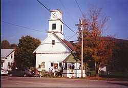
Waterville town hall
|
|

Waterville, Vermont
|
|
| Country | United States |
| State | Vermont |
| County | Lamoille |
| Area | |
| • Total | 16.41 sq mi (42.49 km2) |
| • Land | 16.35 sq mi (42.34 km2) |
| • Water | 0.05 sq mi (0.14 km2) |
| Elevation | 981 ft (299 m) |
| Population
(2020)
|
|
| • Total | 686 |
| • Density | 42/sq mi (16.2/km2) |
| Time zone | UTC-5 (Eastern (EST)) |
| • Summer (DST) | UTC-4 (EDT) |
| ZIP code |
05492
|
| Area code(s) | 802 |
| FIPS code | 50-77425 |
| GNIS feature ID | 1462246 |
Waterville is a small town located in Lamoille County, Vermont, in the United States. In 2020, about 686 people lived here.
Contents
Geography of Waterville
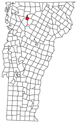
Waterville is in the northwestern part of Lamoille County. It sits in the valley of the North Branch of the Lamoille River. To the west, the town shares a border with Franklin County.
Roads and Rivers
Vermont Route 109 is a main road that goes through the center of Waterville. It follows the North Branch valley. This road leads northeast for about 10 miles to Belvidere Corners. It also goes southwest for about 5 miles to Jeffersonville, which is in the town of Cambridge.
Land and Water Area
The United States Census Bureau says that Waterville covers about 42.5 square kilometers (16.4 square miles). Most of this area is land. Only a small part, about 0.1 square kilometers (0.04 square miles), is water.
Population of Waterville
The number of people living in Waterville has changed over many years. Here is a look at how the population has grown or shrunk since 1810.
| Historical population | |||
|---|---|---|---|
| Census | Pop. | %± | |
| 1810 | 193 | — | |
| 1820 | 273 | 41.5% | |
| 1830 | 488 | 78.8% | |
| 1840 | 610 | 25.0% | |
| 1850 | 753 | 23.4% | |
| 1860 | 747 | −0.8% | |
| 1870 | 573 | −23.3% | |
| 1880 | 547 | −4.5% | |
| 1890 | 577 | 5.5% | |
| 1900 | 529 | −8.3% | |
| 1910 | 485 | −8.3% | |
| 1920 | 469 | −3.3% | |
| 1930 | 370 | −21.1% | |
| 1940 | 386 | 4.3% | |
| 1950 | 409 | 6.0% | |
| 1960 | 332 | −18.8% | |
| 1970 | 397 | 19.6% | |
| 1980 | 470 | 18.4% | |
| 1990 | 532 | 13.2% | |
| 2000 | 697 | 31.0% | |
| 2010 | 673 | −3.4% | |
| 2020 | 686 | 1.9% | |
| U.S. Decennial Census | |||
People and Households
In 2000, there were 697 people living in Waterville. They lived in 260 households. A household is a group of people living together. Most of these households, 186 of them, were families.
About 38% of households had children under 18 living there. Most families, 58%, were married couples living together. The average household had about 2.6 people.
Age Groups
The population in Waterville includes people of all ages. In 2000:
- 28% were under 18 years old.
- 7.6% were between 18 and 24 years old.
- 30.1% were between 25 and 44 years old.
- 24.1% were between 45 and 64 years old.
- 10.2% were 65 years or older.
The average age of people in Waterville was 36 years.
Culture and Art in Waterville
Waterville has been a source of inspiration for artists.
Famous Paintings
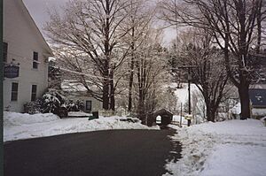
The American oil painter Emile Gruppe painted many scenes of Waterville in the 20th century. His paintings often showed the church, the North Branch of the Lamoille River, and the Church Street covered bridge. Gruppe had a studio and painting school nearby in Jeffersonville.
Notable People from Waterville
Some important people have come from Waterville.
- James M. Hotchkiss (1812–1877) was a member of the Vermont House of Representatives and the Vermont Senate. These are parts of Vermont's state government.
- Luke P. Poland (1815–1887) was a U.S. senator and representative. He also served as a justice on the Vermont Supreme Court, which is the highest court in Vermont.
See also
 In Spanish: Waterville (Vermont) para niños


