
Waves, North Carolina facts for kids
Quick facts for kids
Waves, North Carolina
|
|
|---|---|

Location in Dare County and the state of North Carolina
|
|
| Country | United States |
| State | North Carolina |
| County | Dare |
| Named for | Wind waves |
| Area | |
| • Total | 0.69 sq mi (1.78 km2) |
| • Land | 0.68 sq mi (1.75 km2) |
| • Water | 0.01 sq mi (0.03 km2) |
| Elevation | 5 ft (2 m) |
| Population
(2020)
|
|
| • Total | 172 |
| • Density | 254.81/sq mi (98.38/km2) |
| Time zone | UTC-5 (Eastern (EST)) |
| • Summer (DST) | UTC-4 (EST) |
| ZIP code |
27982
|
| FIPS code | 37-71440 |
| GNIS feature ID | 1023135 |
Waves is a small community in Dare County, North Carolina, United States. It is located on Hatteras Island, which is part of North Carolina's Outer Banks. In 2020, about 172 people lived there. Waves is part of a larger area called Chicamacomico, which also includes the communities of Rodanthe and Salvo.
Contents
Government and Leadership in Waves
The people living in Waves are governed by the Dare County Board of Commissioners. This board makes decisions for the entire county. Waves is part of District 4. This district also includes other nearby communities like Avon, Buxton, Frisco, Hatteras, Rodanthe, and Salvo.
Population of Waves
| Historical population | |||
|---|---|---|---|
| Census | Pop. | %± | |
| 2020 | 172 | — | |
| U.S. Decennial Census | |||
In 2020, the community of Waves had 172 residents. Most of the people living in Waves are White. There were also a few people who identified as Black or African American, or as Other/Mixed race. A small number of residents were also of Hispanic or Latino background.
History of Waves
Waves got its name because of the ocean waves that crash on the beach. It's a very fitting name for a place right on the coast!
An important historical building in the area is the Rasmus Midgett House. This house was added to the National Register of Historic Places in 2009. This means it's a special place recognized for its history.
Where Does Waves Begin and End?
The northern edge of Waves is usually thought to be a ditch under Highway 12, just south of Resort Rodanthe Drive. The southern border, which separates Waves from Salvo, is a bit harder to define. People who have lived there a long time have different ideas about where the "official" line is.
In the past, Waves, Rodanthe, and Salvo each had their own post office. Today, there is only one post office, and it's located in Waves. This means the old dividing lines between the communities are not as clear as they once were.
What is the Economy Like in Waves?
The economy in Waves mainly focuses on tourism. The area has many campgrounds, both big and small. There are also lots of houses available for rent. Visitors come to enjoy the beaches and the outdoor activities.
Climate and Weather in Waves
Waves, North Carolina, has a humid subtropical climate. This means it has hot and humid summers, and cool winters. It rains throughout the year.
Summer Weather in Waves
During the summer, a cool sea breeze often blows in the afternoon. However, it can sometimes get extremely hot and humid. The heat index (what the temperature feels like) can reach 100 degrees Fahrenheit (38 degrees Celsius) or even higher.
Hurricanes and Storms
Waves is located in an area that can be hit by hurricanes. The Atlantic hurricane season runs from June 1 to November 30. The busiest time for hurricanes is usually from late August through September. In winter, strong winds and cold temperatures can occur. The wind chill can make it feel colder than 10 degrees Fahrenheit (-12 degrees Celsius).
Ocean Water Temperature Near Waves
The ocean water temperature near Waves changes throughout the year. It is coldest in February, averaging about 46 degrees Fahrenheit (8 degrees Celsius). The water is warmest in August, averaging about 80 degrees Fahrenheit (27 degrees Celsius).
| Climate data for Waves, NC (1981-2010 Averages) | |||||||||||||
|---|---|---|---|---|---|---|---|---|---|---|---|---|---|
| Month | Jan | Feb | Mar | Apr | May | Jun | Jul | Aug | Sep | Oct | Nov | Dec | Year |
| Mean daily maximum °F (°C) | 53.2 (11.8) |
54.8 (12.7) |
59.5 (15.3) |
66.2 (19.0) |
73.2 (22.9) |
80.4 (26.9) |
84.0 (28.9) |
83.6 (28.7) |
79.7 (26.5) |
72.1 (22.3) |
64.7 (18.2) |
57.0 (13.9) |
69.1 (20.6) |
| Daily mean °F (°C) | 46.3 (7.9) |
47.7 (8.7) |
52.5 (11.4) |
59.8 (15.4) |
67.3 (19.6) |
75.3 (24.1) |
79.2 (26.2) |
78.7 (25.9) |
74.9 (23.8) |
66.6 (19.2) |
58.5 (14.7) |
50.3 (10.2) |
63.2 (17.3) |
| Mean daily minimum °F (°C) | 39.4 (4.1) |
40.6 (4.8) |
45.4 (7.4) |
53.3 (11.8) |
61.4 (16.3) |
70.3 (21.3) |
74.5 (23.6) |
73.9 (23.3) |
70.1 (21.2) |
61.0 (16.1) |
52.3 (11.3) |
43.7 (6.5) |
57.2 (14.0) |
| Average precipitation inches (mm) | 4.57 (116) |
3.81 (97) |
4.11 (104) |
3.46 (88) |
3.70 (94) |
4.19 (106) |
5.18 (132) |
6.37 (162) |
5.98 (152) |
4.39 (112) |
4.14 (105) |
3.92 (100) |
53.82 (1,367) |
| Average relative humidity (%) | 69.9 | 69.5 | 67.9 | 70.0 | 73.1 | 76.8 | 78.9 | 77.6 | 74.6 | 70.7 | 71.7 | 70.0 | 72.6 |
| Average dew point °F (°C) | 37.0 (2.8) |
38.2 (3.4) |
42.2 (5.7) |
50.0 (10.0) |
58.4 (14.7) |
67.5 (19.7) |
72.1 (22.3) |
71.1 (21.7) |
66.3 (19.1) |
56.8 (13.8) |
49.4 (9.7) |
40.9 (4.9) |
54.2 (12.3) |
| Source: PRISM | |||||||||||||
| Climate data for Cape Hatteras, NC Ocean Water Temperature (27 S Waves) | |||||||||||||
|---|---|---|---|---|---|---|---|---|---|---|---|---|---|
| Month | Jan | Feb | Mar | Apr | May | Jun | Jul | Aug | Sep | Oct | Nov | Dec | Year |
| Daily mean °F (°C) | 49 (9) |
46 (8) |
52 (11) |
59 (15) |
68 (20) |
74 (23) |
78 (26) |
80 (27) |
77 (25) |
70 (21) |
58 (14) |
55 (13) |
64 (18) |
| Source: NOAA | |||||||||||||
Nature and Plants in Waves
The natural plants in Waves, North Carolina, would mostly be Live oak trees and Sea Oats (a type of grass called Uniola paniculata). This kind of plant life is typical for a Coastal Prairie area.
Schools in Waves
Children living in Waves go to schools run by Dare County Schools. The local schools for students in Waves are Cape Hatteras Elementary School and Cape Hatteras Secondary School.
Images for kids
-
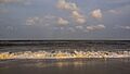
The beach at Waves, North Carolina.

See also
 In Spanish: Waves (Carolina del Norte) para niños
