
Waynesboro, Pennsylvania facts for kids
Quick facts for kids
Waynesboro, Pennsylvania
|
||
|---|---|---|
|
Borough
|
||

|
||
|
||

Location of Waynesboro in Franklin County, Pennsylvania
|
||

Waynesboro, Pennsylvania
Location in Pennsylvania
|
||
| Country | United States | |
| State | Pennsylvania | |
| County | Franklin | |
| Settled | 1749 | |
| Government | ||
| • Type | Borough Council | |
| Area | ||
| • Total | 3.41 sq mi (8.84 km2) | |
| • Land | 3.41 sq mi (8.84 km2) | |
| • Water | 0.00 sq mi (0.00 km2) | |
| Elevation | 719 ft (219 m) | |
| Population
(2020)
|
||
| • Total | 10,951 | |
| • Density | 3,190.50/sq mi (1,231.92/km2) | |
| Time zone | UTC−5 (Eastern (EST)) | |
| • Summer (DST) | UTC−4 (EDT) | |
| ZIP code |
17268
|
|
| Area code(s) | 717, 223 | |
| FIPS code | 42-81824 | |
| GNIS feature ID | 1215248 | |
| Website | Waynesboro | |

Waynesboro (/ˈweɪnzbʌroʊ/) is a town, also called a borough, in Franklin County, Pennsylvania, United States. It's located right on the southern border of Pennsylvania. Waynesboro is in the Cumberland Valley, a beautiful area between Hagerstown, Maryland, and Chambersburg, Pennsylvania. It's also very close to the famous Mason–Dixon line, which divides states. You'll find it just two miles north of this historic line.
In 2020, about 10,951 people lived within the town limits of Waynesboro. If you include the nearby areas of Washington and Quincy Townships, the total population for the greater Waynesboro area is around 31,166 people. The local school district, Waynesboro Area School District, serves about 33,182 residents.
Contents
Exploring Waynesboro's Past
Early Settlement and Naming the Town

For thousands of years before European settlers arrived, the land around Antietam Creek was home to Native American tribes like the Susquehannock and Lenape. In the mid-1700s, Anglo-European settlers began to move into the area.
A man named John Wallace first claimed land here in 1749 and again in 1751. His son, also named John Wallace, officially planned out the town in 1797. He called it Waynesburg. The town was first made an official borough in 1818. However, that first plan was changed. When it became a borough again in 1831, it was given the name "Waynesboro." The town is named after General Anthony Wayne, a brave hero from the American Revolution.
Waynesboro During the Civil War
Waynesboro played a small but important part during the Civil War in 1863. This was during the time leading up to the famous Battle of Gettysburg. In the week before the big battle, Confederate soldiers, led by Major General Jubal Early, marched through Waynesboro on their way north. After the battle, General Robert E. Lee and his retreating forces also passed through the town.
Growth and Industry in Waynesboro
In the early 1900s, Waynesboro became a busy industrial town. It was well-known for making many different machines. These included engines, boilers, grinders, and tools for working with wood and iron. Many local companies like Frick Company and Landis Machine Company were important. The town's population grew a lot between 1880 and 1920, increasing five times from about 1,900 people to nearly 10,000.
Fun Places and Landmarks

Waynesboro has some interesting places to visit.
Renfrew Museum and Park
One popular spot is Renfrew Museum and Park. This is a historical museum that shows what farm life was like in the 1700s. It's named after two young sisters who are said to have died there in 1764 during a Native American attack.
Historic Buildings and Bridges
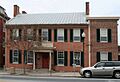
Several buildings and a bridge in Waynesboro are listed on the National Register of Historic Places. This means they are important historical sites. These include the Alexander Hamilton House, the Borough Hall of the Borough of Waynesboro, the Joseph J. Oller House, the Royer–Nicodemus House and Farm, and the Welty's Mill Bridge.
Outdoor Adventures at Camp Penn
If you like the outdoors, Camp Penn is a great place. It's located across from Old Forge State Park, right on the edge of the Michaux State Forest.
Understanding Waynesboro's Geography
Waynesboro covers an area of about 3.4 square miles (8.84 square kilometers). All of this area is land, with no large bodies of water inside the borough limits.
Who Lives in Waynesboro?
| Historical population | |||
|---|---|---|---|
| Census | Pop. | %± | |
| 1840 | 799 | — | |
| 1850 | 1,019 | 27.5% | |
| 1860 | 1,233 | 21.0% | |
| 1870 | 1,345 | 9.1% | |
| 1880 | 1,888 | 40.4% | |
| 1890 | 3,811 | 101.9% | |
| 1900 | 5,396 | 41.6% | |
| 1910 | 7,199 | 33.4% | |
| 1920 | 9,720 | 35.0% | |
| 1930 | 10,167 | 4.6% | |
| 1940 | 10,231 | 0.6% | |
| 1950 | 10,334 | 1.0% | |
| 1960 | 10,427 | 0.9% | |
| 1970 | 10,011 | −4.0% | |
| 1980 | 9,726 | −2.8% | |
| 1990 | 9,578 | −1.5% | |
| 2000 | 9,614 | 0.4% | |
| 2010 | 10,568 | 9.9% | |
| 2020 | 10,951 | 3.6% | |
| Sources: | |||
In 2010, there were 10,568 people living in Waynesboro. The population density was about 3,108 people per square mile. Most residents were White (90.6%), with smaller percentages of African American (2.9%), Native American (0.3%), and Asian (0.6%) people. About 3.7% of the population identified as Hispanic or Latino.
The average age in Waynesboro in 2010 was about 36.6 years old. About 23.4% of the population was under 18 years old. The median income for a household in Waynesboro was $41,155. This means half of the households earned more than this amount, and half earned less.
Famous People from Waynesboro
Waynesboro has been home to several notable people:
- Fred Bear: A famous American bow hunter, who also made bows and hosted TV shows.
- Max Bishop: A professional baseball player who played second base for the Philadelphia Athletics from 1924 to 1935.
- John Goucher: A Methodist pastor.
- Roy L. Hess: An American politician, business owner, and private pilot.
Images for kids
-
The Alexander Hamilton Memorial Free Library.

See also
 In Spanish: Waynesboro (Pensilvania) para niños
