West Coast Trail facts for kids
The West Coast Trail is a famous 75 km (47 mi) hiking path located on the southwest coast of Vancouver Island in British Columbia, Canada. It was first known as the Dominion Lifesaving Trail. This trail was built in 1907 to help rescue people from shipwrecks along the coast. This area was very dangerous for ships and was called the "Graveyard of the Pacific".
Today, the West Coast Trail is part of the Pacific Rim National Park. Many hiking guides say it is one of the best hiking trails in the world. You can hike the trail from May 1 to September 30, but you need to make a reservation first.
Contents
History of the West Coast Trail
The West Coast Trail goes through the traditional lands of several First Nations groups. These include the Pacheedaht, Ditidaht, Huu-ay-aht, and Nuu-chah-nulth peoples. They have lived in this area for over 4,000 years. Long before Europeans arrived, these groups used trails here for trading and traveling.
Why Was the Trail Built?
In the 1800s, Europeans started using the area. They built a telegraph line to send messages between Victoria and Cape Beale. More and more ships also sailed past Vancouver Island's west coast. These ships often traveled between San Francisco and Alaska.
The rocky coast and strong waves were very dangerous for ships. Many ships crashed here, leading to the area being called the "Graveyard of the Pacific". One report says almost 500 ships were wrecked around Vancouver Island alone.
At the start of the 1900s, there wasn't much help for shipwreck survivors on the island. After a big shipwreck in January 1906, when the SS Valencia sank, the Canadian government decided to act. They created a big plan to improve safety.
What Improvements Were Made?
The plan to make the coast safer included:
- A new lighthouse was built at Pachena Point. This was near where the Valencia ship had crashed.
- Wireless telegraphy (like early radio) was added to the BC coast. Five wireless stations were built, including one at Pachena Point. These stations helped ships send distress calls.
- Shelters were built along the trail every 8 km (5.0 mi). Each shelter had a telegraph, blankets, food, and directions.
- A special lifeboat station was set up in Bamfield. In 1908, it got the world's first motor-powered lifeboat. This boat helped rescue many people.
The trail allowed shipwreck survivors and rescuers to travel through the forest. They could use the telegraph line and cabins for help. In 1973, the trail became part of Pacific Rim National Park. It has been improved many times since then.
First Nations and the Trail Today
The trail goes through several Indigenous reserve lands. In the 1970s, some hikers went off the trail. They entered important cultural and historical sites of the First Nations.
Because of this, hikers must now stay on the trail when passing through these areas. To help people learn about their history, the Ditidaht First Nation now offers guided tours on their traditional lands. The Canadian Coast Guard Station Bamfield is still open today.
Exploring the West Coast Trail
The trail begins near Bamfield at Barkley Sound and goes south to Port Renfrew on Port San Juan Bay. In 1902, Bamfield became a key point for a big underwater telegraph cable that connected the British Empire around the world. A trail was built to carry this line south to Victoria.
Hikers can start the trail from either Port Renfrew (going north) or Bamfield (going south). The southern parts of the trail are much harder than the flatter northern areas. If you want to hike overnight, you need a permit. Only a certain number of people are allowed on the trail at one time. However, you can visit during the day without a permit.
What is the Trail Like?
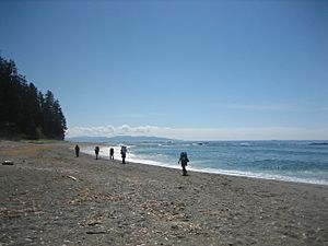
The trail goes through thick forests, muddy bogs, and slippery areas. You might need to climb ladders or even use ropes to go down steep parts. Some sections are on the beach. Hikers can sometimes choose to stay in the higher, boggier forest or walk on the beach. The beach walk is slower but can be easier on your feet.
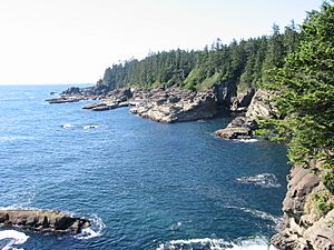
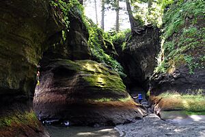
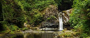
You will see very old trees, beautiful waterfalls, streams, and deep mud. Along the coast, there are sand and pebble beaches, rocky points, and exposed areas at low tide. The trail often moves inland to avoid dangerous water channels or cliffs that drop straight into the sea. High tides can make some beach sections impossible to pass. Parks Canada gives hikers tide tables and maps before they start. In some inland areas, there are wooden boardwalks, but they can be old, mossy, and muddy.
The main campsites have special bear boxes to keep food safe from animals. They also have outhouses and offer views of the Pacific Ocean and Olympic Peninsula on clear days. Sometimes, thick sea fog rolls in, making the view unique. There are also smaller campsites if you want a quieter experience away from the main, often crowded, spots.
The trail is still very rugged and needs good fitness and skills to complete. However, over the last 10-15 years, it has been improved to make it safer and easier for less experienced hikers. It's a good idea to hike in groups for safety, but some people do hike alone.
To cross larger rivers, hikers use cable cars that hang above the water. Smaller streams might have fallen logs to cross or require wading. Two waterways need a boat to cross: the Gordon River at the south end and the Nitinat Narrows in the middle. Local First Nations operate these ferry services. The trail also has about three dozen ladder structures, some as high as 30 feet (9.1 m), that hikers must climb up or down.
Most hikers take about 7 days to finish the trip. About 6,000 backpackers complete the trail each year. A small number (1-2%) need emergency help due to injuries or illness.
Food and Transportation
You can buy food at two spots on the trail. At Nitinat Narrows (km 32), the ferry operator, Doug, sells fresh seafood like salmon and crab, with baked potatoes and corn. Just south of the Carmanah Lighthouse, Chez Monique's used to sell burgers and drinks (Note: Chez Monique's has been closed since June 2021). Other than these two places, hikers must carry all their own food and supplies.
Transportation services are available at both ends of the trail by bus or float plane. If you don't want to finish the whole trail, you can take a water taxi at Nitinat Narrows. This taxi takes you to the other end of Nitinat Lake.
The official length of the trail is 75 km, but it has been rerouted many times. Its actual distance can change depending on if you walk on the beach or in the forest. GPS devices used by hikers show the true distance is between 80 km and 92 km.
Wildlife on the Trail
When hiking the West Coast Trail, you might see many animals. These include cougars, black bears, wolves, hummingbirds, orcas, gray whales, seals, sea lions, and eagles. The tidal pools on the beaches are full of life, like molluscs, sea anemones, and fish.
Before starting the trail, hikers get important information on how to react if they meet dangerous animals like cougars, bears, or wolves. During certain times of the year, you might see seal pups on the beach. It's important not to go near them, as their mother might leave them. Always view all wildlife from a safe distance.
Trail Damage in 2006/2007
In January 2007, big storms caused a lot of damage to the trail. About 3,000 trees fell, a bridge and a cable car were destroyed, and a serious landslide happened at kilometre 12. In March, the government gave extra money to help fix the trail.
Today, many walkways, ladders, and bridges have been rebuilt. However, because of the wet coastal weather, structures can wear out quickly. So, you might still find fallen trees and slippery boardwalks on the trail.
|
 | Kyle Baker |
 | Joseph Yoakum |
 | Laura Wheeler Waring |
 | Henry Ossawa Tanner |


