Yulara, Northern Territory facts for kids
Quick facts for kids YularaNorthern Territory |
|||||||||||||||
|---|---|---|---|---|---|---|---|---|---|---|---|---|---|---|---|

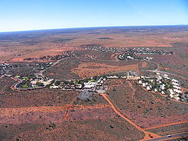
Yulara from helicopter, August 2004
|
|||||||||||||||
| Population | 853 (2021 census) | ||||||||||||||
| • Density | 8.20/km2 (21.2/sq mi) | ||||||||||||||
| Established | 10 August 1976 (town) 4 April 2007 (locality) |
||||||||||||||
| Postcode(s) | 0872 | ||||||||||||||
| Elevation | 492 m (1,614 ft)(airport) | ||||||||||||||
| Area | 104 km2 (40.2 sq mi) | ||||||||||||||
| Time zone | ACST (UTC+9:30) | ||||||||||||||
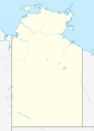
| Location |
|
||||||||||||||
| LGA(s) | Yulara – Ayers Rock Resort | ||||||||||||||
| Territory electorate(s) | Gwoja | ||||||||||||||
| Federal Division(s) | Lingiari | ||||||||||||||
|
|||||||||||||||
|
|||||||||||||||
| Footnotes | Locations Adjoining localities |
||||||||||||||
Yulara is a small town in the southern part of Australia's Northern Territory. It's a special area not governed by a local council, located within the MacDonnell Region. In 2016, about 1,099 people lived there. The town covers an area of 103.33 square kilometers.
Yulara is very close to famous landmarks. It's only 18 kilometers by road from Uluru (also known as Ayers Rock), a World Heritage Site. It's also 55 kilometers from Kata Tjuta (The Olgas). The town is part of the Gwoja area for the Northern Territory government. For the federal government, it's in the Lingiari area.
Contents
How Yulara Was Created
By the early 1970s, many tourists were visiting Uluru and Kata Tjuta. There were motels built too close to Uluru. This tourism was starting to harm the natural environment.
A special committee suggested moving all buildings away from the rock. They wanted a new resort built outside the Uluṟu-Kata Tjuṯa National Park. In 1973, the Australian government agreed to this plan. On August 10, 1976, the new town of Yulara was officially named. It was about 14 kilometers from Uluru.
Building the New Town
The Northern Territory government gained self-government in 1978. Building Yulara became a top priority for them. From 1978 to 1981, they built basic things like roads and water pipes. In 1980, the government created the Yulara Development Company Ltd. This company was in charge of building places for tourists to stay. It also built homes for workers and a shopping center.
Between 1982 and 1984, the first part of the resort was built. It cost about A$130 million. The design was done by Philip Cox & Associates. This design won a major award, the Sir Zelman Cowen Award for Public Architecture, in 1985. In 2019, it won two more awards for its lasting design.
Changes Over Time
The new resort opened in late 1984. At the same time, the government ended all leases for the old motels near Uluru. The area around the rock was then cleaned up and restored. The national park was also renamed Uluṟu-Kata Tjuṯa. Its ownership was given to the local Indigenous people. They then leased it back to Parks Australia for 99 years.
At first, there were three different hotels in Yulara. This made it hard for the resort to make money. The company, and the government, lost a lot of money. From 1990 to 1992, one company, Investnorth Management Pty Ltd, took over all the hotels. In 1992, the government sold part of the resort to a group of investors.
In 1997, the entire resort was sold again to General Property Trust. They hired Voyages Hotels & Resorts to manage it. Voyages managed almost everything in the resort, except for the post office. Most people living in Yulara rented their homes from Voyages. Most residents work at the resort or are tour guides.
In 2011, the resort was sold once more. The Indigenous Land Corporation bought it. They now run the resort through their company, Voyages Indigenous Tourism Australia.
Who Lives in Yulara
The 2016 Australian census counted the people living in Yulara. Here's what they found:
- Aboriginal Australians and Torres Strait Islanders made up 14.2% of the people.
- 52.8% of people were born in Australia.
- 62.6% of people spoke only English at home.
- The most common answer for religion was "No Religion" at 38.4%.
Getting Around Yulara
The Ayers Rock Airport, also called Connellan Airport, is about six kilometers north of Yulara. This airport makes it easy to fly to Yulara. You can fly from major cities like Sydney, Melbourne, Alice Springs, Cairns, Adelaide, or Darwin. Flying is much faster than driving. The nearest big town, Alice Springs, is 428 kilometers away. That's about a five-hour car trip.
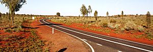
The main road serving the resort is the Lasseter Highway. This road connects Yulara to other roads and important places. In the early 2020s, the highway was made bigger. This was to handle more tourist cars. The paved highway goes east to meet the Stuart Highway. Roads in other directions are not as good. The Great Central Road goes west into Western Australia. However, it's usually only good for four-wheel drive vehicles with high clearance. You need special permits from Aboriginal Land Councils to travel west of Kata-Tjuta.
Weather in Yulara
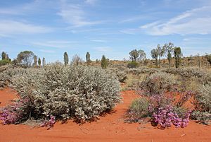
Yulara has a desert climate. This means it has long, hot summers and short, cool winters. There isn't much rain throughout the year. Sometimes, there might be frost on winter mornings.
| Climate data for Yulara Aero (1991-2020 normals, extremes 1983-present) | |||||||||||||
|---|---|---|---|---|---|---|---|---|---|---|---|---|---|
| Month | Jan | Feb | Mar | Apr | May | Jun | Jul | Aug | Sep | Oct | Nov | Dec | Year |
| Record high °C (°F) | 46.8 (116.2) |
45.8 (114.4) |
44.8 (112.6) |
39.6 (103.3) |
35.7 (96.3) |
31.7 (89.1) |
31.1 (88.0) |
34.9 (94.8) |
38.7 (101.7) |
42.3 (108.1) |
45.2 (113.4) |
47.1 (116.8) |
47.1 (116.8) |
| Mean daily maximum °C (°F) | 38.4 (101.1) |
37.0 (98.6) |
34.5 (94.1) |
30.1 (86.2) |
24.3 (75.7) |
20.3 (68.5) |
20.8 (69.4) |
23.8 (74.8) |
29.1 (84.4) |
32.5 (90.5) |
35.0 (95.0) |
36.4 (97.5) |
30.2 (86.3) |
| Daily mean °C (°F) | 30.7 (87.3) |
29.7 (85.5) |
27.0 (80.6) |
22.4 (72.3) |
16.8 (62.2) |
12.9 (55.2) |
12.7 (54.9) |
14.9 (58.8) |
20.0 (68.0) |
23.9 (75.0) |
26.8 (80.2) |
28.7 (83.7) |
22.2 (72.0) |
| Mean daily minimum °C (°F) | 23.0 (73.4) |
22.3 (72.1) |
19.5 (67.1) |
14.7 (58.5) |
9.2 (48.6) |
5.5 (41.9) |
4.5 (40.1) |
6.0 (42.8) |
10.8 (51.4) |
15.2 (59.4) |
18.5 (65.3) |
21.0 (69.8) |
14.2 (57.5) |
| Record low °C (°F) | 14.4 (57.9) |
12.1 (53.8) |
8.0 (46.4) |
4.1 (39.4) |
1.1 (34.0) |
−2.7 (27.1) |
−3.6 (25.5) |
−2.3 (27.9) |
1.0 (33.8) |
3.7 (38.7) |
6.5 (43.7) |
9.9 (49.8) |
−3.6 (25.5) |
| Average rainfall mm (inches) | 29.7 (1.17) |
40.8 (1.61) |
28.6 (1.13) |
15.6 (0.61) |
11.1 (0.44) |
17.4 (0.69) |
16.8 (0.66) |
5.3 (0.21) |
8.0 (0.31) |
22.8 (0.90) |
34.2 (1.35) |
46.5 (1.83) |
276.8 (10.91) |
| Average rainy days (≥ 1 mm) | 3.8 | 3.0 | 2.0 | 1.8 | 1.4 | 1.5 | 1.8 | 1.1 | 1.4 | 2.9 | 3.9 | 4.8 | 29.4 |
| Average afternoon relative humidity (%) | 18 | 23 | 22 | 24 | 31 | 35 | 32 | 25 | 19 | 19 | 19 | 24 | 24 |
| Average dew point °C (°F) | 6.7 (44.1) |
8.1 (46.6) |
6.0 (42.8) |
4.4 (39.9) |
3.9 (39.0) |
2.4 (36.3) |
0.8 (33.4) |
−0.4 (31.3) |
0.2 (32.4) |
1.9 (35.4) |
3.9 (39.0) |
7.3 (45.1) |
3.8 (38.8) |
| Source: Australian Bureau of Meteorology | |||||||||||||
See also
 In Spanish: Yulara para niños


