Zane's Tracts facts for kids
Zane's Tracts were three special pieces of land in what was called the Northwest Territory. This area later became the state of Ohio. The United States government gave these lands to a man named Ebenezer Zane in the late 1700s. He received them because he built an important road and started ferry services across several rivers.
Contents
Building a New Road: History of Zane's Trace
Ebenezer Zane was born in 1747. He traveled west in 1767, reaching Brownsville, Pennsylvania. In 1770, Zane and his two brothers settled near the Ohio River in Wheeling, Virginia. This town is now in West Virginia. Ebenezer and his brother Jonathan Zane learned a lot about the lands across the Ohio River, which is now Ohio.
The late 1780s and early 1790s were a time of fighting on the frontier. This was during the Northwest Indian War. This war officially ended in 1795 with the Treaty of Greenville. After peace, more people wanted to move west. In March 1796, Ebenezer Zane asked Congress to let him build a road. This road, also called a "trace," would go between Wheeling and Limestone, Kentucky (now Maysville).
Zane asked for land as payment. He wanted land at three river crossings. There, he would set up ferry services to help people cross the rivers. A group in Congress liked his idea. They said Zane was skilled and honest. They also agreed that the road would be very helpful.
Congress Approves Zane's Plan
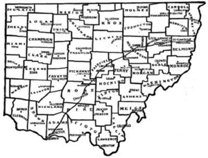
The United States Congress agreed to Zane's plan. They passed a law on May 17, 1796. This law said that Ebenezer Zane would get "three tracts of land." Each piece of land would be about one square mile. One piece would be on the Muskingum River. Another would be on the Hockhocking River. The third would be on the north side of the Sciota River.
These lands were chosen to be in the best spots for the new road. Zane had to pay for his own land surveys. He also had to send maps of the land to the government. He needed to open the road by January 1, 1797. Plus, he had to set up ferries at the river crossings. The prices for the ferries had to be approved by judges in the Northwest Territory.
Building the Trace: Zane's Road is Ready
Work on building Zane's Trace started in the summer of 1796. Jonathan Zane, John McIntire (Ebenezer Zane's son-in-law), and others did the work. They often followed old Native American trails. They also used trails that were already west of the Scioto River.
The road was not finished by the January 1, 1797 deadline. It took a few more months, finishing in the summer of 1797. Even so, President Adams gave Zane the land titles in 1800. The surveys for Zane's land were done before the areas around them were surveyed. This means Zane's land plots do not line up with later survey lines.
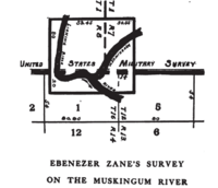
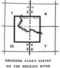
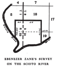
Zane's Land Surveys
| Muskingum River | Hocking River | Scioto River |
|---|---|---|
 |
 |
 |
Muskingum River Land
Zane chose a spot for a ferry on the Muskingum River. This was where it met the Licking River. He started the town of Zanesville, Ohio there in 1799. Rufus Putnam oversaw the survey in 1797. Zane gave this land to his brother Jonathan and his son-in-law McIntire. This was for their hard work building the road. They signed the deed in December 1800.
They then rented the land to William McCullough and Henry Crooks for five years. McCullough and Crooks had to run the ferry. They became the first people to live in Zanesville in the fall of 1797. This land is partly in the United States Military District. It is also partly in the Congress Lands East of Scioto River. 39°56′26″N 82°00′51″W / 39.94056°N 82.01417°W
Hocking River Land
The town of Lancaster, Ohio was started in 1799 or 1800. It was at the site of the Hocking River ferry. Ebenezer's sons, John and Noah Zane, laid out the town. They had the power to sell land for their father. Ebenezer Zane himself never visited Lancaster. This land is in the Congress Lands East of Scioto River. 39°42′30″N 82°36′14″W / 39.70833°N 82.60389°W
Scioto River Land
Ebenezer Zane picked a spot across from Chillicothe, Ohio. It was about half a mile north of that town. This land is also in the Congress Lands East of Scioto River. 39°20′53″N 82°58′14″W / 39.34806°N 82.97056°W
Isaac Zane's Land
Ebenezer Zane had a younger brother named Isaac Zane. When he was nine, Native Americans captured him and took him to Detroit. He grew up there. As an adult, he helped communicate between the United States and the Native American tribes.
Because of his help, Congress gave Isaac Zane three sections of land. This happened on April 3, 1802. Two of these sections were set aside for his children after he died. On August 28, 1806, he received the official papers for these lands. One section was in Salem Township in Champaign County. The other two sections were for his heirs in the same township and in Concord Township, Champaign County.
 | Calvin Brent |
 | Walter T. Bailey |
 | Martha Cassell Thompson |
 | Alberta Jeannette Cassell |


