Amissville, Virginia facts for kids
Quick facts for kids
Amissville
|
|
|---|---|
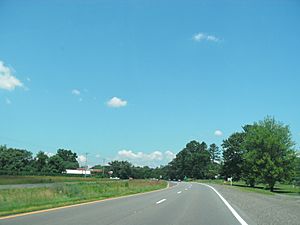
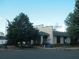
View of Amissville, along Route 211 (facing west)
|
|
| Country | United States |
| State | Virginia |
| County | Rappahannock |
| Elevation | 410 ft (120 m) |
| Time zone | UTC−5 (Eastern (EST)) |
| • Summer (DST) | UTC−4 (EDT) |
| ZIP code |
20106
|
| Area code(s) | 540 |
Amissville (pronounced AY-mis-vil) is a small, unincorporated community. It is located in Rappahannock County, in the state of Virginia, USA. You can find it along U.S. Route 211, about halfway between the towns of Warrenton and Washington, Virginia.
Two important places in Amissville are listed on the National Register of Historic Places. These are the Locust Grove/R.E. Luttrell Farmstead and Meadow Grove Farm.
Contents
Amissville's History
The land where Amissville now stands was once part of a huge area. This area was called the Northern Neck Proprietary. In the 1700s, it belonged to Thomas Fairfax, 6th Lord Fairfax of Cameron.
Early Land Ownership
Back in 1649, King Charles II of England gave this land to seven loyal friends. Later, in 1719, Thomas 6th Lord Fairfax inherited it. He then started granting pieces of this land to different people.
Between 1747 and 1766, Lord Fairfax gave land in the Amissville area to five individuals. These included Thomas Burk, Samuel Scott, James Genn, Gabriel Jones, and Philip Edward Jones.
People often thought the Amiss and Bayse families also received land directly from Lord Fairfax. However, records show they actually bought land from others. Joseph Amiss bought 380 acres in 1766. Edmond Bayse bought 800 acres in 1770.
In 1794, Joseph Amiss gave parts of his land to his sons and grandsons. The Amiss and Bayse families became major landowners in the area.
Naming the Town
By 1810, the community had grown enough to get its own U.S. Post Office. This meant the town needed a name. The Amiss and Bayse families both wanted the town named after them.
They decided to vote on it. Amissville won by just one vote over Bayseville! The post office officially opened on October 2, 1810. Thomas Amiss became the first postmaster.
In 1833, Amissville became part of Rappahannock County. At that time, it had a store, a schoolhouse, and likely a blacksmith shop and a church. By 1854, Amissville was a small village with about 75 people.
Amissville During the Civil War
Amissville was involved in some events during the American Civil War.
Battle Mountain Skirmish
On July 24, 1863, a small fight happened near Amissville. This was after the Confederate army lost the Battle of Gettysburg. General George Armstrong Custer and his cavalry (horse soldiers) attacked Confederate troops.
Custer's men attacked from Battle Mountain. But they were greatly outnumbered. After a tough fight, they had to retreat back to Amissville. Two of Custer's soldiers later received the Medal of Honor. They earned it for capturing Confederate artillery during this fight.
Interestingly, Battle Mountain and Little Battle Mountain were not named after this battle. They were named after the Bataille family who lived there in the 1700s. Over time, "Bataille" changed to "Battle."
Corbin's Crossroads Fight
In November 1862, another cavalry fight took place near Amissville. This happened at Corbin's Crossroads. General J.E.B. Stuart, a Confederate cavalry leader, was nearly killed here. A Union bullet clipped off half of his mustache! This spot is about three-quarters of a mile south of Amissville.
General Pope's Papers
In August 1862, General Stuart and his cavalry were scouting around the Federal Army of Virginia. On August 22, Stuart's men reached Amissville. They then turned back to try and surround the Union army. In an attack near Catlett's Station, Stuart's men captured General John Pope's overcoat and important military papers.
Amissville's Climate
The weather in Amissville has hot and humid summers. The winters are generally mild to cool. According to the Köppen Climate Classification system, Amissville has a humid subtropical climate. This means it gets plenty of rain all year, and has warm temperatures.
Amissville's Geology
The ground and rocks around Amissville are very old and interesting.
Ancient Volcanic Rocks
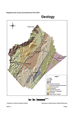
The oldest rocks in the area are about 704 million years old. These rocks are from the Robertson River Igneous Suite. They formed when the supercontinent Rodinia began to break apart.
This area has granitic rocks and rhyolite. Rhyolite is a type of volcanic rock. These rocks are found on the eastern slopes of Battle Mountain and Little Battle Mountain.
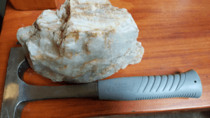
Battle Mountain and Little Battle Mountain are special. They are the only mountains in Rappahannock County that formed from volcanoes. They are also some of the oldest visible extinct volcanoes in Virginia. You can often find white quartz boulders and pieces around Battle Mountain. These formed from molten silica within the volcanic lava.
Other Rock Types
The Robertson River Igneous Suite stretches north-northeast in a band about four kilometers wide. East of Amissville, you'll find older rocks called gneiss. This type of rock is common from the Amissville post office area south to Viewtown.
Another type of gneiss, called Flint Hill Gneiss, is found west of Amissville. It extends towards Massies Corner and Washington, Virginia.
Aaron Mountain is made of sandstone and conglomerate. These rocks are also very old. They form a narrow band that runs north-northeast.
Finally, along the creeks and rivers like the Thorton River and Rappahannock River, you'll find alluvium. This is made of sand, silt, and gravel that has been carried and deposited by water.
 | Emma Amos |
 | Edward Mitchell Bannister |
 | Larry D. Alexander |
 | Ernie Barnes |


