Antelope, Kansas facts for kids
Quick facts for kids
Antelope, Kansas
|
|
|---|---|

|
|
| Country | United States |
| State | Kansas |
| County | Marion |
| Township | Clear Creek |
| Founded | 1870 |
| Named for | antelope |
| Elevation | 1,368 ft (417 m) |
| Time zone | UTC-6 (CST) |
| • Summer (DST) | UTC-5 (CDT) |
| Area code | 620 |
| FIPS code | 20-01950 |
| GNIS ID | 477249 |
Antelope is a small, unincorporated community in Marion County, Kansas, United States. An unincorporated community means it's a place where people live but it doesn't have its own local government like a city or town.
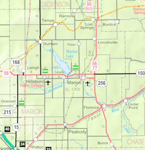
Antelope got its name from the antelope animals that used to graze (eat grass) in the area. They were often seen near where the first school was being built. The community is located northeast of Marion. You can find it about 0.9 miles west of the intersection of U.S. Route 77 (also known as U.S. Route 56) and 250th Street, right along the Union Pacific Railroad tracks.
History of Antelope

Early Days
For thousands of years, the Great Plains of North America were home to nomadic (traveling) Native American tribes. These groups moved around to hunt and find food.
In the 16th to 18th centuries, the Kingdom of France claimed a large part of North America. This included the land where Antelope is today. In 1762, after a war, France secretly gave this land to Spain.
Becoming Part of the U.S.
In 1802, Spain gave most of this land back to France. Then, in 1803, the United States bought a huge area from France. This was called the Louisiana Purchase. It was 828,000 square miles and included most of what is now Kansas. The U.S. paid about 2.83 cents per acre for it.
In 1854, the Kansas Territory was officially created. Kansas then became the 34th U.S. state in 1861. Marion County, where Antelope is located, was established in 1855.
Railroads and Growth
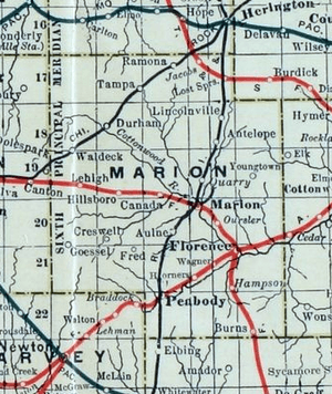
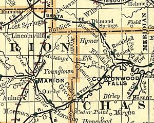
In 1887, a railroad company called the Chicago, Kansas and Nebraska Railway built a train line. This line went north and south, passing through Antelope. It connected Herington to Caldwell.
Over the years, this railroad changed hands several times. It became the Chicago, Rock Island and Pacific Railway, then the Oklahoma, Kansas and Texas Railroad, and finally merged with the Union Pacific Railroad. Even today, many local people still call it the "Rock Island" railroad.
Antelope also had its own post office for many years. It opened on July 25, 1870, and closed on June 20, 1988.
Where is Antelope?
Antelope is located in a beautiful part of Kansas. It sits between the scenic Flint Hills and the wide-open Great Plains. The community is found between the towns of Marion and Lincolnville. The Union Pacific Railroad tracks run right next to it.
Cool Places to Visit
Antelope has some interesting historical sites nearby. These places are listed on the National Register of Historic Places (NRHP). This means they are important places that are protected for their history.
- Amelia Park Bridge: This historic bridge is about 1 mile northeast of Antelope on 260th Street.
- Island Field Ranch House: This old ranch house is about 1 mile east of Antelope on U.S. Route 77. It was the childhood home of Alvin Silas Wight, a notable person from the area.
Schools and Learning
The community of Antelope is part of the Centre USD 397 public school district. This district serves several communities in the area.
The high school in the district is Centre High School. It's located at 2374 310th St, near Lost Springs and Lincolnville. Centre High School is also part of T.E.E.N. This is a special video teaching network that connects five high schools in the area. It allows students to take classes taught by teachers at other schools through video.
News and Media
If you want to know what's happening in the area, there are a couple of local newspapers:
- Marion County Record: This newspaper comes from Marion.
- Hillsboro Free Press: This is a free newspaper that covers the wider Marion County area.
Getting Around and Services
Transportation
U.S. Route 77 is a main highway that runs about 1 mile east of Antelope. The Oklahoma Kansas Texas (OKT) line of the Union Pacific Railroad also goes right through the community.
Utilities
People in Antelope have access to various services:
- Internet: You can get internet service through satellites from companies like HughesNet, StarBand, and WildBlue.
- TV: Satellite TV is available from DirecTV and Dish Network. You can also get local TV channels through digital TV stations.
- Electricity: Electricity for homes and farms in the area is provided by Flint Hills RECA.
Notable People From Antelope
- Alvin Silas Wight (1887–1949): He was an important person in Kansas. He served in the Kansas House of Representatives, which is part of the state government. He was also an educator and a farmer. His childhood home was the Island Field Ranch, which is now a historic site.
See Also
- List of cities and towns in Kansas
- List of counties in Kansas
 | May Edward Chinn |
 | Rebecca Cole |
 | Alexa Canady |
 | Dorothy Lavinia Brown |


