
Attalla, Alabama facts for kids
Quick facts for kids
Attalla
|
||
|---|---|---|
.jpg)
Aerial view of Attalla
|
||
|
||
| Motto(s):
"Gateway to Northeast Alabama"
|
||

Location of Attalla in Etowah County, Alabama.
|
||
| Country | United States | |
| State | Alabama | |
| County | Etowah | |
| Area | ||
| • Total | 7.00 sq mi (18.13 km2) | |
| • Land | 7.00 sq mi (18.13 km2) | |
| • Water | 0.00 sq mi (0.00 km2) | |
| Elevation | 558 ft (170 m) | |
| Population
(2020)
|
||
| • Total | 5,827 | |
| • Density | 832.55/sq mi (321.46/km2) | |
| Time zone | UTC-6 (Central (CST)) | |
| • Summer (DST) | UTC-5 (CDT) | |
| ZIP code |
35954
|
|
| Area code(s) | 256 | |
| FIPS code | 01-03028 | |
| GNIS feature ID | 2403130 | |

Attalla is a city located in Etowah County, Alabama, in the United States. In 2010, about 6,048 people lived there.
Contents
Discovering Attalla's Past

Attalla is built on the site of an old Creek Native American village. This village was important during a time of conflict called the Creek War. Later, many Creek people were forced to leave their homes because of a law passed in 1830.
Settlers from Europe then moved into this area. Some started large cotton farms. They used the forced labor of enslaved African Americans to work these farms.
Cherokee people also lived in this area. A Cherokee translator named David Brown helped create the Cherokee Spelling Book while he lived here.
How Attalla Began
Attalla was officially started in 1870. The land for the town was given by W. C. Hammond, who owned a large farm. It became an official city on February 5, 1872.
The city got its official name, "Attalla," in 1893. This name comes from the Cherokee language word otali, which means "mountain."
Railroads were important for connecting Attalla to other places. They helped the town's economy grow. However, when the railroads faced money problems, Attalla's growth slowed down.
Attalla is also special because it was the site of the first hydroelectric dam built to provide electricity for a city. This dam was built in 1887.
Attalla in Modern Times
In 1963, a man named William Lewis Moore died in Attalla. He was a postman and a civil rights activist. He was walking to support civil rights when this tragic event happened.
Attalla's Location and Landscape
Attalla is located in Etowah County. It is next to Gadsden, which is the county seat. It also borders Rainbow City to the south.
Interstate 59 runs along the eastern side of Attalla. You can get on or off the interstate at Exits 181 and 183. U.S. Route 11 goes through the center of Attalla. It connects the city to Fort Payne to the northeast and Birmingham to the southwest.
Other major roads like U.S. Route 278 and U.S. Route 431 also pass through Attalla. These roads help connect the city to nearby towns like Gadsden, Albertville, and Cullman.
Attalla covers about 7 square miles (18.1 square kilometers) of land. Big Wills Creek flows through the city. This creek is a branch of the Coosa River. The southern part of Lookout Mountain can be seen rising to the east of the city.
Attalla's Population Over Time
| Historical population | |||
|---|---|---|---|
| Census | Pop. | %± | |
| 1880 | 351 | — | |
| 1890 | 1,254 | 257.3% | |
| 1900 | 1,692 | 34.9% | |
| 1910 | 2,513 | 48.5% | |
| 1920 | 3,462 | 37.8% | |
| 1930 | 4,585 | 32.4% | |
| 1940 | 4,885 | 6.5% | |
| 1950 | 7,537 | 54.3% | |
| 1960 | 8,257 | 9.6% | |
| 1970 | 7,510 | −9.0% | |
| 1980 | 7,737 | 3.0% | |
| 1990 | 6,859 | −11.3% | |
| 2000 | 6,592 | −3.9% | |
| 2010 | 6,048 | −8.3% | |
| 2020 | 5,827 | −3.7% | |
| U.S. Decennial Census | |||
Attalla's People in 2010
In 2010, there were 6,048 people living in Attalla. They lived in 2,442 households, with 1,627 being families.
Most people (81.5%) were White. About 12.7% were Black or African American. Other groups included Native American, Asian, and people of two or more races. About 4.7% of the population was Hispanic or Latino.
The average age of people in Attalla was about 39.8 years old.
Attalla's People in 2020
| Race | Num. | Perc. |
|---|---|---|
| White (non-Hispanic) | 4,337 | 74.43% |
| Black or African American (non-Hispanic) | 774 | 13.28% |
| Native American | 13 | 0.22% |
| Asian | 33 | 0.57% |
| Other/Mixed | 333 | 5.71% |
| Hispanic or Latino | 337 | 5.78% |
As of the 2020 United States census, there were 5,827 people living in Attalla. There were 2,151 households and 1,364 families.
Education in Attalla
The Attalla City School System is the public school district for the city. In 2006, about 1,823 students attended schools in the district.
The schools in Attalla include:
- Attalla Elementary School (for grades Pre-kindergarten to 5th grade)
- Etowah Middle School (for grades 6th to 8th grade)
- Etowah High School (for grades 9th to 12th grade)
Getting Around Attalla
Etowah County Rural Transportation provides bus service in Attalla and the surrounding county. This service is called "dial-a-ride," which means you can call to arrange a pickup.
Famous People from Attalla
Many interesting people have come from Attalla, including:
- Gerald William Barrax (1933–2019), a poet and teacher.
- Betty Kelly (born 1944), a singer in the Motown group Martha and the Vandellas.
- Larry Means (born 1947), a former state senator and current mayor of Attalla.
- Patrick Nix (born 1972), a former quarterback for Auburn University.
- Tyrone Nix (born 1972), a football coach.
- Derrick Nix (born 1980), another football coach.
- B. L. Noojin (1885–1950), an athlete, teacher, and politician.
- Albert Staton (1899–1980), a basketball and football player for Georgia Institute of Technology.
Gallery
-
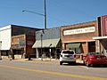
4th Street, Attalla
-
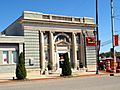
Bank of Attalla
-
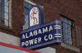
Historic Alabama Power Company sign, Attalla
-
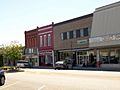
5th Avenue, Attalla
-
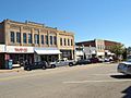
5th Avenue, Attalla
-
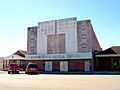
Country Music Opera House, Attalla
-
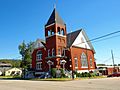
First United Methodist Church, Attalla
-

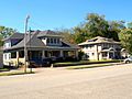
Seven Cedars, Attalla
-
Houses on 5th Avenue, Attalla
-
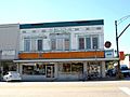
Walker's Drug Store building, Attalla
-
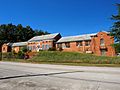
Old Attalla Elementary School


See also
 In Spanish: Attalla para niños
