Automotive navigation system facts for kids

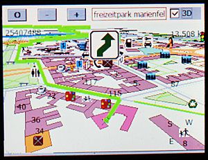
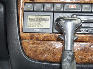
An automotive navigation system helps you find your way when you are driving a car. It can be built into the car or added later. These systems usually use satellite navigation (like GPS) to figure out where the car is. Then, they match this location to a map of roads. When you need directions, the system can calculate the best way to get to your destination. It can even use live traffic updates to change your route if there are road closures or traffic jams.
Sometimes, if satellite signals are weak (like in cities with tall buildings or in tunnels), the system can still work. It uses other sensors in the car, like those that measure distance, speed, and direction. This method is called dead reckoning and helps the system stay accurate.
At its core, car navigation uses a math idea called the "shortest path problem." This helps the system find the best way (shortest, fastest, or cheapest) between two points on a map. These navigation systems are also very important for making self-driving cars work.
Contents
Car navigation systems combine many different technologies. Many of these ideas have been around for a long time. But they used to be too expensive or hard to use. Over time, improvements in batteries, screens, and computer power made these systems possible for everyone.
- 1961: A Japanese inventor named Hidetsugu Yagi designed an early wireless navigation system. It was simple and meant for military use.
- 1966: General Motors (GM) worked on a system called DAIR. It didn't use satellites. Later, this idea helped create OnStar in 1996.
- 1981: The first car navigation systems became available in Japan. Companies like Honda, Nissan, and Toyota used dead reckoning technology.
- 1981: Honda's Electro Gyrocator was the first navigation system you could buy for a car. It used sensors to track distance and direction. It was also the first to show a map on a screen.
- 1983: A company called Etak was started. They made a system that used maps stored on cassette tapes.
- 1987: Toyota introduced the first car navigation system that used a CD-ROM to store maps.
- 1990: The Mazda Eunos Cosmo was the first car made with a built-in GPS navigation system.
- 1991: General Motors worked with others to create TravTek. This system was tested in 100 Oldsmobile Toronado cars in Orlando, Florida. It showed navigation and listed places like restaurants.
- 1991: Toyota and Mitsubishi also introduced GPS car navigation systems in their cars.
- 1992: Toyota introduced a GPS system that gave voice directions.
- 1994: The BMW 7 series was the first European car with GPS navigation.
- 1995: Oldsmobile introduced GuideStar, the first GPS navigation system in a US production car. Many people in the US first used car navigation through rental cars with this system.
- 1995: A device called "Mobile Assistant" (MASS) offered turn-by-turn navigation using a wireless internet connection.
- 1995: Acura introduced the first navigation system that used a hard disk drive to store maps.
- 1998: Toyota introduced the first navigation system that used a DVD to store maps.
- 2000: The United States made GPS signals more accurate for everyone to use.
- 2007: Toyota introduced "Map on Demand," which allowed map updates to be sent to car navigation systems.
- 2009: Mobile navigation apps, like Sygic for iOS, started to become very popular on phones.
The maps used in navigation systems are like digital drawings called vector maps. They store street names, house numbers, and interesting places (points of interest) as geographic coordinates. This means you can find a place by its address or its exact location on Earth.
Most map formats are special and only work with certain systems. There isn't one standard for all navigation maps. However, some companies are trying to create standards like SDAL and Navigation Data Standard (NDS). Companies like Tele Atlas and Navteq create the main map data. Then, each car company or electronics maker changes it into their own special format.
The Navigation Data Standard (NDS) is a group of car makers, navigation companies, and map data suppliers. They want to create a standard format for map data used in car navigation systems. This would make it easier to update maps and allow the same maps to work in systems from different car brands. The NDS group started in 2004. Many big companies are involved, including BMW, Volkswagen, Daimler, Renault, TomTom, and Navteq.
Map Storage
The map data can be stored in different ways:
- ROM: Permanently built into the system.
- CD or DVD: On discs.
- Flash memory: Like a USB stick or memory card.
- Hard disk: Like in a computer.
Often, a basic map is stored permanently, and then more detailed maps for specific areas can be added from other sources. Maps can be pre-loaded, downloaded from a computer, or accessed wirelessly. Some companies offer free map updates that you can get by connecting your navigation device to a computer.
Live Traffic Information
Some navigation systems can get and show information about traffic jams. They use special radio signals like TMC or RDS, or they can get data through mobile phones using GPRS/3G. For example, Google Maps updates itself to tell users if a faster route becomes available because of traffic.
Other Features
- Many navigation systems have color screens that can also show television or DVD movies.
- Some systems can connect to your mobile phone using Bluetooth or Wi-Fi. This allows for hands-free talking and sending text messages.
- Some systems can even help you manage your meetings by combining your calendar with traffic information.
Factory-Installed Systems
Many car makers offer navigation systems as an extra option when you buy a new car. If your car didn't come with one, you might be able to buy and install the original factory system later. Sometimes, this is easy if the car already has the right wires. Other times, new wiring is needed, which makes it more complex.
The main benefit of a factory-installed system is that it fits perfectly and looks like it belongs. Many of these systems also have extra sensors, like a gyrocompass or accelerometer. They can also use information from the car's speed sensors. This helps them navigate even if the GPS signal is lost for a short time. However, these factory systems can be much more expensive than portable ones.
SMS and Location Sharing
Some systems can send your location using text messages. This is called Gps2sms. For example, some cars can automatically send a text message if they are stolen or break down. The person receiving the message can then see the car's location on a map or in their own navigation system.
See also
 In Spanish: Sistema de navegación para automóviles para niños
- Augmented reality
- Automatic vehicle location
- Autonomous car
- Electronic Route Guidance System
- GPS eXchange Format
- GPS navigation device
- Global Positioning System (GPS)
- Guidance, navigation, and control
- Map database management
- Mapscape BV
- Mobile data terminal
- Navigation Data Standard (NDS)
- NavPix
- Navteq
- Personal navigation assistant (PNA)
- TomTom
- Traffic Message Channel (TMC)
- Hybride Navigation (Hybrid)
 | William Lucy |
 | Charles Hayes |
 | Cleveland Robinson |


