
Baxter Springs, Kansas facts for kids
Quick facts for kids
Baxter Springs, Kansas
|
|
|---|---|

Downtown Baxter Springs (2008)
|
|

Location within Cherokee County and Kansas
|
|

|
|
| Country | United States |
| State | Kansas |
| County | Cherokee |
| Founded | 1858 |
| Incorporated | 1868 |
| Named for | A. Baxter |
| Area | |
| • Total | 3.24 sq mi (8.38 km2) |
| • Land | 3.15 sq mi (8.16 km2) |
| • Water | 0.09 sq mi (0.23 km2) |
| Elevation | 843 ft (257 m) |
| Population
(2020)
|
|
| • Total | 3,888 |
| • Density | 1,200.0/sq mi (464.0/km2) |
| Time zone | UTC-6 (CST) |
| • Summer (DST) | UTC-5 (CDT) |
| ZIP code |
66713
|
| Area code | 620 |
| FIPS code | 20-04625 |
| GNIS ID | 485544 |
Baxter Springs is a city in Cherokee County, Kansas, United States. It is located along the Spring River. In 2020, the city had a population of 3,888 people.
Contents
History of Baxter Springs
For thousands of years, Native American tribes lived near the rivers in this area. The Osage people moved west from the Ohio River region. They settled in Kansas by the mid-1600s. They became known for their traditions of the plains.
The Black Dog Trail
One large Osage group was led by Chief Black Dog. His men created the Black Dog Trail by 1803. This trail started east of Baxter Springs. It went southwest to their summer hunting grounds. The Osage used the springs for healing on their journeys. They cleared the trail of brush and rocks. They also built earthen ramps to cross rivers. This wide trail was the first improved road in Kansas and Oklahoma.
Early Settlers and the Civil War
Later, settlers named the city and springs after A. Baxter. He claimed land around 1850. He built a frontier inn there. During the American Civil War, the U.S. government built military posts in Baxter Springs. These included Fort Baxter, Camp Ben Butler, and Camp Hunter.
In October 1863, Quantrill's raiders attacked Fort Baxter. Many United States Colored Troops defended the fort. They successfully held the fort. Quantrill's men then attacked Union troops on the prairie. This was known as the Battle of Baxter Springs. The Confederates outnumbered the Union forces outside the fort. They killed 103 Union soldiers. The U.S. forces later moved to Fort Scott. Before leaving, they destroyed Fort Baxter. This was to prevent enemies from using it.
Cattle Drives and Mining
By 1867, a cable ferry was built across the Spring River. This ferry operated until the 1880s. It was then replaced by the first bridge over the river. Around 1868, there was a high demand for beef in the North. Texas cattlemen drove large herds of cattle north. Baxter Springs became an important stop on the way to markets. This led to Baxter Springs growing quickly. By the early 1870s, it was the first "cow town" in Kansas. Its population reached about 5,000 by 1875.
The town created the Stockyards and Drovers Association. They bought and sold cattle. They built corrals for up to 20,000 cattle. These corrals had plenty of grazing land and fresh water. The cattle trade helped other businesses grow. Baxter Springs became a busy place. While some built schools and churches, it was also a lively place for cowboys. There were many saloons, stables, and hotels.
Later, railroads were built into Texas. Cattlemen could then ship their beef directly from Texas. This meant they no longer needed Baxter Springs as a stop. The first railroad into Texas was completed in 1872. Business in Baxter Springs and other cow towns then slowed down.

The discovery of lead in the area helped the towns recover. Small amounts of lead were found early on in Baxter Springs. People thought more lead could be found deeper underground. The city council passed a rule (Ordinance 42). This rule limited mining inside the city. This protected the land within Baxter Springs. Nearby towns suffered from mining pollution.
Baxter Springs benefited from the mining economy. Many mine owners and operators chose to live there. They built large houses to show their success. Many mining companies also had offices in Baxter Springs. By the 1940s, most of the good lead ore was gone. The mining industry then declined. Some towns disappeared completely. Mining practices at the time caused a lot of environmental damage. Since the late 1900s, efforts have been made to clean up the land.
The Estes family owned a notable mine southwest of town. They were a pioneering Black family. They arrived after the Civil War. Their mine was not the biggest. However, it employed about 25 Black workers. This was important because of racial discrimination in the industry at that time.
In 1926, the main street downtown became part of Route 66. This famous highway connected Chicago and Los Angeles. It was known as America's "Main Street." The town has kept Riverside Park along the Spring River. This allows the community to enjoy the riverbanks.
2014 Tornado
A tornado hit Baxter Springs on April 27, 2014. It started near Quapaw, Oklahoma and moved through the city.
Geography
Baxter Springs is located at 37°1′23″N 94°44′5″W / 37.02306°N 94.73472°W. The city sits on the western bank of the Spring River. It is at the edge of the Ozarks. U.S. Route 69 Alternate and U.S. Route 166 meet in the city. U.S. Route 400 goes around it to the northeast. The center of town is less than two miles (3 km) from the Kansas-Oklahoma border. The city's area extends to the border. It is also about 13 miles (21 km) west-southwest of Joplin, Missouri.
The United States Census Bureau says the city covers about 3.19 square miles (8.26 km2). Most of this is land, with a small amount of water.
Population and People
| Historical population | |||
|---|---|---|---|
| Census | Pop. | %± | |
| 1870 | 1,284 | — | |
| 1880 | 1,177 | −8.3% | |
| 1890 | 1,248 | 6.0% | |
| 1900 | 1,641 | 31.5% | |
| 1910 | 1,598 | −2.6% | |
| 1920 | 3,608 | 125.8% | |
| 1930 | 4,541 | 25.9% | |
| 1940 | 4,921 | 8.4% | |
| 1950 | 4,647 | −5.6% | |
| 1960 | 4,498 | −3.2% | |
| 1970 | 4,489 | −0.2% | |
| 1980 | 4,773 | 6.3% | |
| 1990 | 4,351 | −8.8% | |
| 2000 | 4,602 | 5.8% | |
| 2010 | 4,238 | −7.9% | |
| 2020 | 3,888 | −8.3% | |
| U.S. Decennial Census | |||
2020 Census Information
The 2020 United States census counted 3,888 people in Baxter Springs. There were 1,595 households and 979 families. The population density was about 1,235 people per square mile (477/km2).
Most residents (78.86%) were white. About 7.07% were Native American. About 11.5% were from two or more races. Hispanic or Latino people made up 3.06% of the population.
About 23.8% of the people were under 18 years old. About 17.3% were 65 years or older. The average age in the city was 38.8 years. For every 100 females, there were about 102 males.
The average household income was about $37,926. The average family income was about $54,219. About 10.8% of the population lived below the poverty line. This included 9.2% of those under 18.
Education
The public schools in Baxter Springs are part of the Baxter Springs USD 508 school district.
Notable People
Many interesting people have connections to Baxter Springs:
- Waylande Gregory (1905–1971), an artist
- Richard Hilderbrand, a member of the Kansas Senate
- Hale Irwin, (born 1945), a PGA golfer
- Max McCoy (born 1958), a journalist and author
- Charles Parham (1873–1929), a Pentecostal leader
- Joe Rooney, (born 1975), lead guitarist for the band Rascal Flatts
- H. Lee Scott, Jr., (born 1949), former President and CEO of Wal-Mart
- Tim Shallenburger (born 1954), former Kansas State Treasurer
- Byron Stewart (born 1956), an actor
- Glad Youse (1898 – 1985), a composer
Images for kids
-
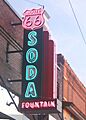
Route 66 Soda Fountain, 2008
-
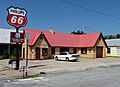
Route 66 Welcome Center, 2010
-
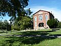
Johnston Public Library, 2010


See also
 In Spanish: Baxter Springs (Kansas) para niños
