
Berrigan, New South Wales facts for kids
Quick facts for kids BerriganNew South Wales |
|||||||||
|---|---|---|---|---|---|---|---|---|---|

Chanter Street, Berrigan, looking west; the main street of Berrigan contains a mix of Federation and more-modern architectural styles.
|
|||||||||

Berrigan
Location in New South Wales
|
|||||||||
| Population | 1,260 (2016 census) | ||||||||
| Postcode(s) | 2712 | ||||||||
| Elevation | 119 m (390 ft) | ||||||||
| Location | |||||||||
| LGA(s) | Berrigan Shire | ||||||||
| County | Denison | ||||||||
| State electorate(s) | Murray | ||||||||
| Federal Division(s) | Farrer | ||||||||
|
|||||||||
Berrigan is a town in the Riverina region of New South Wales, Australia. It is located on the Riverina Highway. Berrigan is part of the Berrigan Shire local government area. The main offices for the Berrigan Shire Council are in the town. In 2016, Berrigan had a population of 1,260 people.
Contents
History of Berrigan
The first signs of settlement in the Berrigan area date back to 1849. This was when Robert Rand set up a large farm called Momalong Station. It covered about 22,500 acres.
The town itself was built on what used to be swamp land. This might seem like a strange choice. But the mail route from Corowa to Murray Hut passed through this spot. The road from Jerilderie also followed the same path. These routes are very similar to the Riverina Highway today. The Berrigan Post Office first opened its doors on May 11, 1884.
In 1888, the first hotel, called the Berrigan Hotel, was built. It was located where the two main roads met. Other shops quickly followed along Chanter Street. This original hotel is still standing, but it is now a private home. Other old hotels include the Momalong Hotel, also now a private house. The Federal Hotel and Royal Hotel are still open today.
Berrigan officially became a town on May 31, 1890. This helped more businesses and homes to be built. By 1891, the population had grown to 254 people. This number more than doubled by the time Australia became a federation.
The railway line to Berrigan officially opened in late 1896. It was the first "light railway" built in the colony.
The first newspaper in Berrigan was the Berrigan Advocate. Its first issue came out on October 23, 1891. This paper later joined with others. In 1970, it became known as the Southern Riverina News.
Berrigan's Role in Australia's Federation
Berrigan played an important part in the push for Australia to become a Federation. This means that the different colonies would join together to form one country. Berrigan was close to the border with Victoria.
The local Berrigan Australian Natives' Association suggested the first meeting of the Federation League. Because it was easy for people to get to, the meeting was held in Corowa.
Climate in Berrigan
Berrigan has a cold semi-arid climate. This means it has hot summers and cool winters. It is a little cooler than Deniliquin because of its location. The amount of rain is quite low throughout the year. On average, it gets about 443.3 mm (17.45 inches) of rain. However, it can be very cloudy during the winter months.
From 1965 to 1975, Berrigan recorded its extreme temperatures. The highest temperature ever recorded was 46.1°C (115°F) on February 1, 1968. The lowest temperature was −4.4°C (24.1°F) on July 10, 1965.
| Climate data for Berrigan Post Office (1907−1975, rainfall 1875−2016); 119 m AMSL; 35.66° S, 145.81° E | |||||||||||||
|---|---|---|---|---|---|---|---|---|---|---|---|---|---|
| Month | Jan | Feb | Mar | Apr | May | Jun | Jul | Aug | Sep | Oct | Nov | Dec | Year |
| Record high °C (°F) | 44.7 (112.5) |
46.1 (115.0) |
40.0 (104.0) |
32.6 (90.7) |
27.0 (80.6) |
22.1 (71.8) |
25.6 (78.1) |
22.8 (73.0) |
32.8 (91.0) |
36.7 (98.1) |
39.4 (102.9) |
42.5 (108.5) |
46.1 (115.0) |
| Mean daily maximum °C (°F) | 31.9 (89.4) |
31.5 (88.7) |
28.1 (82.6) |
22.8 (73.0) |
18.0 (64.4) |
14.0 (57.2) |
13.5 (56.3) |
15.4 (59.7) |
19.0 (66.2) |
22.9 (73.2) |
27.1 (80.8) |
30.4 (86.7) |
22.9 (73.2) |
| Mean daily minimum °C (°F) | 15.8 (60.4) |
15.8 (60.4) |
13.2 (55.8) |
9.2 (48.6) |
6.2 (43.2) |
3.8 (38.8) |
3.1 (37.6) |
3.9 (39.0) |
5.8 (42.4) |
8.3 (46.9) |
11.3 (52.3) |
13.9 (57.0) |
9.2 (48.5) |
| Record low °C (°F) | 6.7 (44.1) |
8.9 (48.0) |
4.4 (39.9) |
2.2 (36.0) |
−2.5 (27.5) |
−3.9 (25.0) |
−4.4 (24.1) |
−3.0 (26.6) |
−1.1 (30.0) |
−1.1 (30.0) |
2.8 (37.0) |
6.0 (42.8) |
−4.4 (24.1) |
| Average rainfall mm (inches) | 31.2 (1.23) |
31.1 (1.22) |
34.4 (1.35) |
35.3 (1.39) |
41.0 (1.61) |
43.1 (1.70) |
39.3 (1.55) |
42.5 (1.67) |
38.8 (1.53) |
42.0 (1.65) |
31.6 (1.24) |
33.0 (1.30) |
443.3 (17.45) |
| Average rainy days (≥ 0.2 mm) | 3.6 | 3.2 | 3.7 | 4.6 | 6.8 | 8.4 | 9.4 | 9.3 | 7.3 | 6.7 | 5.0 | 4.3 | 72.3 |
| Source: Bureau of Meteorology | |||||||||||||
Education in Berrigan

Berrigan has a public primary school. The Catholic primary school in town closed at the end of 2020. If you need to go to high school, the closest one is in Finley. Finley is about 22 kilometers (14 miles) to the west. Oaklands also has a Central School. This school is part of a special partnership for education in the Riverina area.
Sports and Fun in Berrigan

Many sports are popular in Berrigan. These include Australian rules football. The local team, Berrigan Football Club, plays in the Picola & District Football League. Other popular sports are netball, golf, bowls, and tennis.
Horse racing is also a big event. The Berrigan Gold Cup race is held on the same day as the Victoria Derby. It always brings in a large crowd of people.
Other Cool Things to See
Every year, on the Sunday of the October long weekend, Berrigan hosts its Agricultural Show. This show has been happening for over 120 years! There's also an annual Show & Shine event in January.
In the past, the town held a big Canola Festival. This celebrated how important canola crops are to the region. Even though the festival has stopped, canola fields are still a big part of the landscape.
Berrigan is also close to towns along the Murray River. These include Barooga and Tocumwal. Between Berrigan and Barooga, you can find 'The Drop'. This is Australia's first hydroelectric power station built on an irrigation canal. It's called the Mulwala Canal. This power station could create 2.5 megawatts of electricity.

Berrigan used to have four pubs and a golf club. Now, there are two pubs and the club. These places are great for getting together with friends and family.
Images for kids
-
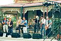
Berrigan Bushdrovers at Nangunia Homestead for the launch of their third album in 2004

Nearby towns
