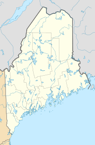
Boundary Peak (Maine/Quebec) facts for kids
Quick facts for kids Boundary Peak |
|
|---|---|
| Highest point | |
| Elevation | 3,855 ft (1,175 m) |
| Prominence | 495 ft (151 m) |
| Listing | New England 100 Highest #83 |
| Geography | |
| Location | Oxford County, Maine, U.S. / Le Granit Regional County Municipality, Quebec, Canada |
| Parent range | Longfellow Mountains |
| Topo map | USGS Northwest Pond |
Boundary Peak is a special mountain that sits right on the border between the United States and Canada. It doesn't have an official name, but it's known for being the highest point along this long border east of the Rocky Mountains. Imagine a line stretching for thousands of miles – this peak is the tallest spot on that line for a huge distance!
Contents
About Boundary Peak
Boundary Peak stands tall at 3,855 feet (about 1,175 meters) above sea level. It's part of the Longfellow Mountains range. Even though it's not super famous, it's an important landmark. It marks the highest point on the Canada-US border for a very long stretch. This includes 3,190 miles of border, all the way from Passamaquoddy Bay to a spot in Liberty County, Montana.
Where is Boundary Peak?
This unique mountain is split right down the middle by the international border. One half of Boundary Peak is in Oxford County, Maine, in the United States. The other half is in Le Granit Regional County Municipality, Quebec, in Canada. So, when you stand on top, you're literally in two countries at once! It's located between border markers 445 and 446, which are official signs that show where the border lies.
How Water Flows from Boundary Peak
Mountains often act like giant water towers, and Boundary Peak is no different. Rain and melting snow from the mountain flow in different directions, eventually reaching the ocean.
Water Flowing South and East
The water from the south and east sides of Boundary Peak starts a long journey. It flows into streams that lead to the Kennebago River. From there, it goes into Cupsuptic Lake and then through a series of other lakes. Eventually, this water reaches the Rapid River and Umbagog Lake. Umbagog Lake is the source of the Androscoggin River. This river then flows into Merrymeeting Bay, which is where the Kennebec River meets the ocean's tides. Finally, all this water empties into the Gulf of Maine, which is part of the Atlantic Ocean.
Water Flowing North and West
On the other side of the mountain, water from the north and west slopes takes a different path. It drains into a stream called Ruisseau Clearwater. This stream then joins the Rivière Arnold and the Rivaux Araignées. These waters flow into Lake Mégantic (Lac Mégantic in French). From Lake Mégantic, the water continues into the Chaudière River. The Chaudière River then flows into the mighty Saint Lawrence River. The Saint Lawrence River is one of Canada's most important rivers, and it eventually empties into the Gulf of St. Lawrence, which is also part of the Atlantic Ocean.
So, Boundary Peak is a place where water divides, sending its flow to different parts of the same vast ocean!
 | Ernest Everett Just |
 | Mary Jackson |
 | Emmett Chappelle |
 | Marie Maynard Daly |


