Bristol (CDP), New Hampshire facts for kids
Quick facts for kids
Bristol, New Hampshire
|
|
|---|---|

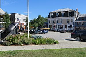
Central Square in 2018
|
|
| Country | United States |
| State | New Hampshire |
| County | Grafton |
| Town | Bristol |
| Area | |
| • Total | 4.07 sq mi (10.55 km2) |
| • Land | 4.01 sq mi (10.39 km2) |
| • Water | 0.06 sq mi (0.16 km2) |
| Elevation | 470 ft (140 m) |
| Population
(2020)
|
|
| • Total | 1,911 |
| • Density | 476.56/sq mi (183.98/km2) |
| Time zone | UTC-5 (Eastern (EST)) |
| • Summer (DST) | UTC-4 (EDT) |
| ZIP code |
03222
|
| Area code(s) | 603 |
| FIPS code | 33-07620 |
| GNIS feature ID | 2378054 |
Bristol is a census-designated place (CDP) and the main village in the town of Bristol in Grafton County, New Hampshire, United States. A "census-designated place" is a special area the government identifies for collecting population data. The population of the CDP was 1,911 people at the 2020 census. The entire town of Bristol had a population of 3,244 people at that time.
Contents
Geography of Bristol
The Bristol CDP is located in the southern part of the town of Bristol. It sits along the Newfound River, right where it flows into the larger Pemigewasset River. The Pemigewasset River also forms the border with Belknap County to the southeast.
Rivers and Borders
To the west, the CDP borders the town of Alexandria. The CDP's southern edge includes all of Chestnut Street. To the east, it stretches out along New Hampshire Route 104 past Hall Road. In the north, it covers areas like Brookwood Park Road, Keezer Road, Wind Ridge Road, Redbone Drive, and Blue Tick Drive.
Main Roads and Travel
Two important roads pass through the center of Bristol. New Hampshire Route 3A goes north about 14 miles (23 km) to Newfound Lake and then to New Hampshire Route 25 in West Plymouth. Southward, Route 3A leads about 13 miles (21 km) to Franklin.
New Hampshire Route 104 crosses Route 3A in the middle of Bristol. This road goes east about 5.5 miles (8.9 km) to Interstate 93 in New Hampton. To the southwest, Route 104 travels about 9 miles (14 km) to Danbury.
Land and Water Area
According to the U.S. Census Bureau, the Bristol CDP covers a total area of about 4.1 square miles (10.6 km2). Most of this area, about 4.0 square miles (10.4 km2), is land. The remaining part, about 0.1 square miles (0.2 km2), or 1.54%, is water.
Population in Bristol
The population of Bristol has changed over the years. Here's how the number of people living in the CDP has grown:
| Historical population | |||
|---|---|---|---|
| Census | Pop. | %± | |
| 1950 | 1,262 | — | |
| 1960 | 1,054 | −16.5% | |
| 1970 | 1,080 | 2.5% | |
| 1980 | 1,258 | 16.5% | |
| 1990 | 1,483 | 17.9% | |
| 2000 | 1,670 | 12.6% | |
| 2010 | 1,688 | 1.1% | |
| 2020 | 1,911 | 13.2% | |
| U.S. Decennial Census | |||
Recent Population Data
In 2010, there were 1,688 people living in the Bristol CDP. These people lived in 721 households, and 440 of these were families. There were also 1,027 housing units, but about 306 of them were empty. Many of the empty homes (236) were used only during certain seasons, like for vacations.
Diversity and Households
Most of the people in Bristol in 2010 were white (96.7%). There were also small percentages of African American (0.4%), Native American (0.1%), and Asian (0.8%) residents. About 1.9% of the population identified as being from two or more races. About 1.2% of the population was Hispanic or Latino.
Out of the 721 households, 31.2% had children under 18 living there. About 42.6% of households were married couples living together. Some households (12.1%) had a female head of household with no husband present. About 39.0% of households were not families.
Age Groups
In 2010, the average household size was 2.33 people, and the average family size was 2.90 people. About 23.7% of the people in Bristol were under 18 years old. About 7.4% were between 18 and 24 years old. About 24.8% were between 25 and 44 years old. About 28.2% were between 45 and 64 years old. About 15.8% were 65 years old or older. The median age, which is the middle age of the population, was 39.8 years.
See also
 In Spanish: Bristol (condado de Grafton) para niños
 | Percy Lavon Julian |
 | Katherine Johnson |
 | George Washington Carver |
 | Annie Easley |


