
Bullitt County, Kentucky facts for kids
Quick facts for kids
Bullitt County
|
|||
|---|---|---|---|

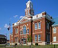
Bullitt County Courthouse in Shepherdsville
|
|||
|
|||

Location within the U.S. state of Kentucky
|
|||
 Kentucky's location within the U.S. |
|||
| Country | |||
| State | |||
| Founded | 1792 | ||
| Named for | Alexander Scott Bullitt | ||
| Seat | Shepherdsville | ||
| Largest city | Mount Washington | ||
| Area | |||
| • Total | 300 sq mi (800 km2) | ||
| • Land | 297 sq mi (770 km2) | ||
| • Water | 3.2 sq mi (8 km2) 1.1%% | ||
| Population
(2020)
|
|||
| • Total | 82,217 | ||
| • Estimate
(2023)
|
84,863 |
||
| • Density | 270/sq mi (106/km2) | ||
| Time zone | UTC−5 (Eastern) | ||
| • Summer (DST) | UTC−4 (EDT) | ||
| Congressional district | 2nd | ||


Bullitt County is a county in the central part of Kentucky. In 2020, about 82,217 people lived here. The main town, or county seat, is Shepherdsville. The county was started in 1796.
Bullitt County is just south of Louisville. It is part of a larger area called Kentuckiana. A small part of the county is also home to Fort Knox, a large U.S. Army base used for training.
Contents
History of Bullitt County
Early People and Salt Licks
The first people in what is now Bullitt County were Paleo-Indians. They arrived in North America thousands of years ago. These early people were nomads, meaning they moved around a lot. They hunted big animals like mammoths and bison.
They often gathered near special places called salt licks. These were spots where salty minerals came out of the ground. Animals loved these salt licks, and so did the hunters. Later, Native American tribes, like the Shawnee, used this area for hunting.
European Settlers and Salt Production
In the 1700s, both France and Britain wanted control of these lands. After a big war, the British took over in 1763. Soon, settlers from the colonies began to arrive.
One important salt lick was named Bullitt's Lick. It was named after Captain Thomas Bullitt, who explored the area. During the American Revolutionary War, salt was very important. Bullitt's Lick became Kentucky's first industry. People harvested salt here and sent it to other places. This saltworks operated until about 1830.
Forming the County
The first settlement in the area was a fort built in 1779. It was called Brashear's Station. Most of the county was settled after the Revolutionary War. Shepherdsville is the oldest town. It was named after Adam Shepherd, a businessman who bought land there in 1793. Shepherdsville became the county seat.
In December 1796, Bullitt County was officially created. It was formed from parts of Jefferson and Nelson counties. The county was named after Alexander Scott Bullitt, who was Kentucky's first Lieutenant Governor.
Geography of Bullitt County
Bullitt County covers about 300 square miles. Most of this is land, with a small amount of water. The county is in a part of Kentucky known as the Knobs. This area has many small, rounded hills.
Neighboring Counties
- Jefferson County (north)
- Spencer County (east)
- Nelson County (southeast)
- Hardin County (southwest)
Population of Bullitt County

In 2000, there were 61,236 people living in Bullitt County. By 2020, the population had grown to 82,217. The county has seen a lot of growth, especially since the 1970s. Many families moved to Bullitt County during that time.
Most people in the county are White. There are also smaller groups of African American, Native American, and Asian people. About 0.63% of the population is Hispanic or Latino.
The average age in the county in 2000 was 34 years old. About 27% of the people were under 18.
Economy in Bullitt County
Bullitt County is a busy place for businesses. A major highway, I-65, runs through the county. This makes it a great spot for shipping and storage. Many large warehouses and distribution centers have been built here.
The county is also close to the Louisville International Airport. This airport is home to Worldport, a huge air-freight hub for UPS. This means many jobs are available in shipping and logistics. People in Bullitt County can also easily find jobs in nearby cities like Elizabethtown and Louisville.
Education in Bullitt County
Most students in Bullitt County attend schools run by Bullitt County Public Schools. If you live on the Fort Knox base, you would go to schools managed by the Department of Defense Education Activity.
Middle Schools
There are six middle schools in the county:
- Bernheim Middle School
- Bullitt Lick Middle School
- Eastside Middle School
- Hebron Middle School
- Mount Washington Middle School
- Zoneton Middle School
High Schools
There are four county high schools:
- Bullitt Central High School (in Shepherdsville, opened 1970)
- Bullitt East High School (in Mount Washington)
- North Bullitt High School (in Hebron Estates)
- Riverview High School
Students living on the Fort Knox base attend Fort Knox Middle High School.
Communities in Bullitt County
Cities
Census-designated place
Other Communities
Many new homes are being built in and around Shepherdsville and Mount Washington. These two towns are growing so much that they are almost connected!
Images for kids
-

The flag of Bullitt County.
-

The official seal of Bullitt County.
-
The Bullitt County Courthouse in Shepherdsville.
See also
 In Spanish: Condado de Bullitt para niños
