Burlington, Connecticut facts for kids
Quick facts for kids
Burlington, Connecticut
|
||
|---|---|---|

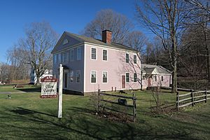
Brown Tavern
|
||
|
||
| Motto(s):
"A Town Where Community Counts"
|
||
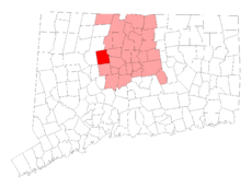
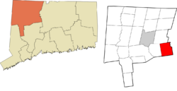
 Hartford County and Connecticut Hartford County and Connecticut Northwest Hills Planning Region and Connecticut Northwest Hills Planning Region and Connecticut |
||
| Country | ||
| U.S. state | ||
| County | Hartford | |
| Region | Northwest Hills | |
| Incorporated | 1806 | |
| Hamlets | Burlington Covey Corners Lake Garda Whigville |
|
| Government | ||
| • Type | Selectman-town meeting | |
| Area | ||
| • Total | 30.4 sq mi (78.8 km2) | |
| • Land | 29.7 sq mi (77.0 km2) | |
| • Water | 0.7 sq mi (1.7 km2) | |
| Elevation | 817 ft (249 m) | |
| Population
(2020)
|
||
| • Total | 9,519 | |
| • Density | 320.2/sq mi (123.6/km2) | |
| Time zone | UTC-5 (EST) | |
| • Summer (DST) | UTC-4 (EDT) | |
| ZIP code |
06013
|
|
| Area code(s) | 860/959 | |
| FIPS code | 09-10100 | |
| GNIS feature ID | 0213401 | |
| U.S. Routes | ||
Burlington is a lovely town located in Hartford County, Connecticut. It sits near the beautiful the Berkshires mountains and the Farmington River. Burlington is a peaceful, rural town about 20 miles (32 km) west of Hartford. It became an official town in 1806. In 2020, about 9,519 people lived there. Burlington is part of the Northwest Hills Planning Region.
Contents
History of Burlington
The land where Burlington is today was first home to the Tunxis tribe.
How Burlington Became a Town
Long ago, Burlington was part of a bigger area called Farmington Plantation. In 1785, it separated and became part of the town of Bristol. Then, on June 16, 1806, Burlington officially became its own town.
In its early years, many small businesses, like clock-making shops, thrived in Burlington. However, when the Farmington Canal was finished in 1829, many of these businesses closed or moved to nearby towns.
Geography of Burlington
Burlington covers about 78.8 square kilometers (30.4 square miles). Most of this area, about 77.0 square kilometers (29.7 square miles), is land. The rest, 1.7 square kilometers (0.7 square miles), is water.
Natural Features and Parks
A large part of Burlington's land is owned by public water companies and the State of Connecticut. This helps protect the natural beauty of the area.
Burlington is home to:
- The State of Connecticut Fish Hatchery, where young fish are raised.
- The Nepaug Reservoir, an important water source.
- Sessions Woods Wildlife Management Area, a great place to see nature.
The highest point in town is Johnnycake Mountain, which is 1,165 feet (355 meters) tall. The Tunxis Trail, a popular hiking path, also runs through Burlington from north to south.
Population and People
| Historical population | |||
|---|---|---|---|
| Census | Pop. | %± | |
| 1820 | 1,360 | — | |
| 1850 | 1,161 | — | |
| 1860 | 1,031 | −11.2% | |
| 1870 | 1,319 | 27.9% | |
| 1880 | 1,224 | −7.2% | |
| 1890 | 1,302 | 6.4% | |
| 1900 | 1,218 | −6.5% | |
| 1910 | 1,319 | 8.3% | |
| 1920 | 1,109 | −15.9% | |
| 1930 | 1,082 | −2.4% | |
| 1940 | 1,246 | 15.2% | |
| 1950 | 1,846 | 48.2% | |
| 1960 | 2,790 | 51.1% | |
| 1970 | 4,070 | 45.9% | |
| 1980 | 5,660 | 39.1% | |
| 1990 | 7,026 | 24.1% | |
| 2000 | 8,190 | 16.6% | |
| 2010 | 9,301 | 13.6% | |
| 2020 | 9,519 | 2.3% | |
| U.S. Decennial Census | |||
In 2010, there were 9,326 people living in Burlington. Most people in Burlington are White (96.5%). There are also smaller groups of African American, Asian, and other races. About 2.6% of the population identified as Hispanic or Latino.
Households and Families
There were 3,303 households in Burlington in 2010. Many of these households (40.7%) had children under 18 living with them. Most families (71.4%) were married couples living together. The average household had about 2.82 people.
Age Groups
The population in Burlington includes people of all ages. About 29.0% of the people were under 19 years old. The median age in town was 42.5 years.
Schools in Burlington
Burlington is part of Regional School District #10. This district also serves the town of Harwinton. It was created in 1962.
Schools in the District
The district has four schools:
- Lewis S. Mills High School
- Har-Bur Middle School
- Lake Garda School
- Harwinton Consolidated School
Together, these schools teach more than 2,100 students.
Notable Places to Visit
Burlington has several interesting historical and natural sites:
- Brown Tavern (also known as Elton Tavern)
- Hart's Corner Historic District
- Hitchcock-Schwarzmann Mill
- John Wiard House
- Sessions Woods Wildlife Management Area
- Seventh Day Baptist Cemetery (also known as Green Lady Cemetery)
- Treadwell House
Famous People From Burlington
Some notable people have connections to Burlington:
- Romeo Elton (1790-1870), a well-known academic and author.
- Samuel Griswold (1790–1867), an important industrialist who was born in Burlington.
- Leonidas Lent Hamline (1797–1865), a Methodist Episcopal bishop and the founder of Hamline University. He was born in Burlington.
- Heman Humphrey (1779-1861), an author and clergyman who became the second President of Amherst College. He grew up in Burlington.
- Bernard Moses (1846-1931), an academic and author.
See also
 In Spanish: Burlington (Connecticut) para niños


