Călărași County facts for kids
Quick facts for kids
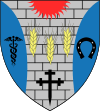
Călărași County
Județul Călărași
|
||
|---|---|---|
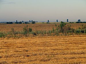
Landscape in Călărași County
|
||
|
||
 |
||
| Country | ||
| Development region1 | Sud | |
| Historic region | Muntenia | |
| Capital city (Reședință de județ) | Călărași | |
| Created | 1981 | |
| Government | ||
| • Type | County Council | |
| Area | ||
| • Total | 5,088 km2 (1,964 sq mi) | |
| Area rank | 28th in Romania | |
| Population
(2021-12-01)
|
||
| • Total | 283,458 | |
| • Rank | 34th in Romania | |
| • Density | 56.02/km2 (145.1/sq mi) | |
| Time zone | UTC+2 (EET) | |
| • Summer (DST) | UTC+3 (EEST) | |
| Postal Code |
91wxyz3
|
|
| Area code(s) | +40 x424 | |
| Car Plates | CL5 | |
| GDP | US$1.635 billion (2015) | |
| GDP/capita | US$5,736 (2015) | |
| Website | County Council County Prefecture |
|
| 1The development regions of Romania have no administrative role. They were formed as a way of managing funds from the European Union 2 as of 2007, the Prefect is not a politician, but a public functionary. He (or she) is not allowed to be a member of a political party, and is banned from having any political activity in the first six months after resigning (or being excluded) from the public functionary corps 3w, x, y, and z are digits that indicate the city, the street, part of the street, or even the building of the address 4x is a digit indicating the operator: 2 for the former national operator, Romtelecom, and 3 for the other ground telephone networks 5used on both the plates of the vehicles that operate only in the county limits (like utility vehicles, ATVs, etc.), and the ones used outside the county |
||
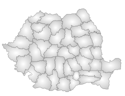
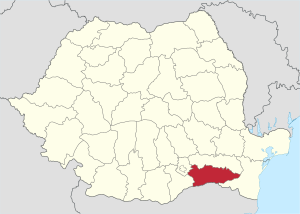
Călărași County is a region in Romania. It shares a border with Bulgaria. The county is located in a historical area called Muntenia. Its main city and capital is also named Călărași.
Contents
People and Population
This section talks about the people living in Călărași County. It also covers how the population has changed over time.
In 2011, about 285,050 people lived here. The population density was about 56 people per square kilometer. This means how many people live in a certain area.
Most people in Călărași County are Romanians.
Population Changes Over Time
The table below shows how the number of people living in the county has changed.
| Year | County population |
|---|---|
| 1948 | 287,722 |
| 1956 | 318,573 |
| 1966 | 337,261 |
| 1977 | 338,807 |
| 1992 | 338,844 |
| 2002 | 324,617 |
| 2011 | 285,050 |
| 2021 | 283,458 |
Main Cities and Villages
Here are some of the most populated places in Călărași County. The numbers are from 2002, except for Călărași city.
- Călărași (the county's capital and largest city) – 73,823 people (as of 2005)
- Oltenița – 27,217 people
- Modelu (the county's largest village) – 9,804 people
- Budești (including Crivăț village) – 9,709 people
- Borcea (village) – 9,676 people
- Dragalina (village) – 8,760 people
- Chirnogi (village) – 8,131 people
Two other towns, Lehliu Gară and Fundulea, have fewer than 8,000 residents.
Geography of Călărași
Călărași County covers an area of 5,088 square kilometers.
The entire county is located in the southern part of the Bărăgan Plain. This is a large, flat area. Small rivers flow through the county, creating deep valleys.
On the southern and eastern sides, you'll find the valley of the Danube River. On the eastern side, the Danube splits into many smaller branches. These branches used to form islands, but now they are mostly drained.
On the western side, the Argeș and Dâmbovița rivers flow into the Danube. They create a wide valley before joining the larger river.
Neighboring Areas
Călărași County shares its borders with several other places:
- To the East: Constanța County
- To the West: Ilfov County and Giurgiu County
- To the North: Ialomița County
- To the South: Bulgaria, specifically the Silistra Province
Economy and Industries
The main activity in Călărași County is farming, also known as agriculture. This county produces about 3% of all the crops in Romania.
Besides farming, Călărași County has several important industries:
- Metallurgy: This involves working with metals. There is a large metal plant in Călărași city.
- Food processing: This industry turns farm products into food items.
- Textiles: This is about making fabrics and clothes.
- Construction materials: This industry produces materials used for building.
Visiting Călărași County
Tourism is not very common in Călărași County. There are only a few hotels available.
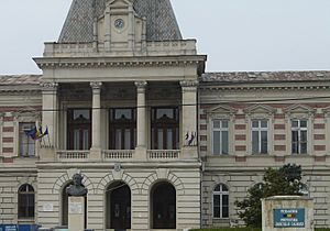
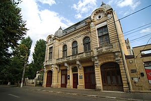
The main places people might visit are:
How the County is Organized
Călărași County is divided into different types of areas. These are called administrative divisions. It has 2 municipalities, 3 towns, and 50 communes.
- Municipalities (these are larger cities)
- Călărași – This is the county's capital city. About 65,181 people lived here in 2011.
- Oltenița
- Towns
- Budești
- Fundulea
- Lehliu-Gară
- Communes (these are smaller areas, often including several villages)
- Alexandru Odobescu
- Belciugatele
- Borcea
- Căscioarele
- Chirnogi
- Chiselet
- Crivăț
- Ciocănești
- Curcani
- Cuza Vodă
- Dichiseni
- Dor Mărunt
- Dorobanțu
- Dragalina
- Dragoș Vodă
- Frăsinet
- Frumușani
- Fundeni
- Gălbinași
- Grădiștea
- Gurbănești
- Ileana
- Independența
- Jegălia
- Lehliu
- Luica
- Lupșanu
- Mânăstirea
- Mitreni
- Modelu
- Nana
- Nicolae Bălcescu
- Perișoru
- Plătărești
- Radovanu
- Roseți
- Sărulești
- Sohatu
- Spanțov
- Șoldanu
- Ștefan cel Mare
- Ștefan Vodă
- Tămădău Mare
- Ulmeni
- Ulmu
- Unirea
- Valea Argovei
- Vasilați
- Vâlcelele
- Vlad Țepeș
See also
 In Spanish: Distrito de Călărași (Rumania) para niños
 | May Edward Chinn |
 | Rebecca Cole |
 | Alexa Canady |
 | Dorothy Lavinia Brown |


