Cabarlah, Queensland facts for kids
Quick facts for kids CabarlahQueensland |
|||||||||||||||
|---|---|---|---|---|---|---|---|---|---|---|---|---|---|---|---|

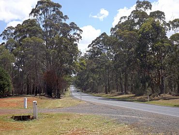
New England Highway, 2014
|
|||||||||||||||
| Population | 1,307 (2021 census) | ||||||||||||||
| • Density | 65.68/km2 (170.1/sq mi) | ||||||||||||||
| Postcode(s) | 4352 | ||||||||||||||
| Area | 19.9 km2 (7.7 sq mi) | ||||||||||||||
| Time zone | AEST (UTC+10:00) | ||||||||||||||
| Location |
|
||||||||||||||
| LGA(s) | Toowoomba Region | ||||||||||||||
| State electorate(s) |
|
||||||||||||||
| Federal Division(s) | Groom | ||||||||||||||
|
|||||||||||||||
Cabarlah is a small country town in Queensland, Australia. It's part of the Toowoomba Region. In 2021, about 1,307 people lived here.
Contents
Where is Cabarlah Located?
Cabarlah is about 15 kilometers (9 miles) north of Toowoomba city. The town covers an area of about 20 square kilometers (8 square miles). It sits on the Great Dividing Range. This means it has amazing views! You can see the Lockyer Valley and even Brisbane to the east. To the west, you can see across the Darling Downs.
For a long time, the land here was used for farming. But now, more homes are being built. This is because the Toowoomba Regional Council area is growing.
What is Geengee?
Geengee is a small area in the west of Cabarlah. It used to have a railway station called Geengee railway station. This station was open from 1886 to 1961. It was on the old Crows Nest railway line. The name Geengee comes from an Aboriginal word. It means 'green plants along a creek'.
A Look Back: Cabarlah's History
Before the railway came, this area was known as Five-Mile Camp. That was from the 1860s until 1883. The name Cabarlah started being used after the Crows Nest railway line was built. This line went from Toowoomba to Crows Nest.
How Did Cabarlah Get Its Name?
People think the name Cabarlah comes from an Aboriginal word. It might describe the ring-tailed possum. However, an old newspaper from 1930 said it was a "Native name of the mountains in the neighbourhood."
Early Buildings and Services
The Queensland Government set aside land for the Geham Cemetery in 1878. This is now known as the Cabarlah Cemetery. The first burials happened there in 1881.
Highfields No 2 State School opened in 1871. It was later renamed Geham State School in 1875. The Cabarlah Post Office opened in 1927. Before that, there was a smaller mail office since 1884.
Cabarlah and the Australian Army
Cabarlah has been important for the Australian Army since World War I. It was first used as a training area during that war. Later, in Second World War, it became a key place for signals and other training. Today, Cabarlah is home to the 7th Signal Regiment. This group works with electronic warfare. Other Australian Defence Force signals facilities are also here.
St Martin's Anglican Church was built at the Cabarlah Barracks in 1959. It closed around 1961.
A Special School
The Cabarlah Community School opened in 2006. It used a special teaching method called the Reggio Emilia approach. This method focuses on children's interests and learning through experience. However, the school closed in 2008. This happened because the Queensland Government's board said it didn't meet their rules.
Who Lives in Cabarlah?
In 2021, Cabarlah had a population of 1,307 people. In 2016, there were 1,075 people. Most people (83.6%) were born in Australia. Also, most people (93.2%) spoke only English at home. When asked about religion, the most common answers were No Religion (26.3%), Catholic (22.5%), and Anglican (18.2%).
Learning in Cabarlah
There are no schools right inside Cabarlah itself. Kids usually go to nearby schools. The closest primary schools are Geham State School in Geham and Highfields State School in Highfields. For high school, students go to Highfields State Secondary College, also in Highfields.
What Can You Find in Cabarlah?
Cabarlah has a few important places.
Borneo Barracks
The Borneo Barracks are a large army base. They are located on the New England Highway. The Defence School of Signals is also found inside these barracks. This is where army members learn about communications and signals. There's also a sewage treatment plant on the barracks site.
Emergency Services
The Cabarlah Rural Fire Station is on the New England Highway. This station helps keep the community safe from fires.
Cabarlah Cemetery
The Cabarlah Cemetery is also on the New England Highway. The Toowoomba Regional Council takes care of it.
Fun Things to Do in Cabarlah
Cabarlah offers a few places for fun and interest.
Cabarlah Golf Club
The Cabarlah Golf Club is located at the Borneo Barracks. It's open to the public, so anyone can play golf there. Just remember to bring your driver's license to show for identification when you enter the barracks.
Black Forest Hill Clock Centre
If you like clocks, you might enjoy the Black Forest Hill Clock Centre. It's on the New England Highway. This place specializes in unique clocks, like grandfather clocks and cuckoo clocks.
 | Victor J. Glover |
 | Yvonne Cagle |
 | Jeanette Epps |
 | Bernard A. Harris Jr. |


