
Camooweal facts for kids
Quick facts for kids CamoowealQueensland |
|||||||||||||||
|---|---|---|---|---|---|---|---|---|---|---|---|---|---|---|---|

Post Office Hotel, 2019
|
|||||||||||||||

Camooweal
Location in Queensland
|
|||||||||||||||
| Population | 236 (2021 census) | ||||||||||||||
| • Density | 0.02475/km2 (0.0641/sq mi) | ||||||||||||||
| Established | 1884 | ||||||||||||||
| Postcode(s) | 4828 | ||||||||||||||
| Elevation | 231.2 m (759 ft) | ||||||||||||||
| Area | 9,537.0 km2 (3,682.3 sq mi) | ||||||||||||||
| Time zone | AEST (UTC+10:00) | ||||||||||||||
| Location |
|
||||||||||||||
| LGA(s) | City of Mount Isa | ||||||||||||||
| State electorate(s) | Traeger | ||||||||||||||
| Federal Division(s) | Kennedy | ||||||||||||||
|
|||||||||||||||
|
|||||||||||||||
Camooweal is a small town in the outback of Queensland, Australia. It's located right on the border with the Northern Territory. In 2021, about 236 people lived in Camooweal. It's known for its wide-open spaces and unique natural features.
Contents
Where is Camooweal?
Camooweal is in the north-western part of Queensland, in a region called the Gulf Country. It's very close to the Northern Territory border. The town itself is about 169 kilometers (105 miles) north-west of Mount Isa. It's only 12 kilometers (7.5 miles) east of the Northern Territory border.
The main road, the Barkly Highway, runs right through Camooweal. It's a very important road that connects Queensland to the Northern Territory.

The Georgina River flows near the town. Even though it's a river, it can sometimes be dry! There are also a few lakes nearby, like Lake Francis and Lake Mary.
Did you know that Camooweal is on a "drainage divide"? This means that rain that falls in the north and east of the area flows towards the Gulf of Carpentaria. But rain that falls in the south and west flows into the Lake Eyre drainage basin, which is a huge inland area.
There are also some small mountains in the area:
- Dog Tooth (287 meters high)
- Quality Knobs (280 meters high)
Camooweal Caves National Park
Camooweal is famous for its caves! The Camooweal Caves National Park is a large protected area south-east of the town. It covers about 13,800 hectares (34,000 acres). This park is home to amazing underground caves.
Most of the land around Camooweal is used for grazing. This means it's used to raise cattle and other animals.
Camooweal's Past
The land around Camooweal has been home to the Indjilandji Indigenous Australians for thousands of years. They were the first people to live here.
In 1861, a explorer named William Landsborough named the Barkly Tablelands. Later, in the 1860s, some of the first European settlers tried to set up cattle stations. They faced many challenges, including conflicts with the local Aboriginal people.
The town's name, Camooweal, has a couple of possible stories. One idea is that it's named after a surveyor, George Telford Weale, who used camels in the area. Another idea is that it's an Aboriginal word meaning strong wind.
The town of Camooweal was officially started in 1884. A Post Office opened in 1885, and a police station followed in 1886.
Camooweal Provisional School opened its doors in 1893, helping children in the remote area get an education. It became Camooweal State School in 1909.
In 1931, the Royal Flying Doctor Service of Australia made an important rescue from Camooweal. They flew a sick man all the way to Brisbane for medical help. This shows how important air travel was for remote communities.

During World War II, the road through Camooweal (now the Barkly Highway) was a key defense route. Army engineers built and improved this road. Over 1000 vehicles used it every day to move supplies and troops.
Electricity came to the town in 1952.

St Therese's Catholic Church was opened in 1961. The Camooweal Caves National Park was officially created in 1994 to protect the unique caves.
The New Georgina River Bridge

For a long time, the Georgina River at Camooweal would flood. This meant the Barkly Highway bridge would be underwater, and trucks couldn't cross for days or even weeks! To fix this, a new, much higher bridge was built. It opened in 2002.
This new bridge is 417 meters (1,368 feet) long. It uses a special arch design so that no support poles are placed in the riverbed. This was important because the riverbed is a special place for the local Dugalunji people. They call the new bridge Ilaga Thuwani, which means The Camping Ground of the Rainbow Serpent.
In 2005, a war memorial was put up in Camooweal to remember those who served.
People of Camooweal
The population of Camooweal has grown a little over the years:
- In 2011, there were 187 people.
- In 2016, there were 208 people.
- In 2021, there were 236 people.
Historic Places
Camooweal has some important historical sites that are listed for their heritage value:
- Community Hall: A place for town gatherings.
- Freckleton's Stores: Old shops that show how people used to live.
- Tree of Knowledge: A special tree on the Barkly Highway.
- Hodgkinson's Marked Tree: A marked tree on Rocklands Station.
Education in Camooweal

Camooweal State School is a government primary school for students from Early Childhood to Year 6. It's located on Nowranie Street. In 2018, the school had 31 students.
For high school, students usually need to go to Mount Isa or study through distance education (learning from home with online lessons). Some students might go to boarding school.
Camooweal's Economy
The main economic activity in Camooweal is grazing. There are several large cattle stations, also known as homesteads, in the area. These include:
- Don
- Morstone
- Rocklands
- Thorntonia
Getting Around Camooweal

Camooweal has its own airport, which is just north-east of the town. This airport helps people travel to and from this remote area.
Because the area is so big and spread out, there are also many smaller airstrips on the cattle stations. These are used for small planes to help manage the properties and for emergencies.
Town Facilities
Camooweal has important services for its residents and visitors:
- Camooweal Police Station: Keeps the community safe.
- Camooweal Volunteer Rural Fire Service and SES Facility: Helps in emergencies like fires or floods.
- Camooweal Primary Health Care Clinic and ambulance station: Provides medical care.
- Camooweal Cemetery: A burial ground for the community.
Places to Visit

- St Theresa's Catholic Church: A local church on Nowranie Street.
- Camooweal Post Office: Where you can send mail and parcels.
- The Post Office Hotel Motel and Caravan Park: A place to stay, eat, and drink.
There are also several parks and recreational areas:
- Sportsground: For cricket and tennis.
- Ellen Finlay Memorial Park: A nice green space.
- Cronin Park: Used for horse racing and shows.
You'll also find places for caravans and mobile homes along the main road.
What to See and Do

The Drover's Camp
The Drover's Camp is a special museum that celebrates the history of drovers. Drovers were people who moved large groups of cattle across long distances in Australia. It's located just outside of town.
Events in Camooweal
The Drover's Camp Festival is held every year in August. It's a fun event that celebrates the droving history.
Camooweal also hosts regular rodeos, gymkhanas (horse riding events), campdrafting (a cattle herding sport), and horse racing events. These are exciting ways to experience the outback culture.
Camooweal's Weather
| Climate data for Camooweal (Camooweal Township 1891-2016) | |||||||||||||
|---|---|---|---|---|---|---|---|---|---|---|---|---|---|
| Month | Jan | Feb | Mar | Apr | May | Jun | Jul | Aug | Sep | Oct | Nov | Dec | Year |
| Record high °C (°F) | 46.0 (114.8) |
45.5 (113.9) |
42.8 (109.0) |
40.0 (104.0) |
38.4 (101.1) |
35.6 (96.1) |
35.7 (96.3) |
37.3 (99.1) |
41.0 (105.8) |
44.0 (111.2) |
44.5 (112.1) |
46.6 (115.9) |
46.6 (115.9) |
| Mean daily maximum °C (°F) | 37.3 (99.1) |
36.3 (97.3) |
35.3 (95.5) |
33.0 (91.4) |
29.0 (84.2) |
26.0 (78.8) |
25.8 (78.4) |
28.4 (83.1) |
32.4 (90.3) |
35.8 (96.4) |
37.6 (99.7) |
38.0 (100.4) |
32.9 (91.2) |
| Mean daily minimum °C (°F) | 24.3 (75.7) |
23.7 (74.7) |
21.8 (71.2) |
18.0 (64.4) |
13.5 (56.3) |
9.9 (49.8) |
8.8 (47.8) |
10.9 (51.6) |
15.2 (59.4) |
19.5 (67.1) |
22.4 (72.3) |
23.8 (74.8) |
17.7 (63.9) |
| Record low °C (°F) | 13.5 (56.3) |
12.8 (55.0) |
10.0 (50.0) |
4.4 (39.9) |
2.4 (36.3) |
−2.2 (28.0) |
−0.3 (31.5) |
0.0 (32.0) |
3.9 (39.0) |
5.7 (42.3) |
11.4 (52.5) |
14.4 (57.9) |
−2.2 (28.0) |
| Average rainfall mm (inches) | 98.8 (3.89) |
93.0 (3.66) |
55.5 (2.19) |
14.2 (0.56) |
10.9 (0.43) |
10.0 (0.39) |
5.5 (0.22) |
3.0 (0.12) |
6.5 (0.26) |
13.7 (0.54) |
29.3 (1.15) |
62.9 (2.48) |
403.3 (15.89) |
| Average rainy days | 8.4 | 8.2 | 5.4 | 1.6 | 1.3 | 1.1 | 0.9 | 0.5 | 1.2 | 2.6 | 4.4 | 6.4 | 42 |
| Source: Australian Bureau of Meteorology | |||||||||||||
Images for kids
-
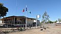
Police station, 2019
-
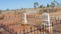
Camooweal Cemetery, 2019
-
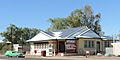
Camooweal post office, 2019


.jpg)
