Cardigan, Ceredigion facts for kids
Quick facts for kids Cardigan
|
|
|---|---|
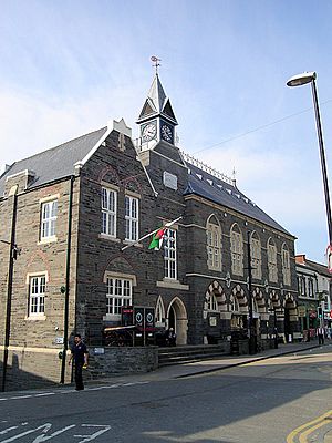
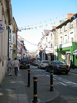 High Street, Cardigan |
|
| Population | 4,216 (2021) |
| OS grid reference | SN175465 |
| Principal area | |
| Ceremonial county | |
| Country | Wales |
| Sovereign state | United Kingdom |
| Post town | CARDIGAN |
| Postcode district | SA43 |
| Dialling code | 01239 |
| Police | Dyfed-Powys |
| Fire | Mid and West Wales |
| Ambulance | Welsh |
| EU Parliament | Wales |
| UK Parliament |
|
| Welsh Assembly |
|
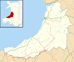
Cardigan (called Aberteifi in Welsh) is a town in Ceredigion, Wales. It sits on the River Teifi, where the county of Ceredigion meets Pembrokeshire. Cardigan used to be the main town of the old county of Cardiganshire.
The town grew around a Norman castle built in the late 1000s or early 1100s. This castle was the place of the very first Eisteddfod in 1176. An Eisteddfod is a special festival where people compete in music and poetry. Cardigan became a busy port in the 1700s. But its harbour became too shallow for big ships, so its importance as a port faded by the early 1900s. The castle was fixed up and restored in 2014.
In 2011, about 4,184 people lived in Cardigan.
Contents
What's in a Name?
Understanding "Cardigan" and "Aberteifi"
The name Cardigan is an English version of the Welsh word Ceredigion. This means "Ceredig's land." Ceredig was a legendary prince. His castle once controlled the area around the town.
The Welsh name for the town is Aberteifi. This name tells you where the town is located. Aber means "mouth" (like the mouth of a river). Teifi is the name of the river. So, Aberteifi means "mouth of the River Teifi."
Cardigan's Past: A Journey Through History
Ancient Times: Roman Connections
In ancient Roman times, the nearest Roman forts were at Loventium and Bremia. These forts were located near gold mines. They were also close to the River Teifi.
Medieval Cardigan: Castles and Culture
Cardigan grew up near old forts. These forts were built to control the River Teifi. A Norman lord named Roger de Montgomery built a castle here in 1093.
Later, Welsh princes fought for control of the area. Prince Rhys ap Gruffydd made the town stronger. He built a castle near the bridge over the Teifi. In 1176, he started the first Eisteddfod. People from all over the British Isles came to compete. They wanted to win prizes in music and poetry.
In 1199, Cardigan received its first official charter. This made it an important trading place. A weekly market was started in 1227. This market still happens today.
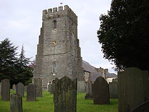
The town became part of the English crown in 1283. A town wall was built in the 1240s. The castle was also rebuilt. St Mary's Church was a Benedictine Priory. It has been a church since medieval times.
Early Modern Cardigan: Trade and Change
After Wales became part of England, trade grew. By the late 1500s, fishing was important. Later, the port traded many other goods. A Customs House was set up to collect taxes.
During the English Civil War, the castle was held by the Royalists. These were supporters of the King.
In the 1700s, the herring fishing industry grew. Cardigan had many merchant ships. They exported fish, slate, and grain. They imported oranges, building materials, and coal. Industries like shipbuilding and brick-making also developed.
In 1819, a ship called the Albion left Cardigan. It carried the first Welsh settlers to Canada. Many of these settlers were farmers.
Cardigan Town Centre: From Port to Modern Life
In the 1700s and early 1800s, Cardigan was a very important port. It was the busiest port in South Wales. It exported many goods like slate and butter. In 1815, it had 314 ships. This was more than Cardiff and Swansea combined! The town also built many ships.
Many different craftsmen worked in Cardigan. In 1830, there were boot makers, bakers, carpenters, and tailors. There were also weavers, printers, and tanners.
The Cardigan Guildhall was built between 1858 and 1860. It cost a lot of money to build.
By the mid-1800s, there were over 60 pubs in town. But the port started to decline. The river became too shallow for large ships. The railway arrived in 1886. This made the port even less important. By the early 1900s, the port was mostly inactive.
For 40 years, a factory in Cardigan made jeans. It closed in 2002, and 400 jobs were lost. But a new jeans company, Hiut Denim, opened in 2012. It hired some of the original workers. This company became famous in 2017.
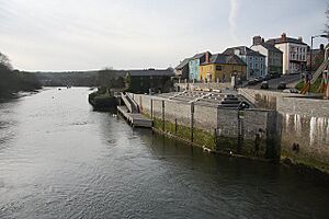
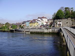
In 2006 and 2008, the town worked to restore its buildings. Many shop fronts were fixed up. The quayside was rebuilt. It now has a new public area and a landing stage for boats.
Cardigan was named one of the best places to live in Wales in 2017.
The Cardigan and District Community Hospital closed in 2019. Its services moved to a new health centre.
Cardigan's Location and Surroundings
Where is Cardigan?
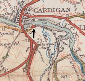
Cardigan is located on the River Teifi. It is the last place where you can cross the river before it reaches the sea. The town is about 77 miles (124 km) northwest of Cardiff. It is about 198 miles (319 km) from London.
Most of the town was north of the river before the 1900s. The Afon Mwldan river flows through the town. Both the town and its rivers can sometimes flood. In 2018, a small earthquake was felt in the area.
Cardigan's Weather
Cardigan has a mild climate. Summers are comfortable, and winters are cold. The nearest weather station is in Aberporth, about 6 miles (10 km) away.
Temperatures rarely go above 25°C (77°F). The highest temperature recorded was 32.7°C (90.9°F) in 2006. On average, there are about 18 nights with frost each year. The coldest night usually drops to about -4.45°C (24°F).
Cardigan gets about 890 mm (35 inches) of rain each year. It rains on about 146 days.
Cardigan Castle: A Historic Landmark
Cardigan Castle is a very important place. In 1176, it hosted the first competitive Eisteddfod. Cardigan also hosted the National Eisteddfod of Wales in 1942 and 1976.
For many years, the castle was privately owned. It became very run down. But a group of volunteers worked to save it. The local council bought it in 2003. The castle and its main house were restored in 2014.
Today, Cardigan Castle is open to the public. You can stay there in luxury rooms. There is a heritage centre to learn about its history. It also has a restaurant and an area for concerts and events.
Buildings of Interest
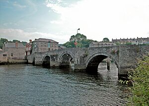
Cardigan has over 100 listed buildings. These are buildings that are protected because of their historical or architectural importance. This includes the castle, which is Grade I-listed. The old bridge is Grade II*-listed. The Old Shire Hall is also Grade II*-listed.
People and Language
Cardigan is the second largest town in Ceredigion. In 2011, it had 4,184 residents.
In 2011, over half of the people (54.6%) in Cardigan could speak Welsh. The town works to provide chances for people of all ages to speak Welsh.
How Cardigan is Governed
Cardigan has two levels of local government. The first is the Cardigan Town Council. This council meets at Cardigan Castle. The second is the Ceredigion County Council.
The Cardigan Town Council has thirteen councillors. After the 2017 election, it was special because it had more women councillors than men.
Cardigan has been a borough since 1284. This means it had its own local government. The town's boundaries changed over time. In 1974, the borough was replaced by a "community" called Cardigan. This is the local government system used today.
Things to Do and See in Cardigan
Education in Cardigan
Cardigan has a college called Coleg Ceredigion. It teaches about 700 full-time students. It also teaches 2,000 part-time students. Classes are taught in both Welsh and English. This college is part of the University of Wales Trinity Saint David.
The college shares a site with Cardigan Secondary School (Ysgol Uwchradd Aberteifi). There is also a primary school called Ysgol Gynradd Gymunedol Aberteifi. It was formed in 2008 and teaches over 300 pupils.
Places of Worship
The main church in Cardigan is St Mary's Parish Church.
Cardigan is also home to Our Lady of Cardigan. This is a Roman Catholic shrine. It is also known as the shrine to Our Lady of the Taper.
Other churches include:
- Bethania Welsh Baptist Church, built in 1775–76.
- Mount Zion Baptist Church, built in 1878.
- Tabernacl Methodist Chapel, built in 1760.
There is also a small Islamic centre on Quay Street. It is called the "Cardigan Islamic Cultural Centre." It serves the local Muslim community.
Fun Activities and Sports
Cardigan has a leisure centre. It offers sports and fitness facilities. There is also a swimming pool. A public library moved to the Council Offices in 2017.
Cardigan Rugby Football Club was started in 1876. They play in WRU Division Two West.
Cardigan Golf Club is an 18-hole course. It is located at Gwbert, north of town. The course started in 1895.
In 2018, a special plaque was put up at Cardigan Quay. It honours Jonathan Jones. He was a famous powerboat champion and boat-builder from Cardigan.
The River Teifi
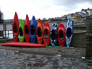
You can moor boats in the River Teifi. There are also places to launch boats. An activity centre near the old bridge offers kayaking.
Cardigan Lifeboat Station is at Poppit Sands. It has been helping people since 1849. Its boathouse is open to visitors in the summer.
Yearly Events
- Barley Saturday: This agricultural event has been held since the 1800s. It happens on the Saturday after the last Friday in April. Farmers used to hire workers and inspect horses. Today, the horses are the main attraction. They are paraded through the town.
- Wine and Food Festival: This festival takes place in August.
- The Dream of Dr. Sardonicus: Since 2014, this three-day music festival happens every August. It features psychedelic music.
Getting Around Cardigan
The A487 road connects Cardigan to the northeast and southwest. The A478 road goes south to Narberth and Tenby. The A484 road goes southeast to Swansea. A bypass road was built around the town in 1989–90. It includes a new bridge over the River Teifi. Bus services connect Cardigan to nearby towns and villages.
Cardigan used to have a railway station. It was the end of the Whitland and Cardigan Railway line. The station opened in 1886. It closed to passengers in 1962. It closed completely in 1965.
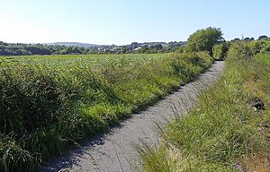
The old railway track between Cardigan and Cilgerran is now a footpath and cycle track. It leads to the Welsh Wildlife Centre.
Famous People from Cardigan
Many notable people have connections to Cardigan:
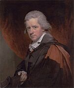
- Charles Symmons (1749–1826), a Welsh poet and priest.
- Kenny Meadows (1790–1874), an artist who drew for Punch magazine.
- Nicola Heywood-Thomas (1955–2023), a Welsh broadcaster and journalist.
- Buddug Verona James (born around 1955), an opera singer and actress.
- David Edwards (1964–2021), a musician and lead singer for the band Datblygu.
- Gareth Milton (born around 1980), an actor who grew up in Cardigan.
Sports Stars
- Brynmor Williams (born 1951), a famous rugby player.
- Hywel Davies (born 1957), a jockey with many wins.
- John Davies (born 1971), a former Welsh rugby player.
- Wayne Proctor (born 1972), another former Welsh rugby player.
- Owen Evans (born 1989), a Welsh rugby player.
- Jodie Grinham (born 1993), an archer who won gold at the 2024 Summer Paralympics.
See also
 In Spanish: Cardigan (Gales) para niños


