
Caroga, New York facts for kids
Quick facts for kids
Caroga, New York
|
|
|---|---|

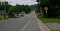
Hamlet of Caroga Lake
|
|

Caroga, New York
Location in New York
|
|
| Country | United States |
| State | New York |
| County | Fulton |
| Government | |
| • Type | Town Council |
| Area | |
| • Total | 54.28 sq mi (140.58 km2) |
| • Land | 50.63 sq mi (131.12 km2) |
| • Water | 3.65 sq mi (9.46 km2) |
| Elevation | 1,637 ft (499 m) |
| Population
(2010)
|
|
| • Total | 1,205 |
| • Estimate
(2016)
|
1,162 |
| • Density | 22.95/sq mi (8.86/km2) |
| Time zone | UTC-5 (Eastern (EST)) |
| • Summer (DST) | UTC-4 (EDT) |
| ZIP code |
12032
|
| Area code(s) | 518 |
| FIPS code | 36-035-12573 |
| GNIS feature ID | 0978794 |
Caroga is a small town located in Fulton County, New York, United States. In 2010, about 1,205 people lived there. The town got its name from a nearby creek.
Caroga is in the northern part of Fulton County. It is northwest of the cities of Gloversville and Johnstown.
Contents
History of Caroga
Early Settlements
People first started settling in the area around Caroga in 1783. This was a time when many new communities were forming in New York.
How Caroga Became a Town
The town of Caroga was officially created in 1842. It was formed from parts of three other towns: Bleecker, Johnstown, and Stratford.
The Name Caroga
The name "Caroga" comes from an older spelling of "Garoga Creek." This creek flows south from the town towards the Mohawk River.
Early Industries
In its early days, Caroga's main industries were lumber and tanning. Tanning is the process of making leather from animal hides. By 1890, the town's population was 624 people.
Geography of Caroga
Size and Location
Caroga covers a total area of about 140.6 square kilometers (54.28 square miles). Most of this area is land, with about 9.5 square kilometers (3.65 square miles) being water.
The town is located inside the Adirondack Park, a large protected area. The northern border of Caroga touches Hamilton County.
Major Roads
Several important roads run through Caroga:
- New York State Route 10 is a main road that goes north and south. It connects Caroga to Piseco Lake in the town of Arietta to the north and Canajoharie to the south.
- New York State Route 29A crosses NY-10 near Pine Lake. It then runs south with NY-10 to Caroga Lake. This route also leads southeast to Gloversville and west to Salisbury.
- New York State Route 10A branches off NY-10 near Bradtville. It provides a route to Johnstown, which is the main town of Fulton County.
Population of Caroga
Population Changes Over Time
| Historical population | |||
|---|---|---|---|
| Census | Pop. | %± | |
| 1850 | 589 | — | |
| 1860 | 629 | 6.8% | |
| 1870 | 828 | 31.6% | |
| 1880 | 855 | 3.3% | |
| 1890 | 624 | −27.0% | |
| 1900 | 470 | −24.7% | |
| 1910 | 441 | −6.2% | |
| 1920 | 332 | −24.7% | |
| 1930 | 306 | −7.8% | |
| 1940 | 408 | 33.3% | |
| 1950 | 462 | 13.2% | |
| 1960 | 568 | 22.9% | |
| 1970 | 822 | 44.7% | |
| 1980 | 1,177 | 43.2% | |
| 1990 | 1,337 | 13.6% | |
| 2000 | 1,407 | 5.2% | |
| 2010 | 1,205 | −14.4% | |
| 2016 (est.) | 1,162 | −3.6% | |
| U.S. Decennial Census | |||
The population of Caroga has changed quite a bit over the years. For example, in 1850, there were 589 people. The population grew to 1,407 in 2000, but then decreased to 1,205 by 2010.
Who Lives in Caroga?
Based on the 2000 census, there were 1,407 people living in Caroga. Most residents were White (98.86%). A small number of people were Native American, Asian, Pacific Islander, or from two or more races. About 0.21% of the population was Hispanic or Latino.
There were 588 households in the town. About 27.9% of these households had children under 18 living with them. Many households (53.7%) were married couples living together.
Age Groups
The population in Caroga is spread across different age groups. In 2000:
- 22.9% of people were under 18 years old.
- 5.0% were between 18 and 24.
- 27.1% were between 25 and 44.
- 28.4% were between 45 and 64.
- 16.6% were 65 years or older.
The average age in Caroga was 42 years old.
Communities and Lakes in Caroga
Caroga is home to several small communities and beautiful lakes.
Communities
- Bradtville – A small place located near the southern border of the town on NY-10.
- Canada Lake – A hamlet (small village) found north of the lake with the same name.
- Caroga Lake – A hamlet located between East Caroga Lake and West Caroga Lake, right on NY-10.
- Glasgow Mills – A hamlet in the southwestern part of the town.
- Newkirk (once called "Newkirks Mills") – A hamlet southwest of Caroga Lake hamlet on NY-10. This used to be the main settlement in the town.
- North Bush – A hamlet in the southern part of the town on County Road 137. This was where the first school in Caroga was located.
- Wheelerville – A hamlet north of Caroga Lake hamlet on NY-10.
Lakes and Mountains
Caroga is known for its many lakes and mountains, which are popular for outdoor activities.
- Camelhump – A mountain located east of Kane Mountain.
- Canada Lake – A lake located south of the Canada Lake community and north of Caroga Lake.
- Caroga Creek – A stream that flows south through the town.
- East Caroga Lake – A lake in the south-central part of the town, connected to West Caroga Lake.
- Green Lake – A lake located near the hamlet of Canada Lake.
- Kane Mountain – A mountain located north of the Canada Lake hamlet.
- Lily Lake – A lake located southwest of Canada Lake.
- Nine Corner Lake – A lake located northwest of Canada Lake.
- Pine Lake – A lake north of Canada Lake and east of NY-10.
- Pine Mountain – A mountain located east of Pine Lake.
- Royal Mountain – A skiing area found near the southern town line.
- Sheeley Mountain – A mountain located east of Kane Mountain.
- Stewart Lake – A lake located north of Wheelerville.
- Stoner Lakes – Three connected lakes near the northern town line.
- West Caroga Lake – A lake in the south-central part of the town, connected to East Caroga Lake.
- West Lake – A lake located west of the Canada Lake hamlet. It is connected to Canada Lake.
Images for kids
-
Hamlet of Caroga Lake
See also
 In Spanish: Caroga (Nueva York) para niños
