Chaghcharan facts for kids
Quick facts for kids
Chaghcharan
چغچران/فیروزکوه
Firuzkoh/Firozkoh or Ahangaran
|
|
|---|---|
|
City
|
|
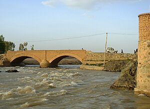
A bridge in Chaghcharan crossing the Hari Rud river
|
|
| Country | |
| Province | Ghor |
| Established | 540-544 AD |
| Founder | Sultan Giathuddin Al-ghori |
| Elevation | 2,230 m (7,320 ft) |
| Population
(2020)
|
|
| • City | 150,892 |
| • Urban | 7,918 |
| • Ethnicities | Pashtuns Hazaras |
| Time zone | UTC+4:30 |
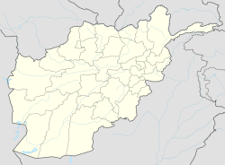
Chaghcharan (also known as Firozkoh) is a city in central Afghanistan. It is the capital of Ghor Province. The city sits on the southern side of the Hari River. It is about 2,230 meters (7,316 feet) above sea level.
Chaghcharan is connected to other major cities by highways. A 380-kilometer (236-mile) highway links it to Herat in the west. Another 450-kilometer (280-mile) highway connects it to Kabul in the east. The city also has its own airport, called Chaghcharan Airport.
In 2020, Chaghcharan had a population of about 150,982 people. Most people speak Dari or Pashto. About 7,918 people live in the city area itself. The main groups of people living here are Pashtuns and Hazaras.
Contents
History of Chaghcharan
Ancient Times and Early Islam
Before Islam arrived, people in this area followed different religions. These included Zoroastrianism, Buddhism, and Hinduism.
In the 10th century, Islam came to the region. This happened during the Islamic conquest of Afghanistan by Sultan Mahmud of Ghazni.
The Ghurid Dynasty and the Minaret of Jam
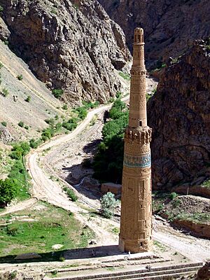
After the Ghaznavids were defeated in the 12th century, a local group called the Ghurid dynasty took control. The Ghurids made Firozkoh their summer capital. They built the famous Minaret of Jam nearby. Today, the Minaret of Jam is a special place. It is recognized as a UNESCO World Heritage Site. This means it's important for everyone in the world to protect.
Mongol Invasions and Later Rulers
In the 13th century, the Mongol army invaded the Ghor region. They destroyed Firozkoh, but they left the Minaret of Jam standing. After the Mongols, the area was ruled by the Ilkhanate. Later, in the 14th century, Timur took control.
Chaghcharan is even mentioned in the book Baburnama from the 16th century. This book describes Babur's visit to the town in 1507. He was on his way to Kabul. At that time, Chaghcharan was in the Gharjistan region. It was located between Herat, Ghor, and Ghazni.
Modern Developments
In 2004, a new independent radio station started broadcasting in Chaghcharan. It was called Voice of Peace Radio. This was the first independent media in this part of Afghanistan.
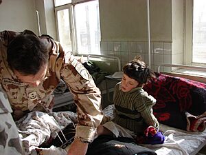
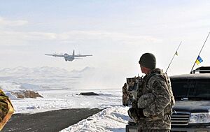
In 2005, an international group called the International Security Assistance Force (ISAF) set up a team in Chaghcharan. This team included soldiers from Lithuania, Croatia, Denmark, the United States, Ukraine, Iceland, and Georgia. They worked to help rebuild the area.
More recently, in August 2021, Chaghcharan became one of the provincial capitals taken by Taliban fighters. This was part of a larger conflict in Afghanistan.
Land Use and Economy
Chaghcharan (also known as Ferozkoh) is known for its agriculture and animal farming. These are the main ways people make a living in Ghor Province. The city has a total land area of 2,614 hectares.
Transportation
The Chaghcharan Airport is located northwest of the Hari River. It used to have regular flights to Kabul and Herat. However, as of 2016, only the United Nations Humanitarian Air Service (UNHAS) uses the airport for flights.
The main road from Chaghcharan goes west towards Herat and east towards Kabul. Traveling on this road can be difficult. It is often closed during winter due to bad weather. Even in summer, it can take up to three days to drive from Chaghcharan to Kabul.
Climate
Chaghcharan has a climate with snowy winters and warm, dry summers. This type of climate is called a warm-summer humid continental climate. Not much rain falls here, and most of it happens in winter and spring.
| Climate data for Chaghcharān | |||||||||||||
|---|---|---|---|---|---|---|---|---|---|---|---|---|---|
| Month | Jan | Feb | Mar | Apr | May | Jun | Jul | Aug | Sep | Oct | Nov | Dec | Year |
| Record high °C (°F) | 12.0 (53.6) |
11.5 (52.7) |
20.6 (69.1) |
26.8 (80.2) |
32.3 (90.1) |
34.6 (94.3) |
37.4 (99.3) |
35.0 (95.0) |
33.0 (91.4) |
27.5 (81.5) |
21.0 (69.8) |
16.7 (62.1) |
37.4 (99.3) |
| Mean daily maximum °C (°F) | −1.3 (29.7) |
0.0 (32.0) |
8.8 (47.8) |
17.4 (63.3) |
21.8 (71.2) |
27.3 (81.1) |
29.8 (85.6) |
28.8 (83.8) |
24.7 (76.5) |
17.9 (64.2) |
11.4 (52.5) |
3.2 (37.8) |
15.8 (60.5) |
| Daily mean °C (°F) | −9.4 (15.1) |
−7.3 (18.9) |
1.6 (34.9) |
9.3 (48.7) |
12.8 (55.0) |
17.2 (63.0) |
19.3 (66.7) |
17.8 (64.0) |
12.4 (54.3) |
6.9 (44.4) |
1.5 (34.7) |
−4.4 (24.1) |
6.5 (43.7) |
| Mean daily minimum °C (°F) | −16.3 (2.7) |
−15.3 (4.5) |
−3.9 (25.0) |
2.1 (35.8) |
3.5 (38.3) |
4.9 (40.8) |
7.1 (44.8) |
5.3 (41.5) |
−0.2 (31.6) |
−2.8 (27.0) |
−6.8 (19.8) |
−11.1 (12.0) |
−2.8 (27.0) |
| Record low °C (°F) | −44 (−47) |
−46.0 (−50.8) |
−26 (−15) |
−10.8 (12.6) |
−6.0 (21.2) |
−2.7 (27.1) |
0.5 (32.9) |
−2.0 (28.4) |
−8.0 (17.6) |
−14.6 (5.7) |
−19.5 (−3.1) |
−35 (−31) |
−46.0 (−50.8) |
| Average precipitation mm (inches) | 30.9 (1.22) |
32.2 (1.27) |
40.0 (1.57) |
35.3 (1.39) |
20.1 (0.79) |
0.4 (0.02) |
0.1 (0.00) |
0.5 (0.02) |
0.0 (0.0) |
11.0 (0.43) |
15.8 (0.62) |
18.1 (0.71) |
204.4 (8.04) |
| Average rainy days | 0 | 1 | 6 | 8 | 5 | 0 | 0 | 0 | 0 | 3 | 3 | 1 | 27 |
| Average snowy days | 8 | 9 | 5 | 1 | 0 | 0 | 0 | 0 | 0 | 0 | 2 | 7 | 32 |
| Average relative humidity (%) | 70 | 71 | 66 | 56 | 49 | 39 | 34 | 32 | 36 | 44 | 54 | 64 | 51 |
| Mean monthly sunshine hours | 146.4 | 150.2 | 198.6 | 223.9 | 320.6 | 383.9 | 389.4 | 358.0 | 344.7 | 267.7 | 217.9 | 154.7 | 3,156 |
| Source: NOAA (1968-1983) | |||||||||||||
See also
 In Spanish: Čaġčarān para niños
 | James Van Der Zee |
 | Alma Thomas |
 | Ellis Wilson |
 | Margaret Taylor-Burroughs |


