Cleeve Hill, Gloucestershire facts for kids
Quick facts for kids Cleeve Hill |
|
|---|---|

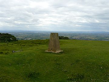
The trig point on the northern part of Cleeve Hill at SO985263. There is also a toposcope at this location
|
|
| Highest point | |
| Elevation | 1,083 ft (330 m) |
| Prominence | 794 ft (242 m) |
| Parent peak | The Wrekin |
| Listing | Marilyn, County Top |
| Geography | |
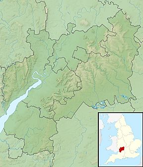
| Location | Gloucestershire, England |
| Parent range | Cotswolds |
| OS grid | SO996246 |
| Topo map | OS Landranger 163 OS Explorer 179 |
| Geology | |
| Age of rock | Jurassic |
| Mountain type | Sedimentary |
| Climbing | |
| Easiest route | Hike |
Cleeve Hill, also known as Cleeve Cloud, is the tallest point in the Cotswolds hills and in the county of Gloucestershire. It stands at about 1,083 feet (330 meters) high.
It's part of Cleeve Common, a special natural area called a Site of Special Scientific Interest (SSSI). A group called Cleeve Common Trust takes care of it. From the top, you can see amazing views! Look west to see Cheltenham town and its famous horse racing track. You can also spot the River Severn and even Wales in the distance. To the north, you'll see the town of Winchcombe.
Cleeve Hill is a noticeable rock formation on the edge of the Cotswolds' limestone cliffs, sometimes called the "Cotswold Edge." A popular walking path, the Cotswold Way, goes right over it. The southern slopes of Cleeve Hill drain into the River Coln. This means Cleeve Hill is the highest point in the entire area that drains into the River Thames.
Contents
What Can You See From Cleeve Hill's Top?
The very highest point of Cleeve Hill is about 1,083 feet (330 meters) high. It's marked by a special stone pillar called a trig point. This spot is on a fairly flat part of the common, so the views aren't always super wide from right there.
However, if you go a bit north-northwest to another spot that's 1,033 feet (315 meters) high, you'll find another trig point and a toposcope. A toposcope is like a circular map that shows you what landmarks you're looking at. This spot offers much wider and more impressive views. On a very clear day, especially after rain, you might even see as far as Winsford Hill on Exmoor, Somerset, which is about 90 miles (145 kilometers) away!
Ancient History and Rock Climbing
Close to the top of Cleeve Hill, you can find an ancient burial mound called Belas Knap. It's a Neolithic long barrow, built by people thousands of years ago.
On the western side of the hill's steep slope, there's also an Iron Age hill fort. This was a fortified settlement built by people living in the Iron Age.
Cleeve Hill also has one of the few rock faces in the area that's good for rock-climbing. It's called Castle Rock. The climbing routes here are short and can be quite challenging, even for experienced climbers.
Golf and Cleeve Common
Cleeve Hill has been home to a golf course since 1891. Many golf tournaments have been held here over the years.
Cleeve Common, which covers Cleeve Hill, is officially recognized as a Site of Special Scientific Interest by Natural England. This means it's a very important place for wildlife and geology.
How to Reach Cleeve Hill's Highest Point
There are several ways to get to the top of Cleeve Hill.
If you're coming from the south, there's a road that leads very close to the summit's trig point. From the parking area, it's just a short walk. You can reach this road from Cheltenham by driving through Ham Hill and Aggs Hill, or from the village of Whittington, Gloucestershire.
To get to the northern viewpoint, which has better views, you can take a smaller road off the B4632. This road leads to the golf course, where you can park for free in an old quarry. From there, it's about a half-mile walk uphill to the viewpoint.
Many other paths and tracks cross Cleeve Hill, making it easy to explore. Ordnance Survey maps are great for finding all the different routes, paths, and the best places to enjoy the views.
 | Georgia Louise Harris Brown |
 | Julian Abele |
 | Norma Merrick Sklarek |
 | William Sidney Pittman |


