Darlaston facts for kids
Quick facts for kids Darlaston |
|
|---|---|
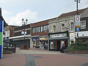 Darlaston town centre |
|
| Population | 27,821 (2011.Wards) |
| OS grid reference | SO9797 |
| Metropolitan borough |
|
| Metropolitan county | |
| Region | |
| Country | England |
| Sovereign state | United Kingdom |
| Post town | WEDNESBURY |
| Postcode district | WS10 |
| Dialling code | 0121 |
| Police | West Midlands |
| Fire | West Midlands |
| Ambulance | West Midlands |
| EU Parliament | West Midlands |
| UK Parliament |
|
Darlaston is an industrial town located in the West Midlands of England. It's part of the Metropolitan Borough of Walsall. You can find it close to other towns like Wednesbury and Willenhall.
Contents
Understanding Darlaston's Landscape
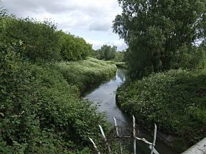
Darlaston sits in a valley where three main streams of the River Tame meet. It's located on the South Staffordshire Coalfield, an area known for lots of coal mining. The coal found here was formed a very long time ago, during the Carboniferous Period.
Many old, unused coal mines are hidden around Darlaston. You can find them near Queen Street in Moxley, behind Pinfold Street JMI School, and in George Rose Park. Sometimes, old mines can cause the ground above them to sink. This is called mining subsidence. In 1999, a house on the New Moxley estate actually collapsed into an old mine shaft! Luckily, the person living there had already moved out safely.
A Look Back: Darlaston's History
Darlaston has a long history, but much of its very early past is a bit of a mystery. This is because a lot of old records are missing. Also, intense coal mining in the 1700s and 1800s destroyed much of the old evidence. People think there might have been a Saxon castle here a long time ago, but no parts of it remain today.
From the 1100s to the 1400s, the de Darlaston family owned the land. After they were gone, the Hayes family took over.
How Industry Shaped Darlaston
Because Darlaston was on the South Staffordshire Coalfield, coal mining started very early. At first, it was small-scale. For example, in 1698, Timothy Woodhouse managed coal mines and sold thousands of sacks of coal.
In the early 1800s, Darlaston grew very quickly due to industry. This growth also brought problems like poor housing. By 1839, many homes were in bad condition. However, Darlaston had great transport links, like the Birmingham Canal Navigations and the Grand Junction Railway, which helped businesses.
One important family was the Rose family, who became wealthy from industry. James Rose, for example, was a latch, bolt, and nut maker. By 1881, his business employed 90 people, including children.
Becoming Part of a Bigger Area
On January 1, 1895, Darlaston became its own "urban district," meaning it had its own local council. Later, in 1966, Darlaston became part of Walsall. Then, in 1974, it joined the larger metropolitan county of the West Midlands.
During World War II, Darlaston was bombed a few times. On June 5, 1941, a bomb hit Lowe Avenue, killing 11 people. The houses were later rebuilt.
In the second half of the 1900s, many old Victorian houses were pulled down. The council built thousands of new homes and flats. In 2001 and 2004, some of the town's tall apartment blocks were taken down.
By the late 1980s, many of the factories and industries in Darlaston had closed. To help the town, 15 empty sites were made into "enterprise zones" in 2011. These zones offer special benefits to businesses that want to set up there, hoping to create many new jobs.
Learning in Darlaston
Darlaston has one main secondary school, Grace Academy. Before 2009, it was known as Darlaston Comprehensive School. It's located in the western part of the town.
Important Buildings and Places
All Saints Church
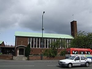
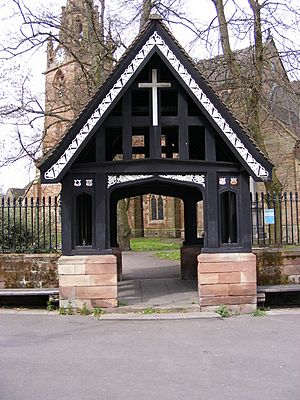
The original All Saints' Church, Darlaston was built in 1872 but was destroyed during World War II in 1942. A new church, designed by local architect Richard Twentyman, opened in 1952. It is now a Grade 2 listed building, meaning it's historically important.
Bentley Old Hall
Bentley Old Hall was a large country house in Darlaston until the early 1900s. It was famous because in 1651, after a big battle, the future King Charles II hid there! He was helped by Colonel John Lane and later escaped disguised as a servant with the Colonel's sister, Jane Lane. Today, the area where Bentley Old Hall stood is a housing estate.
Darlaston Manor House
The old manor house of Darlaston is thought to have been located where the Asda supermarket car park is now, near St Lawrence's Church.
Darlaston Town Hall
This beautiful building on Victoria Road was designed by architect Jethro Anstice Cossins and opened in 1888. It used to have offices, a public library, and a large hall. Between 2006 and 2008, the building was restored. Today, it houses local Social Services, and the hall is still used for public meetings, concerts, and other events.
The Pipe Organ
In 1903, a wonderful pipe organ was added to the public hall. It was a gift to the town from the widow of James Slater, a former local leader. The organ was built by J. J. Binns, a famous company. This organ is still used today! In 2018, it was recognized as very important nationally because it's an original example from 1903.
Darlaston Windmill
Darlaston had its own windmill as early as 1695. It was used to grind grain until about 1860.
St Lawrence Darlaston
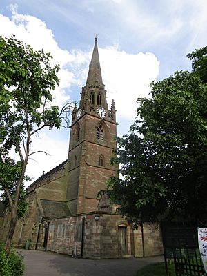
The impressive St Lawrence's Church you see today was mostly built in the late 1800s. However, the church site itself is much older, going back to medieval times. The church records, which are very old, can be found in archives. In 2018, the church's inside was beautifully redecorated with help from the UK Heritage Lottery Fund.
Famous People from Darlaston
- Mark Rhodes: A TV presenter who was a runner-up in the 2003 Pop Idol contest.
- Sue Nicholls: An actress, known for her role in Coronation Street.
- John Fiddler: A musician from the 1970s band Medicine Head.
- Mark Lewis-Francis: A well-known sprinter.
- Netan Sansara: The first Asian player to play for the England Under-18 football team. He also played for Walsall FC.
- Elizabeth Benton: A professional unicyclist who was runner-up at the 1998 World Championship.
Darlaston's Neighbourhoods
- Rough Hay: Mostly council houses built between the World Wars, near Willenhall.
- Moxley: A mix of private and council homes, close to Bilston.
- Kings Hill: East of the town centre, with a diverse population and different types of housing, plus factories.
- Woods Bank: Mostly council houses built between the World Wars, near Wednesbury.
- Bentley: The most northern part of Darlaston, developed after 1945.
- Darlaston Green: A mix of homes and industrial areas, near Rough Hay and Bentley.
Getting Around Darlaston
Buses
Buses stop at the Darlaston Town Bus Interchange. You can catch buses to many nearby places like Walsall, Wolverhampton, Wednesbury, and West Bromwich.
Canals
The Walsall Canal, which is 7 miles long, runs through Darlaston. It's part of the larger Birmingham Canal Navigations system.
Trains
- A new train station for Darlaston is planned to open in 2023. It will connect Walsall to Wolverhampton.
- The old Darlaston railway station closed in 1887, and there's not much left of it today.
- Darlaston James Bridge railway station also closed in 1965.
Roads
Since the early 1970s, a road called St Lawrence's Way has helped traffic bypass the town centre. While no motorway runs directly through Darlaston, a section of the M6 motorway is very close by.
Trams
Since 1999, there has been a West Midlands Metro tram stop at Bradley Lane in the Moxley area of Darlaston.
Fun and Games in Darlaston
Darlaston has a few green spaces for recreation. There are playing fields at Broadwaters Road and three parks: Kings Hill Park, George Rose Park, and Victoria Park.
Sports Clubs
The town has a football team called Darlaston Town (1874) FC. They play in the West Midlands (Regional) League. The previous club, Darlaston Town FC, stopped playing in 2013.
|
 | Valerie Thomas |
 | Frederick McKinley Jones |
 | George Edward Alcorn Jr. |
 | Thomas Mensah |


