Dunstable Downs facts for kids
Quick facts for kids Dunstable Downs |
|
|---|---|
 |
|
| Highest point | |
| Elevation | 797 ft (243 m) |
| Prominence | c. 344 ft |
| Parent peak | Haddington Hill |
| Listing | County Top |
| Geography | |
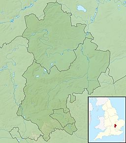
| Location | Chiltern Hills, England |
| OS grid | TL008194 |
| Topo map | OS Landranger 166 |
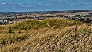
Dunstable Downs are beautiful hills in Bedfordshire, England. They are part of the Chiltern Hills. These hills are made of chalk and form the highest point in Bedfordshire, reaching 797 feet (243 meters) high!
Because they are so high up, Dunstable Downs were once used for an old communication system. From 1808 to 1814, a 'shutter telegraph' station here helped send messages. It connected the British Navy in London to their ships far away in Great Yarmouth.
You can also spot a giant lion shape carved into the chalk on one of the hills! This amazing artwork was made by Whipsnade Zoo. It can be seen from the B489 road, which goes from Aylesbury to Dunstable.
These hills are perfect for flying! Many people come here to enjoy gliding, kite flying, hang gliding, and paragliding. The London Gliding Club is even located right at the bottom of the downs.
A large part of Dunstable Downs is looked after by the National Trust. They manage it as part of the Dunstable Downs & Whipsnade Estate.
Visiting Dunstable Downs
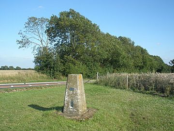
There is a special building called the Chilterns Gateway Centre at the very top of Dunstable Downs. This visitor centre was built by Central Bedfordshire Council and the National Trust. The summit is right next to the B4541 road. This means you can easily get out of your car and walk to the highest point, where you'll find a trig point.
If you want to walk up the hill from the bottom, there are great paths to follow. You can start from the village of Whipsnade. Just follow the Icknield Way Path and the Chiltern Way. Both of these paths are shown on Ordnance Survey maps. You can even make your walk longer by including the northern top of Five Knolls. You can also climb the hill from the town of Dunstable to the north.
The Icknield Way Trail is another route that goes over Dunstable Downs. This trail is made for horse riders and off-road cyclists.
Ancient Discoveries
At the northern end of Dunstable Downs, you'll find the Five Knolls Barrow Cemetery. This site was first described by a historian named William Stukeley in the 1700s. Before it was excavated, the site held burials from the late Neolithic period all the way to the Saxon times.
One discovery was the "Five Knolls Woman," who was about 35 to 40 years old. She was buried on her side with a flint knife. Another amazing find was a mother and child buried together. They were found with several echinoid fossils and date back to the early Bronze Age. This site is also known for the special burials of Saxon criminals who had been executed.
Nature and Wildlife
Dunstable Downs is home to many different kinds of plants and animals. You can find rare wild flowers here, like the beautiful bee orchid. There are also many butterfly species, such as the marbled white and the chalkhill blue.
Some parts of the downs, especially the west-facing slope, are very important for nature. They were officially named a Site of Special Scientific Interest (SSSI) in 1987. This means they are protected under the Wildlife and Countryside Act 1981. This SSSI is called Dunstable and Whipsnade Downs.
Blow's Down is another part of the Dunstable Downs escarpment, located on the eastern side of Dunstable. It is also an SSSI. Most of Blow's Down is managed by the Wildlife Trust for Bedfordshire, Cambridgeshire and Northamptonshire.
Images for kids
 | Stephanie Wilson |
 | Charles Bolden |
 | Ronald McNair |
 | Frederick D. Gregory |


