
Eastchester, New York facts for kids
Quick facts for kids
Eastchester, New York
|
||
|---|---|---|
| Town of Eastchester | ||

Eastchester Town Hall
|
||
|
||
_highlighted.svg)
Location of Eastchester (town), New York
|
||
| Country | United States | |
| State | New York | |
| County | Westchester | |
| Settled | 1664 | |
| Established | 1665 | |
| Government | ||
| • Type | Civil township | |
| Area | ||
| • Total | 4.94 sq mi (12.80 km2) | |
| • Land | 4.85 sq mi (12.57 km2) | |
| • Water | 0.09 sq mi (0.23 km2) | |
| Elevation | 194 ft (59 m) | |
| Population
(2020)
|
||
| • Total | 34,641 | |
| • Density | 7,012/sq mi (2,706.3/km2) | |
| Time zone | UTC-5 (Eastern (EST)) | |
| • Summer (DST) | UTC-4 (EDT) | |
| ZIP code |
10707, 10708, 10709
|
|
| Area code(s) | 914 | |
| FIPS code | 36-21820 | |
| GNIS feature ID | 978916 | |

Eastchester is a town located in southern Westchester County, New York, in the United States. In 2020, about 34,641 people lived here.
Eastchester is home to two smaller villages: Bronxville and Tuckahoe. There's also a special area called a census-designated place that is also named Eastchester. This area includes the whole town except for Bronxville and Tuckahoe.
Contents
Exploring Eastchester's Past
The town of Eastchester started to be settled in 1664. Ten families moved here from Fairfield, Connecticut. They were given land by Thomas Pell, who also owned areas like New Rochelle and Pelham. The land was near where Anne Hutchinson had lived before. Soon, 26 more families joined the original ten.
The Eastchester Covenant
In 1665, the settlers created a special agreement called the "Eastchester Covenant." This document was quite unique for its time. It had 26 rules that covered many parts of daily life. These rules included how children should be educated, how property should be managed, and how to support a minister.
Land Disputes and Royal Patents
The English took over the area, and in 1666, Governor Richard Nicolls confirmed the land ownership for the settlers. Later, in 1700, there was a disagreement about land with the Native Americans. This land was known as "Long Reach" because of its unusual shape. It included parts of today's Bronxville, Tuckahoe, and a section of northwest Mount Vernon.
Other towns and the Pell family were also involved in this land dispute. When the decision favored Eastchester, Queen Anne of England gave a second official document in 1708.
Eastchester During the American Revolution
Before the American Revolution, Eastchester was mostly a farming community. No big battles happened here, but it was part of the "Neutral Ground." This meant there was constant fighting for over 13 years. Both sides of the war, and local groups, caused trouble in the area.
Growth and Modern Boundaries
Eastchester's rural feel began to change when the railroad arrived in the 1840s. In 1853, a group of New York business people created the village of Mount Vernon. Later, the village of Bronxville was formed in 1898, and Tuckahoe in 1903.
Today, Eastchester is surrounded by Scarsdale to the north and New Rochelle to the east. Yonkers is to the west, and Mount Vernon is to the south. The town covers about five square miles, including Bronxville and Tuckahoe.
Schools in Eastchester's History
In 1899, the Waverly Union School in Eastchester (then called Upper Tuckahoe) received a special charter. This school taught students from kindergarten all the way through twelfth grade. This was the start of the Eastchester Union Free School District. Waverly was the main school until Eastchester High School was built in 1927. Waverly continued as an elementary school until 1983. It was later updated and reopened as the Waverly Early Childhood Center in 1990.
The Wilmot School served the northern part of town after 1909. It was a school for grades K-8. When Greenvale elementary school was built in 1936, the Wilmot School became Eastchester's Town Hall. In 1964, the Oak Ridge Country Club's clubhouse became the current Town Hall. The Wilmot School was then taken down. The Anne Hutchinson School, another elementary school, was built in 1953.
Geography of Eastchester
Eastchester covers about 5.0 square miles. Most of this area, about 4.9 square miles, is land. A small part, about 0.1 square miles, is water.
Communities within Eastchester
Eastchester includes several communities:
- Village of Bronxville
- Bronxville Heights
- Lawrence Park
- Village of Tuckahoe
- Waverly
- Bronxville Manor
- Crestwood
- Eastchester, an unincorporated area
- Lake Isle (parts also in New Rochelle)
- Twin Lakes
- California Ridge
- Hickory Hills
- Huntley Estates
- Chester Heights (parts also in New Rochelle)
- The North End
- The Industrial Sector
- Green Knolls
- Garth Road
- Waverly Heights
- Bronxville Manor
People of Eastchester
| Historical population | |||
|---|---|---|---|
| Census | Pop. | %± | |
| 1800 | 738 | — | |
| 1810 | 1,039 | 40.8% | |
| 1820 | 1,021 | −1.7% | |
| 1830 | 1,030 | 0.9% | |
| 1840 | 1,502 | 45.8% | |
| 1850 | 1,679 | 11.8% | |
| 1860 | 5,582 | 232.5% | |
| 1870 | 7,491 | 34.2% | |
| 1880 | 8,737 | 16.6% | |
| 1890 | 4,612 | −47.2% | |
| 1900 | 3,040 | −34.1% | |
| 1910 | 6,422 | 111.3% | |
| 1920 | 9,372 | 45.9% | |
| 1930 | 20,340 | 117.0% | |
| 1940 | 23,492 | 15.5% | |
| 1950 | 27,174 | 15.7% | |
| 1960 | 33,613 | 23.7% | |
| 1970 | 36,660 | 9.1% | |
| 1980 | 32,648 | −10.9% | |
| 1990 | 30,867 | −5.5% | |
| 2000 | 31,318 | 1.5% | |
| 2010 | 32,363 | 3.3% | |
| 2020 | 34,641 | 7.0% | |
| U.S. Decennial Census | |||
In 2020, the total population of Eastchester was 34,641 people. In 2018, the U.S. Census Bureau estimated the population to be 32,964. About 79.3% of the people were non-Hispanic white. About 8.0% were Asian, and 8.0% were Hispanic or Latino.
In 2018, about 19.1% of the town's residents were born in other countries. Also, 24.1% of people spoke a language other than English at home. The average income for a household in 2014-2018 was $120,867.
Places to See and Things to Do

- Hotel Gramatan: This hotel was built in 1905. It was made to welcome artists in the Lawrence Park area of Bronxville. The hotel was taken down in 1972.
- Lake Isle Country Club: This club opened before 1920. It used to be known as the Mount Vernon Country Club.
- Marble Schoolhouse: This is a one-room schoolhouse built in 1835. It was made from Tuckahoe Marble.
- Twin Lakes County Park: This park has many trails, wildlife, and horse stables. It also has a lake.
- Town Hall: The current Town Hall building was once a country club. It was dedicated in 1957. It is special because it houses many town departments and local community functions in one place.
- Vernon Hills Shopping Center: Built in the 1950s, this is the main shopping center in Eastchester.
- Westchester Funeral Home: Founded in 1832, this historic place arranged the funeral for U.S. President James A. Garfield in 1881.
Education in Eastchester
Eastchester has several school districts that serve its students.


Eastchester Union Free School District
- Eastchester High School
- Eastchester Middle School
- Anne Hutchinson Elementary
- Greenvale Elementary
- Waverly School
Tuckahoe Union Free School District
- Tuckahoe High School
- Tuckahoe Middle School
- Cottle Elementary
Bronxville Union Free School District
- This district has one school that serves students from kindergarten through 12th grade.
Private Schools
- Immaculate Conception School (part of the Roman Catholic Archdiocese of New York)
- Chapel School
- St. Joseph School
Famous People from Eastchester
Many interesting people have lived in or are connected to Eastchester:
- Harrison Bader (born 1994), a Major League Baseball outfielder.
- Aaron Burr, who was the third Vice President of the United States.
- Tom Creavy, a PGA golfer who won a major championship in 1931.
- John Doherty, a former pitcher in Major League Baseball.
- Johnny Farrell, a PGA golfer who won the U.S. Open in 1928.
- Jimmy Fink, a well-known radio personality in New York.
- Nick Fotiu, a former NHL forward.
- Mario Gabelli, a famous stock investor.
- Anne Hutchinson, an early supporter of religious freedom.
- Willie Macfarlane, a PGA golfer who won the U.S. Open in 1925.
- Bobby Moynihan, an actor and comedian known from Saturday Night Live.
- Kenneth Posner, a theatrical lighting designer who has won Tony Awards.
- Tony Sayegh, who worked as Assistant Secretary for Public Affairs for the U.S. Department of the Treasury.
- T. F. Secor (1808–1901), a marine engineer.
- Jess Sweetser, a golfer who won the British Amateur Championship in 1926.
- Ed Ward, a writer and music critic.
- John Peter Zenger, a person involved in an important legal case that helped establish freedom of the press.
Images for kids
-
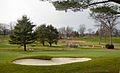
Leewood Golf Course
-
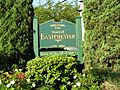
Town of Eastchester welcome sign
-
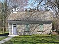
Marble schoolhouse
-
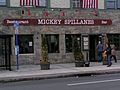
Mickey Spillane's Restaurant
-
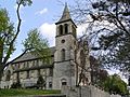
Immaculate Conception Church
-
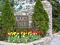
Lake Isle Country Club
-
Anne Hutchinson School
-
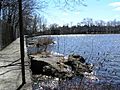
Interlaken Reservoir
-

The entrance to Holy Mount Cemetery
-
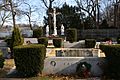
The graves in Holy Mount Cemetery
-
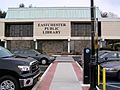
Eastchester Public Library
-
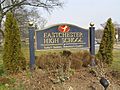
Banner at Eastchester High School


See also
 In Spanish: Eastchester para niños
