
Elba facts for kids
|
Native name:
Isola d'Elba
|
|
|---|---|

Seen from the west, Monte Capanne in foreground
|
|
 |
|
| Geography | |
| Location | Tyrrhenian Sea |
| Coordinates | 42°46′48″N 10°16′30″E / 42.78000°N 10.27500°E |
| Archipelago | Tuscan Archipelago |
| Total islands | 7 |
| Major islands | Elba, Gorgona, Capraia, Pianosa, Montecristo, Isola del Giglio, and Giannutri |
| Area | 224 km2 (86 sq mi) |
| Length | 29 km (18 mi) |
| Width | 18 km (11.2 mi) |
| Coastline | 147 km (91.3 mi) |
| Highest elevation | 1,018 m (3,340 ft) |
| Highest point | Monte Capanne |
| Administration | |
|
Italy
|
|
| Region | Tuscany |
| Province | Livorno |
| Communes of Elba | Portoferraio, Campo nell'Elba, Capoliveri, Marciana, Marciana Marina, Porto Azzurro, Rio |
| Largest settlement | Portoferraio (pop. 12,011) |
| Demographics | |
| Population | 31,592 (January 2019) |
| Pop. density | 140 /km2 (360 /sq mi) |

Elba (called isola d'Elba in Italian) is a beautiful island in the Mediterranean Sea. It is part of Tuscany, a region in Italy. Elba is about 10 kilometers (6 miles) from the Italian mainland.
It is the largest island in the Tuscan Archipelago and the third largest island in Italy. Only Sicily and Sardinia are bigger. Elba is also part of the Arcipelago Toscano National Park. It is located in the Tyrrhenian Sea, about 50 kilometers (31 miles) east of Corsica, a French island.
Elba belongs to the province of Livorno. The island has seven towns, called municipalities. About 30,000 people live here, but many more visit in the summer. The main town is Portoferraio. The other towns are Campo nell'Elba, Capoliveri, Marciana, Marciana Marina, Porto Azzurro, and Rio.
Elba is famous because Napoleon was exiled here from 1814 to 1815.
Contents
Exploring Elba's Geography
Elba is the largest piece of land left from an ancient bridge. This land once connected the Italian peninsula to Corsica. The northern coast of Elba faces the Ligurian Sea. The eastern coast is next to the Piombino Channel. The southern coast faces the Tyrrhenian Sea. The Corsica Channel separates the western part of Elba from Corsica.
How Elba Was Formed
Elba is made of different types of rocks. These rocks were once part of the ancient Tethys Ocean floor. The island is known for its rich iron deposits. A mineral called ilvaite was first found here. Its name comes from "Ilva," the old Latin name for Elba.
Iron-rich liquids moved through cracks in the Earth's crust. These liquids left behind the island's valuable iron ore.

The island's landscape is very diverse. The western part is mountainous and the newest. It is dominated by Mount Capanne, which is 1,018 meters (3,340 feet) tall. People call it the "roof of the Tuscan Archipelago." Many animals live on the mountain, like the mouflon (a type of wild sheep) and wild boar.
The central part of Elba is mostly flat. It is only about 4 kilometers (2.5 miles) wide. This is where you find major towns like Portoferraio and Campo nell'Elba. The eastern part of the island is the oldest, formed over 3 million years ago. This hilly area has the iron deposits that made Elba famous.
Rivers and Water Sources
Elba's rivers are usually short, rarely longer than 3 kilometers (1.9 miles). Many of the smaller rivers dry up in the summer. The longest rivers are:
- Fosso San Francesco (6.5 km or 4 miles)
- Fosso Barion (5.1 km or 3.2 miles)
- Fosso Redinoce (2 km or 1.2 miles)
Between the towns of Poggio and Marciana, at the base of Mount Capanne, there is a spring called Fonte Napoleone. It is known for its excellent water quality.
Elba's Climate
Elba has a typical Mediterranean climate. This means it has warm, dry summers and mild, wet winters. However, on Mount Capanne, winters can be quite cold. Most rain falls in the autumn.
Elba gets less rain than the mainland because it is in the rain shadow of Corsica. This large, mountainous island blocks some of the rain. Most of Elba receives less than 750 mm (30 inches) of rain each year. Snow is rare in the low areas and melts quickly.
| Climate data for Elba | |||||||||||||
|---|---|---|---|---|---|---|---|---|---|---|---|---|---|
| Month | Jan | Feb | Mar | Apr | May | Jun | Jul | Aug | Sep | Oct | Nov | Dec | Year |
| Record high °C (°F) | 16.2 (61.2) |
18.0 (64.4) |
20.0 (68.0) |
22.4 (72.3) |
29.6 (85.3) |
32.0 (89.6) |
34.3 (93.7) |
36.1 (97.0) |
32.0 (89.6) |
25.0 (77.0) |
24.6 (76.3) |
16.8 (62.2) |
36.1 (97.0) |
| Mean daily maximum °C (°F) | 9.6 (49.3) |
10.0 (50.0) |
12.0 (53.6) |
14.2 (57.6) |
18.8 (65.8) |
22.7 (72.9) |
26.5 (79.7) |
26.7 (80.1) |
22.6 (72.7) |
18.0 (64.4) |
13.4 (56.1) |
10.5 (50.9) |
17.1 (62.8) |
| Daily mean °C (°F) | 7.4 (45.3) |
7.5 (45.5) |
9.2 (48.6) |
11.4 (52.5) |
15.6 (60.1) |
19.3 (66.7) |
22.7 (72.9) |
23.1 (73.6) |
19.5 (67.1) |
15.4 (59.7) |
11.2 (52.2) |
8.5 (47.3) |
14.2 (57.6) |
| Mean daily minimum °C (°F) | 5.3 (41.5) |
5.0 (41.0) |
6.3 (43.3) |
8.5 (47.3) |
12.3 (54.1) |
15.8 (60.4) |
19.0 (66.2) |
19.5 (67.1) |
16.4 (61.5) |
12.9 (55.2) |
9.0 (48.2) |
6.5 (43.7) |
11.4 (52.5) |
| Record low °C (°F) | −7.4 (18.7) |
−4.4 (24.1) |
−5.4 (22.3) |
1.2 (34.2) |
3.4 (38.1) |
5.0 (41.0) |
12.2 (54.0) |
11.6 (52.9) |
7.6 (45.7) |
2.0 (35.6) |
— | −5.4 (22.3) |
−7.4 (18.7) |
| Average precipitation mm (inches) | 59.5 (2.34) |
75.6 (2.98) |
56.2 (2.21) |
57.8 (2.28) |
31.6 (1.24) |
26.8 (1.06) |
13.8 (0.54) |
41.5 (1.63) |
75.0 (2.95) |
101.6 (4.00) |
88.7 (3.49) |
50.5 (1.99) |
678.6 (26.71) |
| Average precipitation days (≥ 1.0 mm) | 6.7 | 6.2 | 6.9 | 7.0 | 5.0 | 3.5 | 1.6 | 2.4 | 5.0 | 7.9 | 7.3 | 5.8 | 65.3 |
| Average relative humidity (%) | 77 | 76 | 75 | 76 | 76 | 73 | 68 | 72 | 76 | 80 | 81 | 79 | 76 |
| Mean monthly sunshine hours | 133.3 | 118.7 | 155.0 | 183.0 | 195.3 | 237.0 | 275.9 | 257.3 | 201.0 | 151.9 | 117.0 | 114.7 | 2,140.1 |
| Source 1: Servizio Meteorologico (temperature and precipitation data 1971–2000) | |||||||||||||
| Source 2: Servizio Meteorologico (relative humidity and sun data 1961–1990) | |||||||||||||
Elba's Rich History


Ancient Times
The first people to live on Elba were the Ligures Ilvates. They gave the island its old name, Ilva. Elba was known for its valuable iron mines even in ancient times. The Greeks called it Aethalia, meaning "smoky," because of the smoke from the metal furnaces.
The Greek poet Apollonius of Rhodes wrote about Elba in his poem Argonautica. He said the Argonauts rested there during their journey. He even mentioned that signs of their visit, like skin-colored pebbles, were still visible.
Later, the Etruscans began mining iron on Elba. After 480 BC, the Romans took over the island and called it Ilva.
Medieval and Early Modern Periods
In the early Middle Ages, different groups invaded Elba, including the Ostrogoths and the Lombards. Then, the Republic of Pisa took control. After a big sea battle called the battle of Meloria, the Republic of Genoa briefly held Elba. But Pisa got it back in 1292.
The Appiani family, who were lords of Piombino, ruled Elba for two centuries. In 1544, Barbary pirates attacked Elba and the coast of Tuscany. In 1546, part of the island was given to Cosimo I de' Medici, the Grand Duke of Tuscany. He built strong defenses in Portoferraio and renamed it "Cosmopoli." The rest of the island went back to the Appiani family in 1577.
In 1596, Philip II of Spain captured Porto Longone. He built two fortresses there. This part of Elba became directly controlled by Spain.
Elba in Recent History
In 1796, the British landed on Elba. They wanted to protect French royalists who had found safety in Portoferraio. In 1801, the Treaty of Lunéville gave Elba to the Kingdom of Etruria. Then, in 1802, it was transferred to France by the Treaty of Amiens.
The French Emperor Napoleon was sent to Elba after he gave up his power in 1814. He arrived in Portoferraio on May 4, 1814. He was allowed to have 600 guards. He was the ruler of Elba, but French and British ships patrolled the sea nearby. During his ten months on the island, Napoleon made many changes to improve life for the people. He escaped to France on February 26, 1815.
After Napoleon's escape, the Congress of Vienna returned Elba to the Grand Duchy of Tuscany. In 1860, Elba became part of the new unified Kingdom of Italy.
During World War II, French and British forces freed Elba from German occupation on June 17, 1944. This operation was called Opération Brassard. The battle was harder than expected due to strong defenses.
In 1954, BOAC Flight 781 crashed near Elba.
In recent years, Elba has become a popular place for tourists. People love its history, food, and beautiful nature.
Getting Around Elba
You can reach Elba from the mainland by ferry. Four ferry companies connect Piombino to Elba's towns. These towns include Portoferraio (the capital), Cavo, Rio Marina, and Porto Azzurro.
Elba also has an airport, Marina di Campo Airport. Small planes fly from here to the Italian mainland.
Cycling on Elba
Elba is a great place for cycling. It has trails for serious road cyclists. There are also dirt roads for mountain bikers. Families with children can find safe and easy routes too.
On the road from Rio nell'Elba to Porto Azzurro, there is a special spot called "Fonte di Coppi." Fausto Coppi, a famous Italian cyclist, used to train on Elba's roads. A plaque on the fountain says: "1960–2010, here the champion quenched his thirst, after fifty years on the run."
Images for kids
-
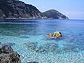
Enfola Beach
-
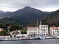
Marciana Marina
-
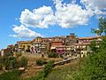
Capoliveri
-
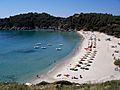
Fetovaia beach
-
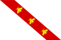
Flag of Elba
-
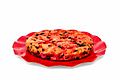
Schiaccia briaca (drunken cake) from Elba and Aleatico (Elban wine) used in the recipe


See also
 In Spanish: Isla de Elba para niños
- List of islands of Italy
- Tuscan Archipelago
- The Count of Monte Cristo, a famous novel by Alexandre Dumas
