Extreme points of Scotland facts for kids
Scotland is a country full of amazing places, and some of them are the "extreme points." These are the very edges of the country, like the most northern, southern, eastern, or western spots. It's like finding the very tip of a map!
Some of Scotland's extreme points are also the extreme points for the whole United Kingdom. This includes both the main part of the country and its many islands.
Contents
Scotland's Furthest Reaches
Here are some of the most extreme points in Scotland, including its islands:
- Northernmost point – Out Stack (Oosta), Shetland. This tiny rock is the furthest north you can go in Scotland! 60°51′N 0°52′W / 60.850°N 0.867°W
- Northernmost town or village – Skaw, Unst, Shetland. This small community is the most northern settlement in Scotland. 60°49′N 0°47′W / 60.817°N 0.783°W
- Southernmost point – Mull of Galloway, Wigtownshire. This is a beautiful headland that marks Scotland's southern tip. 54°38′N 4°52′W / 54.633°N 4.867°W
- Southernmost town or village – Cairngaan, Wigtownshire. This is the most southern place where people live in Scotland. 54°38′N 4°54′W / 54.633°N 4.900°W
- Westernmost point – Rockall. This is a very small, isolated rock in the Atlantic Ocean, far off the coast. 57°35′N 13°41′W / 57.583°N 13.683°W
- Westernmost town or village – Caolas, Bhatarsaigh (Vatersay), Outer Hebrides. This village is on an island and is the most western settlement. 56°56′N 7°32′W / 56.933°N 7.533°W
- Easternmost point – Bound Skerry, Out Skerries, Shetland Islands. This is another small island that marks Scotland's eastern edge. 60°25′N 0°43′W / 60.417°N 0.717°W
- Easternmost town or village – Bruray, Out Skerries, Shetland Islands. This is the most eastern place where people live in Scotland. 60°26′N 0°45′W / 60.433°N 0.750°W
Mainland Scotland's Edges
These points are only on the main part of Scotland, not including the islands:
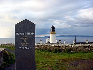
- Northernmost point – Dunnet Head, Caithness, Highland. This is a famous cliff that is the very top of mainland Scotland. 58°40′N 3°22′W / 58.667°N 3.367°W
- Northernmost town or village – Skarfskerry, Caithness, Highland. This is the most northern community on the Scottish mainland. 58°39′N 3°15′W / 58.650°N 3.250°W
- Southernmost point – Mull of Galloway, Wigtownshire. This is the same point as for all of Scotland. 54°38′N 4°52′W / 54.633°N 4.867°W
- Southernmost town or village – Cairngaan, Wigtownshire. This is also the same point as for all of Scotland. 54°38′N 4°54′W / 54.633°N 4.900°W
- Westernmost point – Corrachadh Mòr, Highland. This is a remote spot on a peninsula, the most western part of mainland Scotland. 56°42′N 6°13′W / 56.700°N 6.217°W
- Westernmost town or village – Grigadale, Highland. This is the most western place where people live on the mainland. 56°43′N 6°11′W / 56.717°N 6.183°W
- Easternmost point – Keith Inch, Aberdeenshire. This is a small area near the town of Peterhead, marking the easternmost tip. 57°30′N 1°46′W / 57.500°N 1.767°W
- Easternmost town or village – Peterhead, Aberdeenshire. This is the most eastern town on the Scottish mainland. 57°30′N 1°46′W / 57.500°N 1.767°W
The Center of Scotland
Have you ever wondered where the exact middle of Scotland is? The center point of Scotland is found between two places called Blair Atholl and Dalwhinnie in Perthshire. 56°49′0.257″N 4°11′2.267″W / 56.81673806°N 4.18396306°W
Sometimes, Schiehallion, a mountain in Perthshire, is also called the center of Scotland. This is because of its shape and how it stands out.
Highest and Lowest Places
Scotland has some very tall mountains!
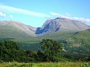
- The highest point in Scotland is the top of Ben Nevis. It stands at an amazing 1,345 metres (4,413 feet) above sea level.
- In fact, the ten tallest mountains in the entire United Kingdom are all found right here in Scotland!
The village of Wanlockhead claims to be the highest settlement in Scotland. It is located about 410 metres (1,345 feet) above sea level.
While many places are at or near sea level, Scotland does not have any natural dry land that is actually below sea level. This is partly because of the amount of rain Scotland gets.
Rivers and Lochs
Scotland is famous for its beautiful rivers and lochs (lakes).
- The longest river in Scotland is the River Tay. It flows for about 188 kilometres (117 miles).
- The largest freshwater loch in Scotland is Loch Lomond. It covers a huge area of about 71 square kilometres (27 square miles). It also holds a lot of water, about 2.6 cubic kilometres!
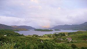
- The deepest freshwater loch is Loch Morar. It goes down to a maximum depth of 309 metres (1,014 feet). That's super deep!
 | Kyle Baker |
 | Joseph Yoakum |
 | Laura Wheeler Waring |
 | Henry Ossawa Tanner |


