Falcón facts for kids
Quick facts for kids
Falcón
|
|||
|---|---|---|---|
|
|||
| Motto(s):
Dios y Federación
(English: God and Federation) |
|||
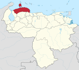
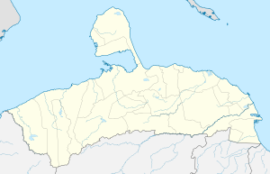
Location within Venezuela
|
|||
| Country | Venezuela | ||
| Created | 1864 | ||
| Capital | Coro | ||
| Government | |||
| • Body | Legislative Council | ||
| Area | |||
| • Total | 24,800 km2 (9,600 sq mi) | ||
| Area rank | 10th | ||
| 2.71% of Venezuela | |||
| Population
(2011 census)
|
|||
| • Total | 902,847 | ||
| • Rank | 11th | ||
| 3.45% of Venezuela | |||
| Time zone | UTC−4 (VET) | ||
| ISO 3166 code | VE-I | ||
| Emblematic tree | Cují yaque (Prosopis juliflora) | ||
| HDI (2019) | 0.701 high · 11th of 24 |
||
| As Coro State; in 1874, it was renamed as Falcón State. | |||
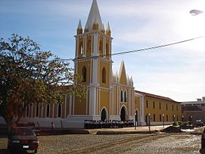
Falcón State is one of the 23 states in Venezuela. Its capital city is Coro. This state is named after Juan Crisóstomo Falcón, an important leader in Venezuelan history.
Contents
History of Falcón State
Early Explorations and Founding
Falcón State was first explored in 1499 by Juan de la Cosa and Américo Vespucio. They were part of an expedition led by Alonso de Ojeda. In 1527, the city of Coro was founded by Juan Ampíes. He named it "Santa Ana de Coro".
Becoming a Province
When Venezuela declared its independence from Spain in 1811, Coro stayed loyal to the Spanish Crown. It became part of the Province of Maracaibo. In 1815, King Fernando VII created the Province of Coro.
In 1821, Josefa Camejo helped free the province from Spain during the Venezuelan War of Independence. The area then joined the department of Zulia in the Republic of Gran Colombia. In 1830, when Venezuela separated from Gran Colombia, the Falcón area became its own province.
From Province to State
By 1856, the province included several areas like Coro and the Paraguaná Peninsula. In 1859, after the Federal War began in Coro, the area was declared the Independent State of Coro. In 1864, it officially became a federal state within the United States of Venezuela.
In 1872, the province was renamed Falcón State. This was to honor Juan Crisóstomo Falcón, a leader of the Federal War. For a short time in 1899, it was called Coro State again, but by 1901, it returned to being Falcón State.
Coro, the capital, was declared a National Monument in 1950. UNESCO recognized it as a Cultural Heritage of Humanity in 1993.
Geography of Falcón
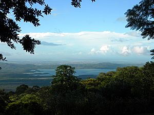
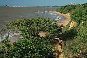
Falcón State is in northern Venezuela. It has mountains in the south that reach the Caribbean Sea in the east.
West of Coro, a flat coastal area runs along the Gulf of Venezuela. To the north is the Paraguana Peninsula. It connects to the mainland by a narrow strip of land called the isthmus of Médanos de Coro National Park.
Climate in Falcón
Most of the western coast and the Paraguaná Peninsula have a hot, dry climate. It doesn't rain much here. For example, Coro gets about 380 millimeters (15 inches) of rain each year. Its average temperature is around 28.4°C (83.1°F). Punto Fijo gets even less rain, about 180 millimeters (7 inches) annually.
The driest areas are the western coasts of Coro and the Los Médanos de Coro isthmus. Here, rainfall is less than 300 millimeters (12 inches) per year. Temperatures average between 28°C and 29°C (82°F and 84°F).
In the eastern coastal areas, rainfall is higher, from 800 to 1200 millimeters (31 to 47 inches) per year. Temperatures remain high. The mountainous areas, like the Sierras de San Luis, have a more humid climate. They get about 1300 millimeters (51 inches) of rain and have cooler average temperatures of about 22°C (72°F).
On April 29, 2015, Coro recorded Venezuela's highest temperature ever: 43.6°C (110.5°F).
| Climate data for Coro | |||||||||||||
|---|---|---|---|---|---|---|---|---|---|---|---|---|---|
| Month | Jan | Feb | Mar | Apr | May | Jun | Jul | Aug | Sep | Oct | Nov | Dec | Year |
| Record high °C (°F) | 37.8 (100.0) |
35.9 (96.6) |
37.5 (99.5) |
43.6 (110.5) |
39.1 (102.4) |
38.2 (100.8) |
38.5 (101.3) |
39.5 (103.1) |
38.5 (101.3) |
38.1 (100.6) |
36.8 (98.2) |
36.8 (98.2) |
43.6 (110.5) |
| Mean daily maximum °C (°F) | 31.3 (88.3) |
31.7 (89.1) |
32.2 (90.0) |
32.6 (90.7) |
33.5 (92.3) |
33.8 (92.8) |
33.5 (92.3) |
34.2 (93.6) |
34.4 (93.9) |
33.5 (92.3) |
32.4 (90.3) |
31.4 (88.5) |
32.9 (91.2) |
| Daily mean °C (°F) | 27.5 (81.5) |
27.8 (82.0) |
28.3 (82.9) |
28.8 (83.8) |
29.6 (85.3) |
29.8 (85.6) |
29.5 (85.1) |
30.0 (86.0) |
30.1 (86.2) |
29.4 (84.9) |
28.6 (83.5) |
27.7 (81.9) |
28.9 (84.0) |
| Mean daily minimum °C (°F) | 23.6 (74.5) |
23.8 (74.8) |
24.3 (75.7) |
24.9 (76.8) |
25.6 (78.1) |
25.7 (78.3) |
25.5 (77.9) |
25.7 (78.3) |
25.8 (78.4) |
25.3 (77.5) |
24.8 (76.6) |
23.9 (75.0) |
24.9 (76.8) |
| Record low °C (°F) | 19.5 (67.1) |
19.0 (66.2) |
20.5 (68.9) |
21.1 (70.0) |
20.4 (68.7) |
21.8 (71.2) |
20.5 (68.9) |
21.6 (70.9) |
20.5 (68.9) |
20.7 (69.3) |
20.8 (69.4) |
18.9 (66.0) |
18.9 (66.0) |
| Average rainfall mm (inches) | 22.0 (0.87) |
16.1 (0.63) |
9.1 (0.36) |
17.0 (0.67) |
28.8 (1.13) |
26.9 (1.06) |
36.7 (1.44) |
29.2 (1.15) |
36.3 (1.43) |
54.2 (2.13) |
52.1 (2.05) |
54.1 (2.13) |
382.5 (15.06) |
| Average rainy days (≥ 1.0 mm) | 2.5 | 1.6 | 1.2 | 1.5 | 2.6 | 3.2 | 4.3 | 3.5 | 3.7 | 5.4 | 5.8 | 4.8 | 40.1 |
| Average relative humidity (%) | 69.0 | 68.5 | 67.0 | 69.0 | 68.5 | 68.0 | 67.5 | 67.0 | 67.0 | 70.5 | 72.0 | 71.0 | 68.8 |
| Mean monthly sunshine hours | 291.4 | 268.8 | 288.3 | 234.0 | 248.0 | 255.0 | 285.2 | 288.3 | 261.0 | 251.1 | 252.0 | 266.6 | 3,189.7 |
| Source 1: Instituto Nacional de Meteorología e Hidrología (INAMEH) | |||||||||||||
| Source 2: NOAA (extremes, rainy days, and sun) | |||||||||||||
Falcón's Rivers and Water
The state's water system is not very large. All rivers flow north into either the Caribbean Sea or the Gulf of Venezuela. The main river is the Tocuyo, which flows for 423 km (263 miles) before reaching the Caribbean. Another important river is the Aroa, which is 130 km (81 miles) long.
- Main rivers: Tocuyo, Aroa, Güigüe, Hueque, Matícora, Mitare, Pedregal, Remedios, Ricoa, San Luis.
- Lakes: There's a large underground lake called "Río Acarite" in the Cueva del Toro, under the San Luis mountain range.
Plants and Animals
Falcón has a rich variety of marine life. Many types of algae grow on the rocky shores and reefs. The waters are great for fishing, with species like shrimp, octopus, squid, and various fish.
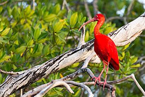
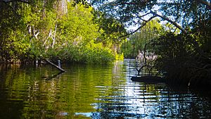
Some animals need protection, such as sea turtles and the critically endangered Orinoco crocodile. These crocodiles live in the coastal mangroves of Morrocoy. You can also find shearwater birds, herons, flamingos, and gannets there.
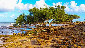
In the dry, lower areas, you'll see plants with many thorns. The cují yaque (Falcón's official tree), broom, and different types of cacti are common. Aloe vera and sisal plants are also grown here. Animals in this area include bats, rabbits, foxes, iguanas, and lizards. Birds like the cardinal coriano and the paraulata llanera are also found.
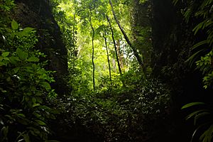
Higher up in the mountains, there are cloud forests with many ferns and palms. In the limestone caves, you might find the guácharo bird, as well as interesting birds like the blacksmith's bellbird. Reptiles like the nibbling turtle, which only lives in the Sistema Coriano mountains, are also present.
Government and Politics
Falcón is a federal state, meaning it has its own government, similar to other states in Venezuela. It follows the Federal Constitution of Falcón State from 2004.
State Leadership
The state is led by the Governor of Falcón State. The Governor is chosen by the people in an election every four years. They can be re-elected for more terms. The Governor manages the state's daily operations.
The first elected governor of Falcón was Aldo Cermeño, who served from 1989 to 1992. The current governor is Víctor Clark.
Like other states in Venezuela, Falcón has its own police force. This force works with the National Police and the Venezuelan National Guard.
Lawmaking Body
The laws for Falcón State are made by the Falcón State Legislative Council. This group has 11 members, called legislators. They are also elected by the people every four years and can be re-elected.
Cities and Towns
Falcón State is divided into 25 smaller areas called municipalities. Each municipality has its own main town or city.
| Municipality | Administrative Capital |
Area (km2) | Population Census 2011 |
Estimate 30 June 2016 |
|---|---|---|---|---|
| San Juan de los Cayos | 757 | 19,045 | 21,272 | |
| Bolívar | San Luis | 295 | 8,539 | 9,420 |
| Capatárida | 2,657 | 22,897 | 25,470 | |
| Yaracal | 190 | 10,874 | 12,149 | |
| Punto Fijo | 684 | 239,444 | 276,251 | |
| Colina | La Vela de Coro | 582 | 41,510 | 46,631 |
| Dabajuro | 1,144 | 23,388 | 26,364 | |
| Democracia | Pedregal | 2,602 | 9,944 | 11,293 |
| Falcón | Pueblo Nuevo | 1,577 | 46,215 | 55,196 |
| Churuguara | 1,084 | 29,251 | 33,138 | |
| Jacura | Jacura | 1,842 | 11,232 | 12,492 |
| Santa Cruz de Los Taques | 231 | 41,579 | 45,681 | |
| Mauroa | Mene de Mauroa | 1,904 | 24,920 | 27,488 |
| Santa Ana de Coro | 1,805 | 211,537 | 239,961 | |
| Chichiriviche | 907 | 19,300 | 21,927 | |
| Palmasola | Palmasola | 194 | 7,077 | 8,306 |
| Petit | Cabure | 1,025 | 13,725 | 15,316 |
| Píritu | Píritu | 1,168 | 10,628 | 11,685 |
| San Francisco | Mirimire | 346 | 11,030 | 12,219 |
| Tucacas | 537 | 32,193 | 41,826 | |
| La Cruz de Taratara | 840 | 5,781 | 6,379 | |
| Tocópero | Tocópero | 83 | 5,519 | 6,010 |
| Unión | Santa Cruz de Bucaral | 975 | 15,660 | 17,441 |
| Urumaco | Urumaco | 752 | 8,349 | 9,044 |
| Zamora | Puerto Cumarebo | 619 | 33,210 | 37,868 |
| Estado Falcón | Coro | 24,800 | 902,847 | 1,030,827 |
The Paraguaná Peninsula includes the municipalities of Carirubana, Los Taques, and Falcón.
People of Falcón
In 2011, Falcón State had 902,847 people. Most people live in cities. About 67.3% of the population lived in urban areas in 1990.
The largest cities are Santa Ana de Coro (with its port La Vela de Coro) and Punto Fijo. Punto Fijo is a big city on the Paraguaná peninsula. Other important towns include Puerto Cumarebo, Dabajuro, Tucacas, and Churuguara.
In 2011, about 55.7% of the people identified as mixed-race (Mestizo). About 38.9% identified as White, mostly in Punto Fijo. And 4.1% identified as Black.
Main Cities and Towns
- Coro: The capital city, founded in 1527. It's important for politics, culture, and history. It's a UNESCO World Heritage Site.
- La Vela de Coro: A historic port where Venezuela's national flag was first raised. It's a fishing and trading town, also a World Heritage Site with Coro.
- Punto Fijo: The main economic and industrial center of Falcón, located on the Paraguaná peninsula. It's a busy commercial city.
- Puerto Cumarebo: Known as "La Perla de Falcon," it's a fishing, trading, and tourist town.
- Chichiriviche: A major tourist spot on the eastern coast, giving access to Morrocoy National Park.
- Churuguara: The most important town in the Falcón mountain range, known for tourism and farming.
- Dabajuro: Has the biggest trade activity in western Falcón, a center for farm and livestock products.
- Mene de Mauroa: Its economy is based on farming.
- Tucacas: The main entry point to Falcón from the east, popular for tourism and trade.
Economy of Falcón
Falcón's economy relies on several key areas.
Farming and Livestock
Farming is a major source of jobs. Important crops include coconuts, onions, corn, tomatoes, melons, and coffee.
Falcón is the biggest producer of coconuts and copra (dried coconut meat). It also leads in goat farming and goat products. It's the second-largest producer of fish, paprika, and vegetables like onions. The state is also third in milk and melon production.
Coffee is grown in the mountains, especially in the Sierra de San Luis and Sierra de Churuguara. On the eastern coast, large coconut plantations support an industry that extracts oil.
Fishing and Industry
Falcón has the longest coastline in Venezuela, making fishing very important. The state produces thousands of tons of fish and seafood each year. There are also shrimp farms along the coast.
Falcón has some oil and natural gas fields. The Paraguaná Refinery Complex is one of the largest oil refining centers in the world. It processes about 75% of Venezuela's total oil. This oil comes from the Maracaibo Lake basin.
The state also has minerals like sand, limestone, coal, and phosphates. Phosphates are mined in Riecito, and limestone in Chichiriviche. There are also large coal deposits.
Thanks to its dry climate, Falcón has natural salt flats. The Las Cumaraguas salt mine is used for industrial salt production.
Infrastructure
Falcón has coastal lowlands and hills from the Andean mountains. The area is mostly dry, so farming happens mainly in river valleys and mountainous regions. Crops include maize, coconut, sesame, coffee, and sugar cane.
Coro and the Paraguaná Peninsula have seen a lot of industrial growth. Big oil refineries, like the Paraguana Refinery Complex in Punto Fijo, are on the Paraguaná Peninsula. About two-thirds of Venezuela's oil is produced here. It's then shipped internationally from the port of Amuay.
Tourism in Falcón
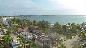
Falcón State offers many beautiful places to visit, from deserts to beaches and mountains.
National Parks and Monuments
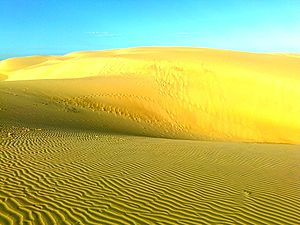
- Médanos de Coro National Park: A unique desert landscape with sand dunes, located near Coro. It covers 91,280 hectares (225,550 acres).
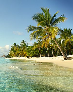
- Morrocoy National Park: Famous for its coral islands, white sand beaches, clear turquoise water, and mangrove forests. It's 32,090 hectares (79,300 acres).
- National Park Cueva de la Quebrada del Toro: Found in the Falcón mountain range, covering 4,885 hectares (12,070 acres).
- Juan Crisóstomo Falcón National Park: Offers a variety of natural attractions across 20,000 hectares (49,400 acres).
- Cerro Santa Ana Natural Monument: A green hill in the middle of the Paraguaná peninsula, standing out from the dry surroundings. It's 1,900 hectares (4,700 acres) and 850 meters (2,790 feet) tall.
Natural Attractions
- Thermal waters of Cardón and Cuiva
- Guaibacoa Hot Springs
- Many beautiful beaches like Boca de Aroa, Adicora, Tucacas, and Chichiriviche.
- Hueque Falls
- Cuare Wildlife Refuge
- The Indian's Cave (Cueva del Indio)
Historic Buildings
- Cathedral Basilica Menor de Santa Ana
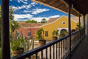
- Balcón de los Arcaya (Museum of Popular Pottery)
- Balcón Bolívar (Museum of Contemporary Art)
- Casa de las Ventanas de Hierro (House of the Iron Windows)
- Jewish cemetery in Coro
- San Francisco Church
- Hato Aguaque or Casa de Josefa Camejo (Josefa Camejo's House)
- Taima Taima Archaeological and Paleontological Museum
Culture
Handicrafts
Falcón is known for its beautiful handicrafts. Artisans make hammocks with special styles. They also create furniture from local wood like cardon, often using plant fibers or animal skins. In Paraguaná, people work with clay to make household items, using old techniques from the Caquetíos Indians. Along the eastern coast, you can find baskets made from reeds and vines.
Food
Falcón's traditional food has many unique flavors. Popular dishes include goat talkarí, celce coriano, and goat milk cheese. Sweets like rice with coconut and rice pudding are also very popular, especially during Easter.
Folklore and Traditions
Falcón's traditions mix African, indigenous, and European cultures.
- Baile de las Turas: An indigenous dance related to hunting and corn harvesting. It's celebrated in the mountain region around September 23-24.
- Drum Dances: Joyful and colorful dances held in Coro, La Vela, and Puerto Cumarebo.
- Day of the Mad: Celebrated on December 28 in La Vela de Coro. People wear masks and parade through the streets, similar to a carnival.
Sports
 Unión Atlético Falcón: A professional football (soccer) club based in Punto Fijo. They play in Venezuela's Second Division.
 Cachorros de Falcón: A baseball team that has been part of the Bolivarian National Baseball League for 15 years. They have won the Central Western Region championship twice.
Sports Facilities
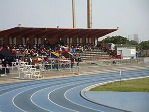
- Pedro Conde Stadium
- José David Ugarte Stadium
- Eduardo "Tata" Amaya Stadium
- Carlos Sanchez Covered Gym
- Fenelon Diaz Covered Gym
- Ramon Pena Gilly Gym
See also
 In Spanish: Estado Falcón para niños
- States of Venezuela
- List of Venezuela state legislatures
 | Jewel Prestage |
 | Ella Baker |
 | Fannie Lou Hamer |


