Farnborough, Hampshire facts for kids
Quick facts for kids Farnborough |
|
|---|---|
| Town | |
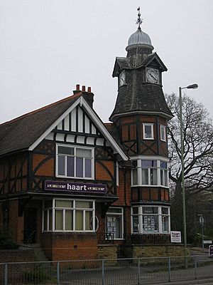
 Clock Tower, Farnborough |
|
| Population | 57,486 |
| OS grid reference | SU871554 |
| District |
|
| Shire county | |
| Region | |
| Country | England |
| Sovereign state | United Kingdom |
| Post town | FARNBOROUGH |
| Postcode district | GU14 |
| Dialling code | 01252, 01276 |
| Police | Hampshire |
| Fire | Hampshire |
| Ambulance | South East Coast |
| EU Parliament | South East England |
| UK Parliament |
|
Farnborough is a town in Hampshire, England. It is part of the Rushmoor area. About 57,000 people live here. Farnborough is famous for its connection to airplanes and flying. It is a key place for aviation, engineering, and technology. You might know it best for the Farnborough International Airshow. It also has Farnborough Airport and important aviation research centers.
Contents
History of Farnborough
Ancient Times: Early People in Farnborough
People have lived in the Farnborough area for thousands of years. Scientists have found old stone tools here. These tools show that hunter-gatherers lived here over 8,000 years ago. Later, during the Neolithic period, people started farming. They built more lasting homes.
Archaeologists have found old settlements and burial mounds. These show that busy communities lived here long ago. The area was also home to people during the Bronze Age and Iron Age. A famous old site is Caesar's Camp. This was an Iron Age hillfort just north of the town.
When the Romans came to Britain, things changed. A major Roman road, the Devil's Highway, passed through Farnborough. This road connected important Roman towns. Many Roman items have been found here. This means a small Roman settlement likely existed.
Saxon Farnborough: The Town's Name
After the Romans left, Anglo-Saxon kingdoms grew. The name "Farnborough" comes from an old English word. "Ferneberga" means "fern-covered hill."
Farnborough is first mentioned in the Domesday Book of 1086. This was a big survey of England. It listed Farnborough as a small village. It had only about 50 to 100 people back then. For many years, Farnborough stayed a small farming village.
Farnborough Grows: The Railway Arrives
Farnborough started to grow faster in the late 1700s. Better transport links helped. It was also close to London. The London and South Western Railway came to Farnborough in the 1830s. This made it much easier to travel to and from the town.
Wealthy people from London started moving here. They liked the healthy air and pretty countryside. Farnborough slowly became a suburban area. Between 1830 and 1850, its population doubled. New homes, churches, schools, and shops were built. The town center moved closer to the railway station.
The Aviation Era: Flying High
The biggest change for Farnborough happened in 1905. The Royal Engineers moved their Balloon School here. They used a large open area called Laffan's Plain. They wanted to develop and test flying machines.
In 1906, Samuel Cody joined them. He showed off his man-lifting kites. He then convinced them to let him build an airplane. In 1908, Cody made the first powered flight in Great Britain. Today, you can see a copy of his plane at the Farnborough Air Sciences Trust (FAST) Aviation Museum.
The Army Balloon Factory became the Royal Aircraft Factory. It was later renamed the Royal Aircraft Establishment (RAE). Farnborough became a world-famous center for aircraft research. Big aerospace companies like Supermarine and De Havilland built factories here. This made Farnborough a key place for British aviation.
After World War II, Farnborough kept growing. New business parks and homes were built. The town also became famous for the Farnborough International Airshow. This is one of the world's largest airshows.
Geography and Climate of Farnborough
Where is Farnborough?
Farnborough is in the northeast part of Hampshire county. It is close to the border with Surrey. The town is in a valley. The main part of town is between the River Blackwater and higher ground. The land slowly rises to about 90 meters above sea level.
The ground in Farnborough is mostly clay, sand, and gravel. The soil is not very good for farming.
Nearby Towns
Farnborough is part of a larger group of towns. These include Aldershot, Camberley, Yateley, Sandhurst, and Frimley. The River Blackwater forms part of the border with Surrey.
Farnborough's Weather
Farnborough has a mild, wet climate. This is typical for southeastern England. Summers are usually warm and dry. High temperatures are around 22°C (72°F). Winters are mild. Highs are about 8°C (46°F) and lows are around 2°C (36°F).
Rain falls throughout the year. The average yearly rainfall is about 760 mm (30 inches). Spring is usually the driest time. October and November are the wettest. Snow sometimes falls in winter. But heavy snow is rare because the town is low and in the south.
The Met Office has a weather station at Farnborough Airport. It has been recording weather since 1914.
| Climate data for Farnborough (1991–2020) | |||||||||||||
|---|---|---|---|---|---|---|---|---|---|---|---|---|---|
| Month | Jan | Feb | Mar | Apr | May | Jun | Jul | Aug | Sep | Oct | Nov | Dec | Year |
| Mean daily maximum °C (°F) | 8.0 (46.4) |
8.5 (47.3) |
11.3 (52.3) |
14.4 (57.9) |
17.7 (63.9) |
20.6 (69.1) |
22.9 (73.2) |
22.4 (72.3) |
19.4 (66.9) |
15.2 (59.4) |
11.0 (51.8) |
8.4 (47.1) |
15.0 (59.0) |
| Mean daily minimum °C (°F) | 1.6 (34.9) |
1.4 (34.5) |
2.7 (36.9) |
4.3 (39.7) |
7.5 (45.5) |
10.4 (50.7) |
12.5 (54.5) |
12.2 (54.0) |
9.7 (49.5) |
7.2 (45.0) |
4.0 (39.2) |
1.9 (35.4) |
6.3 (43.3) |
| Average rainfall mm (inches) | 73.3 (2.89) |
53.2 (2.09) |
46.0 (1.81) |
48.8 (1.92) |
46.5 (1.83) |
49.3 (1.94) |
46.2 (1.82) |
57.5 (2.26) |
59.4 (2.34) |
79.0 (3.11) |
82.6 (3.25) |
73.0 (2.87) |
714.7 (28.14) |
| Average rainy days (≥ 1 mm) | 12.2 | 10.4 | 9.4 | 9.0 | 8.0 | 8.0 | 7.7 | 8.9 | 8.5 | 11.7 | 12.5 | 11.8 | 118.0 |
| Mean monthly sunshine hours | 52.3 | 74.5 | 120.1 | 171.1 | 196.6 | 188.8 | 211.6 | 195.2 | 149.0 | 109.9 | 64.7 | 55.0 | 1,588.9 |
| Source: Met Office | |||||||||||||
Twinned Towns: Friends Around the World
Rushmoor, the area Farnborough is in, is twinned with several towns. This means they have special friendly connections.
- Dayton, Ohio, United States (since 2019)
- Gorkha Municipality, Nepal (since 2020)
- Meudon, France (since 1974)
- Oberursel, Germany (since 1989)
- Rzeszów, Poland (since 2019)
- Sulechów, Poland (since 2001)
Governance: How Farnborough is Run
Farnborough is part of the Rushmoor district. This local council helps run the town. They make decisions about local services.
See also
 In Spanish: Farnborough para niños
 | Emma Amos |
 | Edward Mitchell Bannister |
 | Larry D. Alexander |
 | Ernie Barnes |


