River Blackwater (River Loddon) facts for kids
Quick facts for kids Blackwater (Loddon) |
|
|---|---|

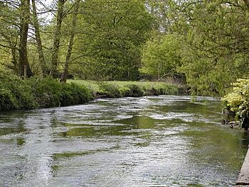
River Blackwater at Eversley bridge
|
|
|
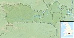
Place of mouth (confluence with the Loddon) in Berkshire
|
|
| Country | England |
| Counties | Hampshire, Surrey, Berkshire |
| Districts / Boroughs | Waverley (borough), Surrey Heath, Rushmoor, Borough of Wokingham |
| Physical characteristics | |
| Main source | Rowhill Nature Reserve south of Aldershot, north of Farnham. County: Surrey. 125 m (410 ft) 51°14′31″N 0°47′13″W / 51.242°N 0.787°W |
| River mouth | River Loddon Berkshire 41 m (135 ft) 51°23′06″N 0°57′29″W / 51.385°N 0.958°W |
| Length | 36 km (22 mi) |
| Discharge (location 2) |
|
| Basin features | |
| Progression | Blackwater, Loddon, Thames |
| River system | Thames Basin |
| Tributaries |
|
The River Blackwater is a river in England. It flows into the River Loddon, which then flows into the famous River Thames. The Blackwater starts from two springs in the Rowhill Nature Reserve. This reserve is located between Aldershot in Hampshire and Farnham in Surrey.
The river flows north and then west. It joins the Loddon in a place called Swallowfield in central Berkshire. For some parts of its journey, the Blackwater forms the border between Hampshire and Surrey. A smaller part of the river also separates Hampshire and Berkshire. The area where the river begins is a rare type of heathland. It is part of a special protected area called the Thames Basin Heaths. After flowing for about 20 miles (32 km), the Blackwater is joined by another river, the "Whitewater", near Eversley. The town of Blackwater is named after this river.
Contents
Exploring the Blackwater Valley
The River Blackwater flows through the middle of the Blackwater Valley. This valley is mostly an open space with many trees. It also has areas of bog, marsh, and wet meadows. The valley stretches for about 22.5 miles (36 km). It starts at the Rowhill Nature Reserve near Aldershot in the south. It then goes north to Swallowfield. Here, the Blackwater meets the Whitewater River and then joins the River Loddon. The Loddon then flows into the River Thames.
For many miles, the banks of the lower part of the river are rural or semi-rural. This means there are not many buildings. However, the upper part of the river flows through urban areas. It passes through towns like Aldershot, Ash, Frimley, Farnborough, Camberley, Blackwater, Sandhurst, and Yateley.
Water Sources and Flow
The river gets some of its water from natural springs underground. However, most of the water comes from five large water treatment plants. These plants clean water from homes and businesses. This cleaned water is then released into the upper parts of the river. There are also two smaller treatment plants further downstream. The natural springs in the area are quite acidic.
Lakes and Nature in the Valley
The Blackwater Valley has many deep gravel pits. These pits were dug out for gravel starting in the 1950s. When the digging stopped, these pits filled with water, creating many lakes. Many of these lakes have been made into beautiful park lakes. People use them for fishing and sailing.
Several of these lakes are called Sites of Special Scientific Interest (SSSI). This means they are very important for nature and have many different kinds of plants and animals. The Blackwater Valley SSSI covers about 86.55 acres (35.03 ha). It includes special meadows, swamps, and wet woodlands. These areas are managed to protect their wildlife. The river also crosses a small part of the Basingstoke Canal SSSI, which has many different water species.
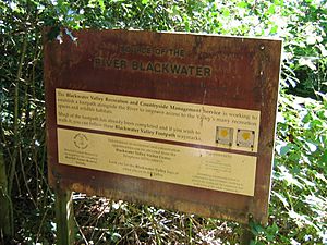
The valley acts as a green space for local people. It has three nature reserves in addition to the SSSIs. Many other parts of the valley are also important for wildlife. A 23-mile (37 km) path runs along the riverside. This path allows people to enjoy the riverbanks. Thanks to efforts to improve the river, wildlife is returning. This includes otters, which had not been seen for over 40 years. Fish populations are also getting healthier. A cycle route also runs along the river for most of its length.
The River's Journey
The Blackwater River begins as several springs in Rowhill Copse. This is a nature reserve near Aldershot. The reserve is 55-acre (22 ha) and has many different types of natural areas. The river first flows east-south-east. It goes under a railway line and between two lakes. It then passes under Badshot Lea Road and more lakes. These lakes are part of the Tice's Meadow nature reserve. This area used to be a hop farm and then a quarry. Now it is a restored nature site. After this, the river makes a big curve and turns north. The A331 road follows the river valley for much of this section.

On the left side of the river is the Aldershot water treatment plant. This plant provides more than half of the river's water flow during dry weather. On the opposite side is the Willow Park Fishery. The river then flows under an aqueduct that carries the Basingstoke Canal. It is then surrounded by Lakeside Nature Reserve on the east and Gold Valley Lakes fishery on the west. The A331 road crosses the river here. Further north is Hollybush Park, which used to be a sand quarry. Now it is a grassland with wild flowers.
After junction 4 of the M3 motorway, the river is joined by Cove Brook. This brook starts from streams near Farnborough Airport and flows north. It passes through housing areas and then under the North Downs railway line to reach the Blackwater. The tree-lined area after this junction is called Blackwater Park. It goes as far as the A30 road bridge. The small town of Blackwater is on the left bank. The Camberley water treatment plant is on the right bank. In 2012, there was a pollution problem here. Partially treated water was released, harming the river for about 1 mile (1.6 km) downstream. Fish in the Shepherds Meadow SSSI died. After this, Thames Water upgraded the plant.
Where Counties Meet
North of the bridge, the Wish Stream joins the river. This stream marks the border between Surrey and Berkshire. It starts at Wishmoor Cross, an area with limited access. It flows through Wishmoor Bottom, a boggy area with pine trees. This area is a Site of Special Scientific Interest (SSSI). It is important for birds like the Dartford warbler and nightjar. It is also a nationally important home for dragonfly and damselfly species.
The stream then flows through the Royal Military Academy Sandhurst. It goes into a bathing pool and through a series of ponds and weirs. These structures make it hard for fish to move freely. There is a large control structure at the end of the Lower Lake that fish cannot pass. Below the Academy, the stream flows underground in culverts. It passes under a car park and several roads before reaching the Blackwater. This meeting point used to be where three counties met. However, the stream was moved slightly north in 1990 when the Blackwater Valley road was built.
Shepherd Meadows and New Mill
The river then flows through Shepherd Meadows. This is an SSSI known for its Black Poplar trees and various wild flowers. These include sneezewort, knapweed, betony, meadowsweet and great burnet. As the river curves west, it goes under the North Downs Line railway bridge. It passes the Sandhurst water treatment plant and enters Trilakes Country Park.
Old gravel pits line both sides of the river here. As it passes the village of Finchampstead, the river is briefly called Long Water. Soon, it reaches New Mill. Here, there is a weir and a sluice. New Mill was a corn mill in 1871 and made animal feed until the 1950s. The mill building and house are very old, with parts dating back to the 15th century. They are now grade II listed buildings. The mill was later used as a restaurant. You could see the restored mill wheel and machinery through glass screens.
The river then follows the northern edge of Bramshill Plantation. This is a 3,200 acres (13 km2) woodland managed by the Forestry Commission. It is a Special Protection Area because of the many bird species found there. It also has many damselflies, dragonflies, and silver studded blue butterflies. Special plants like marsh clubmoss and pillwort grow here.
Joining the Loddon
The river turns to the north-west and is joined by the River Whitewater. This river flows north from Greywell, near the Greywell Tunnel. As the Blackwater gets closer to Swallowfield, the channel splits into two branches, both with weirs. They enter Swallowfield Park, a historic park and gardens. The park was first enclosed by King Edward III in 1354. It was owned by the king until the late 16th century. The large country house in the park was built in the late 17th century. The main road to the house crosses the river on a five-arched brick bridge from the late 18th century. The river continues through the park until it reaches the River Loddon.
Water Mills Along the Blackwater
There is clear evidence of one watermill on the Blackwater River. However, when the Domesday Book was written in 1086, there were four mills in the area. The manors of Little Bramshill and Great Bramshill each had one mill. The manor of Eversley had two mills. By 1237, William de Wauton owned the manor of Eversley. He mentioned a mill pond in an agreement. By 1374, there was only one mill, which was ruined by 1435. After that, there is no more mention of a mill in the records for that manor.
New Mill at Eversley has parts that date back to the 15th century. It also has changes and additions from the 17th, 19th, and 20th centuries. It uses an undershot water wheel to power the mill. In 1948, Squadron Leader Royston Albrecht bought the mill. He restored it almost by himself between 1949 and 1976. He was part of a group that protects old buildings. He used the restored mill to make animal feed. Some of the machinery might be from 1746. The water wheel powers two pairs of grinding stones. In 1995, the building was sold and turned into a restaurant. During the changes, a new waterwheel was put in. The old machinery was covered by a glass screen so people could still see it from the restaurant. The restaurant closed in 2012.
Ash Aqueduct: A River Crossing
The Basingstoke Canal runs from the Greywell Tunnel in the west to the River Wey in the east. It crosses the Blackwater Valley on a raised bank in the village of Ash. The Blackwater River used to flow through a brick tunnel under this bank.
In 1994-95, a big construction project took place. The A331 road was being built along the river valley. Because bats lived in the old tunnel, a new home was built for them on a nearby island. The middle part of the bank was then removed. It was replaced with a new three-span aqueduct. An aqueduct is like a bridge that carries water. This new aqueduct has a main span of 130 feet (40 m) and two side spans of 56 feet (17 m) each.
The structure was built using strong concrete. To avoid the aqueduct's supports, the river channel was moved. It now flows through the western side span. A new path was built for the river until the road was high enough. Then, a box-shaped tunnel carries the river under the new road to rejoin its original path. The new Ash Aqueduct offers great views of the countryside. In the distance to the south, you can see the Hog's Back. This is where the North Downs hills become narrow.
River Blackwater's Water Quality
The Environment Agency checks the water quality of rivers in England. They give each river system an overall ecological status. This status can be one of five levels: high, good, moderate, poor, or bad. To decide this, they look at several things. They check the types and amounts of invertebrates (like insects), flowering plants, and fish. They also check the chemical status. This compares the levels of different chemicals to safe amounts. Chemical status is either rated good or fail.
Here is how the water quality of the Blackwater system was in 2019:
| Section | Ecological Status | Chemical Status | Overall Status | Length | Catchment |
|---|---|---|---|---|---|
| Blackwater (Aldershot to Cove Brook confluence at Hawley) | Moderate | Fail | Moderate | 10.3 mi (16.6 km) | 24.34 sq mi (63.0 km2) |
| Cove Brook | Poor | Fail | Poor | 4.4 mi (7.1 km) | 8.80 sq mi (22.8 km2) |
| Blackwater (Hawley to Whitewater confluence at Bramshill) | Moderate | Fail | Moderate | 10.3 mi (16.6 km) | 27.26 sq mi (70.6 km2) |
| Blackwater (Bramshill to River Loddon confluence at Swallowfield) | Poor | Fail | Poor | 1.8 mi (2.9 km) | 2.40 sq mi (6.2 km2) |
The water quality is not as good as it could be for several reasons:
- Water released from sewage treatment works.
- Runoff from roads and transport areas.
- Polluted land next to the river.
- Physical barriers like weirs that stop fish and other species from moving freely.
- The presence of the North American signal crayfish, which is an invasive species.
|
 | Frances Mary Albrier |
 | Whitney Young |
 | Muhammad Ali |


