
Finsbury facts for kids
Quick facts for kids Finsbury |
|
|---|---|
 Finsbury Square, looking north |
|
 The arms of the Metropolitan Borough refer to the London Wall and the northern gates |
|

Finsbury
|
|
| OS grid reference | TQ315825 |
| London borough | |
| Ceremonial county | Greater London |
| Region | |
| Country | England |
| Sovereign state | United Kingdom |
| Post town | LONDON |
| Postcode district | EC1 |
| Postcode district | WC1 |
| Dialling code | 020 |
| Police | Metropolitan |
| Fire | London |
| Ambulance | London |
| EU Parliament | London |
| UK Parliament |
|
| London Assembly |
|
Finsbury is a cool area in the heart of Central London. It's part of the London Borough of Islington. This district sits right next to the historic City of London.
The name 'Finsbury' comes from 'Vinisbir', first mentioned in 1231. It means 'the manor of a man named Finn'. Long ago, Finsbury was mostly a big swampy area. It was just outside the old London Wall that protected the City of London.
Finsbury also gave its name to two bigger areas. These were the Finsbury Division (from the 1600s to 1900). Later, it was the Metropolitan Borough of Finsbury (from 1900 to 1965). This borough included Finsbury itself, also known as St Luke's, and Clerkenwell.
Don't mix up Finsbury with Finsbury Park! Finsbury Park is a public green space. It's about 3 miles (5 km) north of Finsbury. The park also gives its name to the area around it.
Contents
Where is Finsbury?
Finsbury is located just north of the City of London. It's the part of the London Borough of Islington that is east of Goswell Road. It's also south of City Road.
A small area north of City Road is also part of Finsbury. This area is around the City Road Basin.
Some parts of the City of London's Coleman Street Ward are also sometimes called Finsbury. These parts are outside the old City walls. They are mostly covered by Finsbury Circus today.
Finsbury Town Hall and the Finsbury Estate are further west. They are in Clerkenwell. These places are named after the old borough of Finsbury. That borough included both Finsbury and Clerkenwell.
How Finsbury Started
The Soke of Cripplegate
The Soke of Cripplegate was a piece of land outside the old city gates. These gates were Cripplegate and Aldersgate. This land was partly bordered by the River Walbrook to the east.
It covered areas later known as Aldersgate Without and the parish of St Giles-without-Cripplegate. This parish included Cripplegate Without. It also included the part of Coleman Street Ward north of the wall. The Manor of Finsbury was also part of it.

William the Conqueror gave the Soke to St. Martin's Le Grand in 1068. This was in exchange for prayers for his parents. People think this land might be much older. It could date back to when the Diocese of London was set up in the 600s.

Churches like St Botolph without Aldersgate and St Giles-without-Cripplegate were built in the early 1100s. Before then, there wasn't much building north of the wall. The Empress Matilda confirmed St Martins' rights to the Soke around 1140. She allowed St Martins to fence off land to stop rubbish dumping. But her main goal was to plan a new suburb to the north.
Streets like Redcross Street, Whitecross Street, and Fore Street were built later.
Manor and Parishes
It's not fully clear how the Soke's land became the areas we know today.
Two parishes served the Soke area. The parish of St Botolph without Aldersgate served the area outside the city walls called Aldersgate Without. The parish of St Giles-without-Cripplegate served Cripplegate Without and the Manor of Finsbury.
In the 1600s, parts of Moorfields were moved. They went from the Manor of Finsbury to the Coleman Street Ward of the City of London. They also became part of the parish of St Stephen Coleman Street.

From the mid-1100s, St Paul's Cathedral owned the Manor of Finsbury. It was managed to provide money for a church official or institution. For a long time, this money went to Holywell Priory in Shoreditch. So the area was called the Prebend of Halliwell and Finsbury.
From 1315, the Lord Mayor of London leased the Manor of Finsbury. Because of this, the Mayors of London have been called Mayor of London and Lord of Finsbury. The Mayor's house, Finsbury Court, was at the corner of Chiswell Street and Finsbury Pavement.

The part of St Giles parish that was inside the city was called The Freedom. The Mayor governed it. The rest, The Manor of Finsbury, was called The Lordship. Here, the Mayor was like a renter, but with the title Lord of the Manor of Finsbury.
Some stories say the Manor went to the Lord Mayors later. This was after Richard II gave it to them. He was thankful for Mayor William Walworth killing Wat Tyler in 1381.
In 1733, the population grew a lot. So the part of St Giles-without-Cripplegate outside the city became its own parish. This area had been the Manor of Finsbury. It was named St Luke's after its church.
Later Administration
The parts of St Giles parish outside the city were part of the Hundred of Ossulstone in Middlesex. By the 1600s, this area had too many people. So it was split into smaller parts. The area north of the walls became part of a new Finsbury division. This division took over duties that the Hundred used to handle.
In 1832, the parliamentary borough of Finsbury was created. This area was similar to the Finsbury division. It also included parts of west London. In 1857, Finsbury Park opened about three miles north. It was for the people living in this parliamentary borough to enjoy.

The Metropolitan Borough of Finsbury was created in 1900. It was in the County of London. It covered Finsbury (St Luke's) and Clerkenwell. Finsbury Town Hall was in Clerkenwell. In 1938, Dr. Chuni Lal Katial became mayor of Finsbury. He was the first Asian mayor in the United Kingdom.
The Borough's coat of arms had symbols. These included a wall for the London Wall. There was also a gate for the three northern gates. A winged bull was also on it, which is a symbol for St Luke.
In 1965, Finsbury joined with Islington. They formed the new London Borough of Islington. However, Finsbury Circus is still part of the City of London.
History of Finsbury
In the Middle Ages, Finsbury was a large swampy area. It was outside the walls of the City of London. It gave its name to the Finsbury division of the Ossulstone hundred of Middlesex. In the early 1600s, trees were planted. Gravel paths were made. The area became a place for people to relax.
In 1641, the Honourable Artillery Company moved to Finsbury. They are still there today. In 1665, the Bunhill Fields burial ground opened in the area. The City of London Yeomanry (COLY) also had its main office nearby. This was in Finsbury Square during the Second Boer War.
Building in Finsbury Fields began in the late 1600s. The parish church of St Luke's was built in 1732–33. By the end of the 1700s, a new neighborhood was built. Its center was at Finsbury Square.
In 1832, the parliamentary borough of Finsbury was created. This area was much bigger. It was part of the Finsbury division. In 1857, Finsbury Park opened. It was about three miles north of Finsbury. It was for the people of the parliamentary borough to enjoy.
The Metropolitan Borough of Finsbury was created in 1900. It covered Finsbury and Clerkenwell. In 1938, Dr. Chuni Lal Katial was elected mayor. He was the first Asian mayor in the UK. The borough was ended in 1965. It became part of the borough of Islington.
Famous People from Finsbury
- Charles Gordon, a cricketer. He was the grandson of the person who started Gordon's Gin.
- Eric Maxon, a Shakespearean and early film actor. He passed away in Finsbury.
- Arthur Mullard, a comic actor.
- Dadabhai Naoroji, an important Indian politician.
Cool Places to See
- St Luke Old Street (also called Finsbury St Luke). This church was finished in 1733. Now, the London Symphony Orchestra uses it as a concert hall.
- Ironmonger Row Baths
- Whitecross Street Market
- Moorfields Eye Hospital
- Artillery Ground, an open space. It's a historic place for cricket.
- Bunhill Fields, an old burial ground and open space.
- Finsbury Square
- King Square Gardens
- City Road Basin, a canal basin on the Regent's Canal.
- Golden Lane Estate
- City, University of London
- Finsbury Circus, located in Coleman Street Ward in the City of London.
Images for kids
-
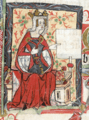
The Empress Matilda wanted to develop a northern suburb.
See also
 In Spanish: Finsbury para niños
